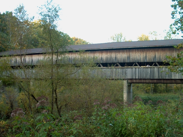
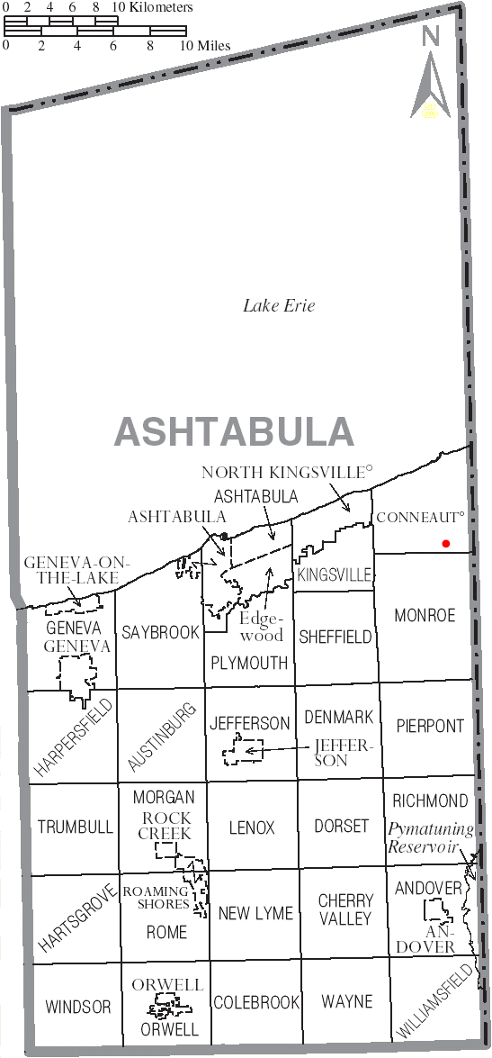
- Middle Road Covered Bridge
-
Middle Road Bridge 
Locale Ashtabula County, Ohio, United States Design single span, Howe truss Total length 136 feet (41.5 m) Construction begin 1868 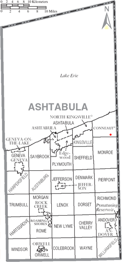
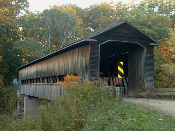
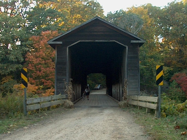
Middle Road Bridge is a covered bridge spanning Conneaut Creek in Conneaut, Ashtabula County, Ohio, United States. The bridge, one of currently 16 drivable bridges in the county, is a single span Howe truss design.[1] Built in 1868, it was reconstructed in 1984 with the help of three volunteers and four college students. The bridge’s WGCB number is 35-04-06,[2] and it is located at 41°54′7.488″N 80°32′49.092″W / 41.90208°N 80.54697°W (41.90208, 80.54697)[3] approximately 3.2 mi (5.1 km) south of downtown Conneaut.
Contents
Directions to bridge
- From Interstate 90 exit 241, head south on State Route 7 approximately 1.1 miles.
- Turn left (east) on South Ridge Road and continue 1.2 miles.
- Turn right (south) on Middle Road and continue 0.2 miles to the bridge.[4]
History
Dimensions
- Length: 136 feet (41.5 m)
Gallery
-

View of bridge from the west
-

View of bridge from the southwest
-

View of south approach
See also
References
- ^ a b c http://www.coveredbridgefestival.org/bridges.htm Ashtabula County Ohio Covered Bridge Festival
- ^ http://www.dalejtravis.com/bridge/ohio/htm/3500406.htm Ohio Covered Bridges List, 35-04-06
- ^ http://mapper.acme.com/?ll=41.90208,-80.54697&z=14&t=H ACME Mapper 2.0
- ^ http://local.live.com/default.aspx?v=2&cp=41.908897~-80.558457&style=r&lvl=14&tilt=-90&dir=0&alt=-1000&rtp=pos.qzkhsh88kb6b_Origin~pos.qzh8wg88mzd6_Destination Windows Live Local
External links
- Middle Road Covered Bridge is at coordinates 41°54′07″N 80°32′49″W / 41.90208°N 80.54697°WCoordinates: 41°54′07″N 80°32′49″W / 41.90208°N 80.54697°W
- Ohio Covered Bridges List
- Ohio Covered Bridge Homepage
- The Covered Bridge Numbering System
- Ohio Historic Bridge Association
- Middle Road Covered Bridge from Ohio Covered Bridges, Historic Bridges
Categories:- Covered bridges in Ashtabula County, Ohio
- Bridges completed in 1868
- Road bridges in Ohio

Wikimedia Foundation. 2010.