- P&W Subdivision
-
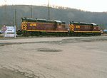 AVR locomotives in Glenwood
The P&W Subdivision is a railroad line owned and operated by CSX Transportation, the Allegheny Valley Railroad (AVR), and the Buffalo and Pittsburgh Railroad (BPRR) in the U.S. state of Pennsylvania. The line runs from Rankin north through Pittsburgh to West Pittsburg (near New Castle)[1] along a former Baltimore and Ohio Railroad line, once the Pittsburgh and Western Railroad.
The line begins in Rankin at the Pittsburgh Subdivision, almost directly under the Rankin Bridge, and runs along the east (right) shore of the Monongahela River. It meets the AVR's W&P Subdivision near the Glenwood Bridge in Glenwood, and continues near the river to near Greenfield. There it turns north away from the river to Bloomfield, where it crosses and junctions with the Norfolk Southern Railway's Pittsburgh Line. CSX ownership ends and AVR ownership begins there; the line continues northwest, junctioning with the AVR's main line and then immediately crossing the Allegheny River on the 33rd Street Railroad Bridge. It turns northeast along the west (right) bank of the river to Etna, turning north there. The AVR owns the line until Glenshaw, where BPRR ownership begins. The Northern Subdivision heads east from Harmony Junction in Eidenau, and the P&W Subdivision continues northwest to the east (left) side of the Beaver River near Ellwood City. It then heads north near the river to West Pittsburg, where it merges with CSX's New Castle Terminal Subdivision near the Pennsylvania Route 168 overpass.
Amtrak's Capitol Limited uses the CSX portion of the line, switching to the NS Pittsburgh Line at Bloomfield.
History
The oldest part of the P&W Subdivision, from Rankin to Greenfield, was opened by the Pittsburgh and Connellsville Railroad in 1857.[2]
The Pittsburgh, New Castle and Lake Erie opened a line from Etna north to Zelienople in 1879. It became the Pittsburgh and Western Railroad that same year, and in 1880 it was extended north to Wurtemberg (near Ellwood City) and southwest from Etna to Allegheny (now part of Pittsburgh).[3] It was soon extended north to New Castle,[4] forming a line that includes today's P&W Subdivision from the 33rd Street Railroad Bridge to West Pittsburg.
The Pittsburgh Junction Railroad built a line connecting the two railroads through the east side of Pittsburgh and over the 33rd Street Railroad Bridge in 1884.[4][5] The B&O acquired all three lines by leases and mergers, and they later passed to CSX.
In 1934, the B&O began operating through trains via trackage rights over the Pittsburgh and Lake Erie Railroad (now the Pittsburgh Subdivision) between McKeesport and New Castle, leaving the P&W for local trains only.[6] At some point, the line between McKeesport and Rankin was abandoned in favor of the adjacent P&LE.[citation needed] In 2003, CSX filed with the Surface Transportation Board to abandon the line from Glenshaw north to Bakerstown, which had not seen local traffic for at least two years.[7] A month later, the Allegheny Valley Railroad leased the piece from Bloomfield north to Glenshaw and acquired trackage rights from Bloomfield south to the W&P Subdivision, which it leased simultaneously.[8] Almost immediately after that, the Buffalo and Pittsburgh Railroad leased the line from Glenshaw north to West Pittsburg.[9]
Highlights of the line
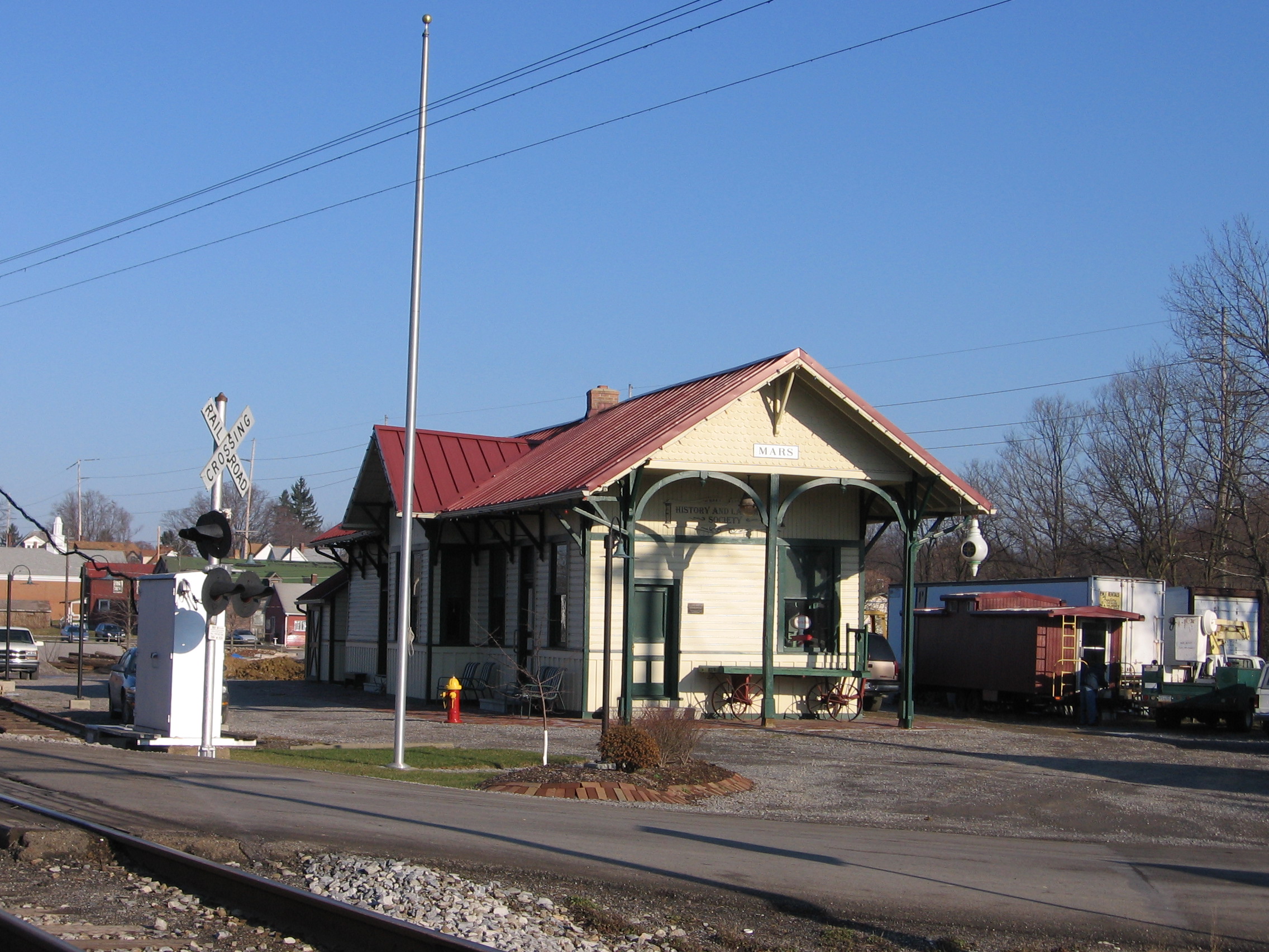
Popular places along the line include the Glenwood Yard and Tower, Schenley Tunnel, 33rd St. Bridge, the Glenshaw Tunnels, Bakerstown Hill and cut, and the Mars Railroad Station in Mars. Other popular places along the line include Harmony Junction, Ellwood Tunnel, High Bridge over the Connoquenessing Creek, and the New Castle Yard.
References
- ^ CSX Timetables: P&W Subdivision
- ^ PRR Chronology, 1857PDF (54.1 KiB), March 2005 Edition
- ^ Bridges and Tunnels of Allegheny County, Pennsylvania: Pittsburgh & Western RR
- ^ a b Dunlap, Scott (October 26, 2006). "Baltimore and Ohio Railroad Timeline". Baltimore and Ohio Railroad Network. Archived from the original on 2005-03-23. http://web.archive.org/web/20050323234705/http://geocities.com/scott_w_dunlap/BORRTIME.htm. Retrieved December 19, 2006.
- ^ Cridlebaugh, Bruce S. (August 31, 2001). "33rd St RR Bridge". Bridges and Tunnels of Allegheny County and Pittsburgh, PA. http://www.pghbridges.com/pittsburghE/0586-4479/33rdst_rr.htm. Retrieved December 19, 2006.
- ^ PRR Chronology, 1934PDF (51.7 KiB), August 2004 Edition
- ^ Surface Transportation Board, Docket AB_55_644_X, CSX Transportation, Inc.--discontinuance of service exemption--in Allegheny County, PA, October 17, 2003
- ^ Surface Transportation Board, Docket FD_34431_0, Allegheny Valley Railroad Company--lease, operation and trackage rights exemption--lines of CSX Transportation, Inc., November 26, 2003
- ^ Surface Transportation Board, Docket FD_34427_0, Buffalo & Pittsburgh Railroad, Inc.--lease and operation exemption--CSX Transportation, Inc., December 5, 2003
Categories:- CSX Transportation lines
- Rail infrastructure in Pennsylvania
- Baltimore and Ohio Railroad lines

Wikimedia Foundation. 2010.