- Marlboro, Alberta
-
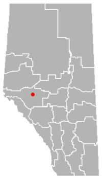
Marlboro is a hamlet in west-central Alberta, Canada within Yellowhead County.[1] It is located on the Yellowhead Highway (Highway 16), approximately 25 kilometres (16 mi) west of Edson. Sundance Provincial Park is located northwest of the hamlet.
Statistics Canada recognizes Marlboro as a designated place.[2]
Demographics
As of 2006, Marlboro had a total population of 156 living in 50 dwellings. With a land area of 0.44 km2 (0.17 sq mi), it has a population density of 355.4 /km2 (920 /sq mi).[2]
See also
- List of communities in Alberta
- List of hamlets in Alberta
References
- ^ Alberta Municipal Affairs (2010-04-01). "Specialized and Rural Municipalities and Their Communities". http://municipalaffairs.gov.ab.ca/documents/msb/2010-ruralmun.pdf. Retrieved 2010-07-10.
- ^ a b Statistics Canada (2007). "Population and dwelling counts, for Canada, provinces and territories, and designated places, 2006 and 2001 censuses - 100% data (Alberta)". http://www12.statcan.ca/english/census06/data/popdwell/Table.cfm?T=1302&SR=1&S=0&O=A&RPP=9999&PR=48&CMA=0. Retrieved 2010-07-10.
 Subdivisions of Alberta
Subdivisions Regions · Census divisions · Municipal districts (counties) · Specialized municipalities · School districts · Regional health authoritiesCommunities Cities · Towns · Villages · Summer villages · Hamlets · Indian reserves · Métis settlements · Ghost towns · Designated placesCities and Urban
Service AreasAirdrie · Brooks · Calgary · Camrose · Cold Lake · Edmonton (capital) · Fort McMurray · Fort Saskatchewan · Grande Prairie · Lacombe · Leduc · Lethbridge · Lloydminster · Medicine Hat · Red Deer · Sherwood Park · Spruce Grove · St. Albert · Wetaskiwin Category ·
  Portal ·
  WikiProject
Coordinates: 53°33′20″N 116°47′46″W / 53.55556°N 116.79611°W
Categories:- Hamlets in Alberta
- Designated places in Alberta
- Yellowhead County, Alberta
- Central Alberta geography stubs

Wikimedia Foundation. 2010.