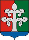
- Medgyesegyháza
-
Medgyesegyháza 
Coat of armsCoordinates: 46°30′N 21°02′E / 46.50°N 21.03°E Country  Hungary
County Békés Area – Total 64.32 km2 (24.8 sq mi) Population (2008) – Total 3,891 – Density 60.49/km2 (156.7/sq mi) Time zone CET (UTC+1) – Summer (DST) CEST (UTC+2) Postal code 5666 Area code(s) 68 Medgyesegyháza (Slovak: Medeš) is a town in Békés County, in the Southern Great Plain region of south-east Hungary.
Geography
It covers an area of 64.32 km² and has a population of 3891 people (2008).
See also
Coordinates: 46°30′N 21°02′E / 46.50°N 21.03°E
Categories:- Populated places in Békés county
- Slovak communities in Hungary
- Shtetls
- Békés county geography stubs
- Slovakia stubs
- Jewish history stubs
Wikimedia Foundation. 2010.


