- Chisbury
-
Coordinates: 51°23′38″N 1°36′07″W / 51.394°N 1.602°W
Chisbury 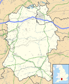
 Chisbury
Chisbury shown within WiltshireOS grid reference SU2764 Parish Little Bedwyn Unitary authority Wiltshire Ceremonial county Wiltshire Region South West Country England Sovereign state United Kingdom Post town Marlborough Postcode district SN8 Dialling code 01672 Police Wiltshire Fire Wiltshire Ambulance Great Western EU Parliament South West England UK Parliament Devizes List of places: UK • England • Wiltshire Chisbury is a hamlet and prehistoric hill fort in the civil parish of Little Bedwyn in Wiltshire, England. Chisbury is about 4 miles (6.4 km) west of Hungerford and about 6 miles (9.7 km) south-east of Marlborough.
Contents
History
At 176 metres (577 ft) above sea level Chisbury hill fort is the highest point in Little Bedwyn parish[1] and encloses an area of about 14 acres (5.7 ha).[2] Palaeolithic, Neolithic and Bronze Age artefacts have been found in the area, but the hill fort was most probably built in the late Iron Age in the 1st century AD.[1]
St. Martin's chapel seems to have been built in the early part of the 13th century.[1] There are written records of it from 1246 onwards and its surviving architecture is contemporary with that period.[1] The windows have the remains of good-quality tracery in a style that suggests they were made in the latter part of the 13th century.[1][2] Between 1496 and 1518 St. Martin's lacked a priest, but it was served again from 1518 until 1547.[1] Thereafter St. Martin's lapsed from use for worship and was turned into a barn.[1] It was re-roofed in the 19th century and is a listed building, but in 1998 its condition was semi-ruinous.[1]
Knowle Farm, about 1.5 miles (2.4 km) north-west of Chisbury, has a 14th century chapel.[1] It is now an outbuilding of the farmhouse.[1] A blocked ogee-headed north window and the surround of the east window are the only surviving features.[3] The farmhouse is a brick-built Georgian house of five bays dated 1735.[3]
See also
References
Sources and further reading
- Aston, Michael; Bond, James (1976). The Landscape of Towns. Archaeology in the Field Series. London: J.M. Dent & Sons Ltd. pp. 59, 60. ISBN 0 460 04194 0.
- Crowley, D.A. (ed.); Baggs, A.P.; Freeman, Jane; Smith, C.; Stevenson, Janet H.; Williamson, E. (1999). A History of the County of Wiltshire: Volume 16: Kinwardstone hundred. Victoria County History. pp. 50–69.
- Pevsner, Nikolaus; Cherry, Bridget (revision) (1975) [1963]. Wiltshire. The Buildings of England. Harmondsworth: Penguin Books. pp. 174–175, 463. ISBN 0 14 0710.26 4.
External links
External links
 Media related to Chisbury at Wikimedia CommonsCategories:
- Villages in Wiltshire
- Wiltshire geography stubs

Wikimedia Foundation. 2010.