- Stoneleigh Park
-
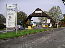
Stoneleigh Events is located south west of the village of Stoneleigh, Warwickshire, in the West Midlands (region) of England.
The site covers about 800 acres (320 ha), 250 acres (100 ha) of which is maintained. Previously known as the National Agricultural Centre, Stoneleigh Events is an exhibition and conference centre which hosts, among many other annual events, the Town and Country Festival, the Kit car show, the UK's largest LAN party (the i-Series by Multiplay UK), the International Historic Motorsport Show, Dirtbiike show, Land rover Max and the now defunct Royal Show, formerly a large agricultural show and event.[citation needed]
It was announced on 12 April 2010 that Stoneleigh Events will play host to The Great Exhibition 2012, a festival showcasing the best of British taking place in the summer of 2012.[1]
The proposed High Speed 2 rail link runs through the Park.[2]
Stoneleigh Events Has the Following: -
- 21,000m2 of exhibition space
- 800 acres of event and activity space
- 250 Maintained
- Conference facilities for up to 2000 people
- On site hotel
- An off-road vehicle track
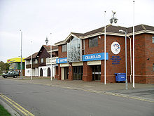
British Charolais Cattle Society
The British Charolais Cattle Society has headquarters within Stoneleigh Park.[3]
References
- ^ Stoneleigh Park - Great Exhibition 2012 Press Release
- ^ Plans of HS2 route through Stoneleigh Park [1]
- ^ "Charolais Contact Us:". British Charolais Cattle Society. http://www.charolais.co.uk/contactus.html. Retrieved 2 October 2010.
External links
Warwick district towns, parishes and settlements Warwickshire • County Council elections • District Council elections • Warwick and Leamington ConstituencyTowns Kenilworth (Abbey End · Castle End · Crackley · Ladyes Hill · St John's · Whitemoor · Windy Arbour) · Leamington Spa (Lillington · Milverton · Old Town · Sydenham) · Warwick (Bridge End · Emscote · Forbes · Heathcote · Myton · Packmores · The Cape · Warwick Gates · Woodloes Park) · Whitnash

Parishes, settlements Ashow · Baddesley Clinton · Baginton · Barford · Beausale · Bishops Tachbrook · Blackdown · Bubbenhall · Budbrooke · Bushwood · Cubbington · Eathorpe · Haseley · Hatton · Honiley · Hunningham · Lapworth · Leek Wootton · Norton Lindsey · Offchurch · Old Milverton · Radford Semele · Rowington · Sherbourne · Shrewley · Stoneleigh · Wappenbury · Wasperton · Weston Under Wetherley · Wroxall
Coordinates: 52°20′35″N 1°31′37″W / 52.343°N 1.527°W
Categories:- Visitor attractions in Warwickshire
- Warwickshire geography stubs
Wikimedia Foundation. 2010.


