- 1978 Atlantic hurricane season
Infobox hurricane season
Basin=Atl
Year=1978
Track=1978 Atlantic hurricane season map.pngJanuary 18 ,1978
Last storm dissipated=November 1 ,1978
Strongest storm name=Greta
Strongest storm winds=115
Strongest storm pressure=947
Average wind speed=1
Total depressions=
Total storms=12
Total hurricanes=5
Total intense=2
Fatalities=37
Da
Inflated=1
five seasons=1976, 1977, 1978, 1979, 1980June 1 ,1978 , and lasted untilNovember 30 ,1978 . These dates conventionally delimit the period of each year when mosttropical cyclone s form in theAtlantic basin . However, the season had the earliest actual start on record due to an unusual subtropical storm in January.Tropical Storm Amelia, which killed 30 when it flooded the Guadalupe River in
Texas , was the most notable storm of the season. Hurricane Greta caused moderate damage inCentral America , avoiding fears that it would be a repeat of the devastatingHurricane Fifi . A very unusualsubtropical storm formed in mid-January, the only storm (tropical or subtropical) to do so in the Atlantic basin.The 1978 season was the last hurricane season when only female names were used for hurricanes and the last season before the modern hurricane naming system was developed.
torms
ubtropical Storm One
Infobox Hurricane Small
Basin=Atl
Type=subtropical.jpg)
Track=1978 Atlantic subtropical storm 1 track.pngJanuary 18
Dissipated=January 23
1-min winds=40
Pressure=1002January 18 while 1,725 miles (2,800 km) east-northeast ofPuerto Rico . It moved westward, intensifying to a 45 mph (75 km/h) subtropical storm over the central Atlantic Ocean. Climatology prevailed, and the storm dissipated onJanuary 23 , 230 miles (370 km) northeast of Puerto Rico.Subtropical Storm One became the earliest recorded tropical or subtropical storm to form in the Atlantic basin, and the only one to do so at all during January, when it formed on
January 18 . Note that two storms on record,Hurricane Alice from the 1954 season andTropical Storm Zeta from the 2005 season have formed during December and lasted into January.Tropical Storm Amelia
Infobox Hurricane Small
Basin=Atl
Track=Amelia 1978 track.pngJuly 30
Dissipated=August 1
1-min winds=45
Pressure=1005Gulf of Mexico nearBrownsville, Texas onJuly 30 . The storm moved over land, but continued to intensify to a 50 mph tropical storm. Land then took its toll, and the storm dissipated overTexas onAugust 1 . Flooding rains due to torrential rains exceeding 40 inches led to the deaths of 30 people in Texas.Tropical Storm Bess
Infobox Hurricane Small
Basin=Atl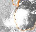
Track=Bess 1978 track.pngAugust 6
Dissipated=August 8
1-min winds=45
Pressure=1005Gulf of Mexico onAugust 5 . Due to a strong high pressure system overTexas , the storm moved southwestward, strengthening to a 50 mph storm. The storm hitNautla, Mexico on earlyAugust 8 , and dissipated later that day.Hurricane Cora
Infobox Hurricane Small
Basin=Atl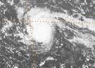
Track=Cora 1978 track.pngAugust 7
Dissipated=August 12
1-min winds=80
Pressure=980August 7 in the tropicalAtlantic . It gradually strengthened to a 90 mph Category 1 hurricane, but weakened to a tropical storm as it moved through theWindward Islands . The storm continued to weaken, and dissipated onAugust 12 near the island ofAruba .Tropical Storm Debra
Infobox Hurricane Small
Basin=Atl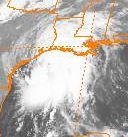
Track=Debra 1978 track.pngAugust 26
Dissipated=August 29
1-min winds=50
Pressure=1000Gulf of Mexico , north of theYucatán Peninsula onAugust 26 . It moved towards theLouisiana coast, steadily intensifying to a 60 mph storm, and made landfall halfway betweenLake Charles, Louisiana andBeaumont, Texas . The highest rainfall report received was from Freshwater Bayou Lock, Louisiana, where 10.81 inches fell. [Hydrometeorological Prediction Center. [http://www.hpc.ncep.noaa.gov/tropical/rain/debra1978.html Tropical Storm Debra.] Retrieved on2007-02-28 .]Hurricane Ella
Infobox Hurricane Small
Basin=Atl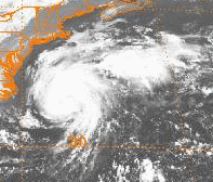
Track=Ella 1978 track.pngAugust 30
Dissipated=September 5
1-min winds=120
Pressure=956Bermuda far to the south, and intensified to a major hurricane. After a brief stall onSeptember 2 , Ella accelerated to the northeast, rapidly strengthening to a 140 mph Category 4 hurricane south ofNova Scotia . It brushed the coast of Newfoundland and dissipated out at sea.Hurricane Flossie
Infobox Hurricane Small
Basin=Atl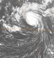
Track=Flossie 1978 track.pngSeptember 4
Dissipated=September 15
1-min winds=85
Pressure=976September 4 , midway betweenCape Verde and theLesser Antilles . The system moved to the west-northwest, reaching 45 mph winds before upper level shear ripped apart the system. After two days of moving to the northeast, the storm re-strengthened to a tropical storm, and became a hurricane onSeptember 12 , located about halfway betweenBermuda and theAzores Islands . Cool waters eventually led the system to its extratropical transition onSeptember 16 . The strongextratropical cyclone brought winds as high as 104 mph to Fair Isle,Great Britain . [Trevor Harley . [http://www.personal.dundee.ac.uk/~taharley/british_weather_in_septemb.htm British Weather in September.] Retrieved on2007-02-01 .]Hurricane Greta
Infobox Hurricane Small
Basin=Atl
Track=Greta 1978 track.pngSeptember 13
Dissipated=September 20
1-min winds=115
Pressure=947Trinidad onSeptember 13 . The storm moved through the Central Caribbean, steadily strengthening. When it neared the coast ofHonduras it rapidly intensified to a Category 4 hurricane, bringing winds to the country. It stayed offshore, but came to shore atStann Creek District ,Belize onSeptember 19 as a Category 2 hurricane. The storm dissipated the next day, but later redeveloped in the Eastern Pacific as Hurricane Olivia. Luckily, death and damage was much lower thanHurricane Fifi , a similar hurricane that devastated the same area in1974 . This was likely due to the lack of flooding, as well as using proper warnings from the affected countries. In all, Greta caused 5 deaths and over $75 million (2005 USD) in damage.Tropical Storm Hope
Infobox Hurricane Small
Basin=Atl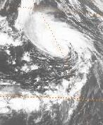
Track=Hope 1978 track.pngSeptember 12
Dissipated=September 21
1-min winds=55
Pressure=987Florida onSeptember 12 . It remained a tropical depression for 3 days as it moved generally eastward. It ultimately attained 65 mph winds over the open Atlantic, but passed cooler waters before it could reach hurricane strength. Still, the storm retained tropical characteristics to nearly 60ºN, not far fromIceland .Tropical Storm Irma
Infobox Hurricane Small
Basin=Atl
Track=Irma 1978 track.pngOctober 2
Dissipated=October 5
1-min winds=45
Pressure=1001Azores onOctober 2 . The storm moved north-northeastward, attaining a maximum windspeed of 50 mph and passing through the Azores before it dissipated onOctober 5 .Tropical Storm Juliet
Infobox Hurricane Small
Basin=Atl.jpg)
Track=Juliet 1978 track.pngOctober 7
Dissipated=October 11
1-min winds=45
Pressure=1006October 7 about 600 miles east ofPuerto Rico . The storm passed north of the island, attained a wind speed of 50 mph, and headed into the open Atlantic before dissipating onOctober 11 southwest ofBermuda . The highest rainfall report from Puerto Rico was 4.51 inches from Toro Negro Plant. [Hydrometeorological Prediction Center. [http://www.hpc.ncep.noaa.gov/tropical/rain/juliet1978.html Tropical Storm Juliet.] Retrieved on2007-02-28 .]Hurricane Kendra
Infobox Hurricane Small
Basin=Atl.jpg)
Track=Kendra 1978 track.pngOctober 28
Dissipated=November 1
1-min winds=70
Pressure=990Bahamas onOctober 28 . The storm strengthened to a Category 1 hurricane with maximum sustained windspeeds of 80 mph, and weakened to a tropical depression onNovember 1 , before dissipating onNovember 3 .Accumulated Cyclone Energy (ACE) Rating
The table on the right shows the ACE for each storm in the season. The ACE is, broadly speaking, a measure of the power of the hurricane multiplied by the length of time it existed for, so hurricanes that lasted a long time have higher ACEs.
torm names
The following names were used for named storms that formed in the north Atlantic basin in 1978.cite web|author=Associated Press|date=1978-05-31|title=Hedge Bets on Hurricanes|accessdate=2007-12-01|url=http://www.thehurricanearchive.com/Viewer.aspx?
] This was the last year that only female names were used. Names that were not assigned are marked in tcname unused.
Retirement
No names were retired after the 1978 season.
ee also
*
List of Atlantic hurricanes
*List of Atlantic hurricane seasons
*1978 Pacific hurricane season
*1978 Pacific typhoon season
*1978 North Indian Ocean cyclone season
*Southern Hemisphere tropical cyclone seasons: 1977–78, 1978–79References
External links
* [http://www.hpc.ncep.noaa.gov/tropical/rain/1978.html HPC rainfall page for 1978 tropical cyclones]
* [http://www.aoml.noaa.gov/general/lib/lib1/nhclib/mwreviews/1978.pdf Monthly Weather Review]

Wikimedia Foundation. 2010.