- 1976 Atlantic hurricane season
Infobox hurricane season
Basin=Atl
Year=1976
Track=1976 Atlantic hurricane season map.pngMay 21 ,1976
Last storm dissipated=October 28 ,1976
Strongest storm name=Belle
Strongest storm winds=105
Strongest storm pressure=957
Average wind speed=1
Total depressions=
Total storms=10
Total hurricanes=6
Total intense=2
Fatalities=72
Da
Inflated=1
five seasons=1974, 1975, 1976, 1977, 1978June 1 ,1976 , and lasted untilNovember 30 ,1976 . These dates conventionally delimit the period of each year when mosttropical cyclone s form in theAtlantic basin . The season was average in activity, with ten total storms and six hurricanes forming.Although several storms made landfall in 1976, only Hurricane Belle caused significant damage when it hit
New England in August, causing $100 million in damage. Hurricane Emmy caused 68 indirect deaths when aVenezuela n Air Force plane carrying a school choir crashed on a landing attempt atLajes Air Base in theAzores during the storm.__TOC__
torms
ubtropical Storm One
Infobox Hurricane Small
Basin=Atl
Type=subtropical
Formed=May 21
Dissipated=May 25
1-min winds=45
Pressure=994OnMay 19 an upper-level trough produced widespread thunderstorms over theGulf of Mexico . Slowly, the system organized, first to asubtropical depression onMay 21 , then to a subtropical storm on the 23rd. The storm began to move faster, and on the 23rd, it hit theFlorida Panhandle . After moving across Georgia at 25 mph the storm reached its peak of 50 mph while southeast of theCarolinas on the 24th. It merged with a frontal system on the 25th. Heavy rainfall was associated with the system, but little damage occurred.Tropical Depression Two
Infobox Hurricane Small
Basin=Atl
Formed=June 7
Dissipated=June 9
1-min winds=30This depression effectedFlorida .Tropical Depression Three
Infobox Hurricane Small
Basin=Atl
Formed=June 11
Dissipated=June 12
1-min winds=30This depression effectedFlorida .Tropical Depression Four
Infobox Hurricane Small
Basin=Atl
Formed=July 20
Dissipated=July 22
1-min winds=30Tropical Depression Five
Infobox Hurricane Small
Basin=Atl
Formed=July 23
Dissipated=July 24
1-min winds=30Tropical Storm Anna
Infobox Hurricane Small
Basin=Atl
Track=Anna 1976 track.pngJuly 28
Dissipated=August 1
1-min winds=40
Pressure=999Bermuda . It began as asubtropical depression onJuly 28 , and strengthened to Subtropical Storm Two on the 30th. That afternoon it rapidly acquired tropical characteristics, and was named Anna. Anna reached her peak of 45 mph winds that day, but became extratropical onAugust 1 . Steering currents were weak, so the system made a slow counterclockwise loop around theAzores before dissipating on the 6th.Hurricane Belle
Infobox Hurricane Small
Basin=Atl
Track=Belle 1976 track.pngAugust 6
Dissipated=August 10
1-min winds=105
Pressure=957Long Island ,New York as a tropical storm, causing $100 million in damage (1976USD )-$342 million in damage (2005 USD)- and 5 casualties.Hurricane Candice
Infobox Hurricane Small
Basin=Atl
Track=Candice 1976 track.pngAugust 18
Dissipated=August 24
1-min winds=80
Pressure=964August 11 , an upper-level low was located south ofBermuda . Over the next week, the system warmed and moved toward the surface. OnAugust 18 , it became a tropical depression, and later that day, it was named Tropical Storm Candice. Moving to the northeast, it remained weak until the 21st, when it rapidly became a hurricane, located at 41ºN, 400 miles east ofCape Cod . When Candice became a hurricane, it was one of only seven hurricanes to reach hurricane strength north of 40ºN. Soon after, Candice rapidly moved to the northeast, and it lost its identity to a cold front onAugust 24 .Tropical Storm Dottie
Infobox Hurricane Small
Basin=Atl
Track=Dottie 1976 track.pngAugust 18
Dissipated=August 21
1-min winds=45
Pressure=996Gulf of Mexico , onAugust 17 . This low became a tropical depression onAugust 18 . After drifting to the east-southeast, a pressure of a 1004mbar occurred onAugust 19 . The storm rapidly moved to the northeast, reaching tropical storm strength on the way. After passing overFlorida , Dottie moved to the north, reaching a peak of 50 mph winds. Conditions appeared favorable, and a hurricane watch was issued. However, upper-level winds ripped the storm apart on the 20th, and it was barely a tropical storm at itsSouth Carolina landfall on the 21st. It weakened to a tropical depression, and advisories were stopped, later onAugust 21 . A tide inAtlanta Beach, North Carolina reached 3.5 feet above normal. The remnant low of the system followed its track, moving southwestward into Florida, bringing more rain to the area. A total of 10.68 inches (271.3 mm) of rain fell at Fort Lauderdale. [David M. Roth . [http://www.hpc.ncep.noaa.gov/tropical/rain/dottie1976.html Tropical Storm Dottie Rainfall Page.] Retrieved on2007-12-25 .] Dottie lost its identity after re-entering theGulf of Mexico onAugust 25 . Damage was minor, but four deaths occurred due to a fishing boat sinking over the Bahamas. [http://www.nhc.noaa.gov/archive/storm_wallets/atlantic/atl1976-prelim/dottie/prelim01.gifDottie TCR Page 1] ] [http://www.nhc.noaa.gov/archive/storm_wallets/atlantic/atl1976-prelim/dottie/prelim02.gifDottie TCR Page 2] ] [http://www.nhc.noaa.gov/archive/storm_wallets/atlantic/atl1976-prelim/dottie/prelim03.gifDottie TCR Page 3] ]Hurricane Emmy
Infobox Hurricane Small
Basin=Atl.jpg)
Track=Emmy 1976 track.pngAugust 21
Dissipated=September 4
1-min winds=90
Pressure=974August 20 from a tropical wave, located about 1000 miles east of theLesser Antilles . As it moved west-northwestward, the area strengthened to a tropical storm on the 22nd. On the 24th, it recurved to the northeastward, and strengthened to a hurricane on the 25th. Its eastward movement so early in the year is almost unprecedented, as it occurred from the rapid development of a low pressure system to its northeast. Emmy moved recurved back northwest on the 26th, but again moved eastward on the 29th, when it reached its peak of 100 mph. It gradually weakened, and onSeptember 4 , a weakened extratropical Emmy was absorbed by the larger circulation of Hurricane Frances while located over theAzores .Hurricane Emmy caused 68 indirect deaths when a
Venezuela n Air Force plane carrying a school choir crashed on a landing attempt atLajes Air Base in theAzores during the storm. This makes Hurricane Emmy the fifth documented storm to have downed an airplane (the others wereHurricane Janet ,Typhoon Emma , Hurricane Betsy andHurricane Esther )Fact|date=February 2007.Hurricane Frances
Infobox Hurricane Small
Basin=Atl.jpg)
Track=Frances 1976 track.pngAugust 27
Dissipated=September 4
1-min winds=100
Pressure=963August 27 , while midway between theLesser Antilles and the coast ofAfrica . The next day, it became a tropical storm, and onAugust 30 , Frances became a hurricane. As it recurved to the north and east, Frances reached her peak of 115 mph onSeptember 1 . Steady weakening occurred afterwards, and Frances became extratropical on the 4th.Tropical Depression Thirteen
Infobox Hurricane Small
Basin=Atl
Formed=September 4
Dissipated=September 6
1-min winds=30Tropical Depression Fourteen
Infobox Hurricane Small
Basin=Atl
Formed=September 7
Dissipated=September 9
1-min winds=30ubtropical Storm Three
Infobox Hurricane Small
Basin=Atl
Type=subtropical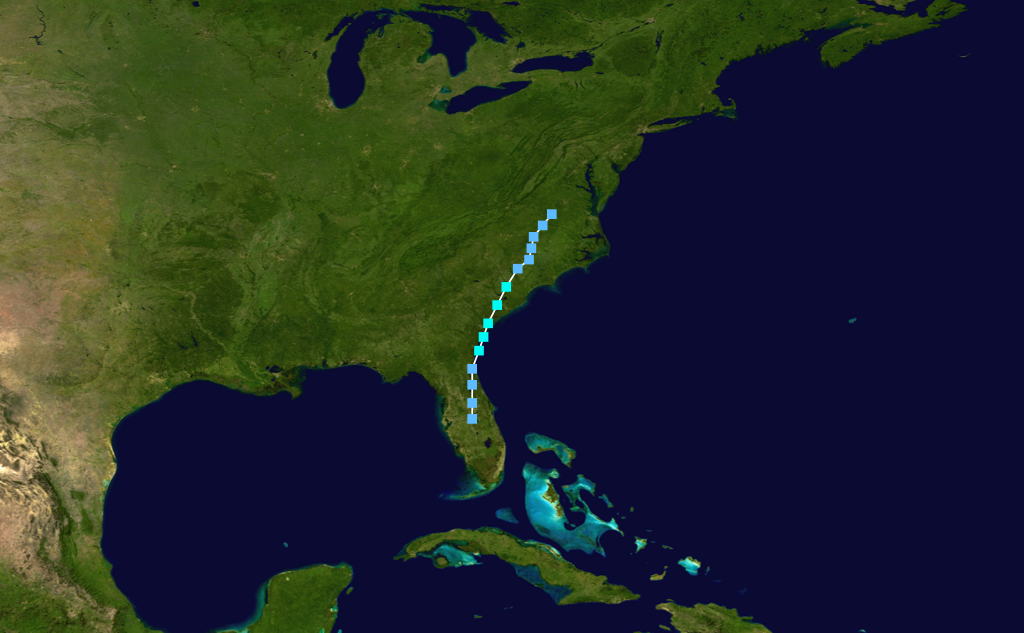
Formed=September 14
Dissipated=September 17
1-min winds=40
Pressure=1011OnSeptember 12 , the interaction between mid-tropospheric low and a diffuse stationary front led to the formation of a low pressure system over centralFlorida . As it moved north-northeastward, it developed a circulation and became asubtropical depression on the 13th. The next day it became a subtropical storm, and reached its peak of 45 mph over the western tropical Atlantic, off the coast of Georgia. The storm quickly made landfall nearCharleston, South Carolina , and dissipated over southernVirginia on the 17th.Tropical Depression Sixteen
Infobox Hurricane Small
Basin=Atl
Formed=September 22
Dissipated=September 25
1-min winds=30Tropical Depression Seventeen
Infobox Hurricane Small
Basin=Atl
Formed=September 22
Dissipated=September 24
1-min winds=30This depression effectedLouisiana andTexas .Hurricane Gloria
Infobox Hurricane Small
Basin=Atl
Track=Gloria 1976 track.pngSeptember 27
Dissipated=October 4
1-min winds=90
Pressure=970September 26 , located 400 miles northeast of theLesser Antilles . On the 27th while moving northward, it strengthened to become Tropical Storm Gloria. After moving northwestward for a day, Gloria moved northeast, strengthening to a 100 mph hurricane on the 30th. Steady weakening ensued, and Gloria lost her tropical characteristics onOctober 4 .Tropical Depression Twenty
Infobox Hurricane Small
Basin=Atl
Formed=October 3
Dissipated=October 12
1-min winds=30This depression effectedCuba .Tropical Depression Twenty-One
Infobox Hurricane Small
Basin=Atl
Formed=October 12
Dissipated=October 15
1-min winds=30Hurricane Holly
Infobox Hurricane Small
Basin=Atl
Track=Holly 1976 track.pngOctober 22
Dissipated=October 28
1-min winds=65
Pressure=990Lesser Antilles onOctober 22 . After a day, the storm became Tropical Storm Holly, strengthening to Hurricane Holly on the 24th. Holly weakened to a tropical storm on the 25th. The storm becameextratropical onOctober 28 while located 400 miles northwest of theAzores islands.Tropical Depression Twenty-Three
Infobox Hurricane Small
Basin=Atl
Formed=October 31
Dissipated=November 3
1-min winds=30eason summary
TC stats cyclone|cat=storm|name=Subtrop One|dates=21 - 25 May
max-winds= 50|min-press= 994|ace= 0TC stats cyclone|cat=storm|name=Anna|dates=28 July - 6 August
max-winds= 45|min-press= 999|ace= 1.05TC stats cyclone|cat=cat3|name=Belle|dates=6 - 10 August
max-winds= 120|min-press= 957|ace= 9.55TC stats cyclone|cat=cat1|name=Candice|dates=18 - 24 August
max-winds= 90|min-press= 964|ace= 8.81TC stats cyclone|cat=storm|name=Dottie|dates=18 - 21 August
max-winds= 50|min-press= 996|ace= 1.01|mult-landfalls=2TC stats cyclone|cat=cat2|name=Emmy|dates=20 August - 3 September
max-winds= 105|min-press= 974|ace= 30.0TC stats cyclone|cat=cat3|name=Frances|dates=27 August - 7 September
max-winds= 115|min-press= 963|ace= 14.7TC stats cyclone|cat=storm|name=Subtrop Three|dates=12 - 17 September
max-winds= 45|min-press= 1011|ace= 0TC stats cyclone|cat=cat2|name=Gloria|dates=26 September - 4 October
max-winds= 105|min-press= 970|ace= 11.5TC stats cyclone|cat=cat1|name=Holly|dates=22 - 29 October
max-winds= 75|min-press= 990|ace= 4.50Accumulated Cyclone Energy (ACE) Rating
The table on the right shows the ACE for each storm in the season. The ACE is, broadly speaking, a measure of the power of the hurricane multiplied by the length of time it existed for, so hurricanes that lasted a long time have higher ACEs.
torm names
The following names were used for named storms (tropical storms and hurricanes) that formed in the
Atlantic basin in 1976.cite web|author=Associated Press|date=1976-05-21|title=Hurricane Center Gets Ready|accessdate=2007-12-01|url=http://www.thehurricanearchive.com/Viewer.aspx?] Names that were not assigned are marked in tcname unused. This is the last time these names have been used except for Gloria, Frances & Maria.
Retirement
None of the names from the 1976 season were retired.
ee also
*
List of Atlantic hurricanes
*List of Atlantic hurricane seasons
*1976 Pacific hurricane season
*1976 Pacific typhoon season
*1976 North Indian Ocean cyclone season
*Southern Hemisphere tropical cyclone seasons: 1975–76, 1976–77References
External links
* [http://www.hpc.ncep.noaa.gov/tropical/rain/1976.html HPC rainfall page for 1976 tropical cyclones]
* [http://www.aoml.noaa.gov/general/lib/lib1/nhclib/mwreviews/1976.pdf Monthly Weather Review]
* [http://www.usatoday.com/weather/hurricane/2003-07-16-flying-hurricanes_x.htm Why and how people fly into hurricanes]

Wikimedia Foundation. 2010.