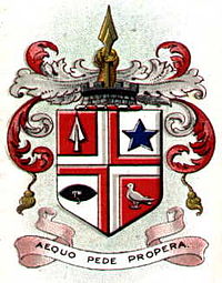
- Municipal Borough of Leigh
-
Leigh Geography Status Urban district (until 1899)
Municipal borough (after 1899)1911 area 6,359 acres 1961 area 6,359 acres History Created 1894 Abolished 1974 Succeeded by Metropolitan Borough of Wigan Demography 1901 population 40,001 1971 population 46,188 
The Municipal Borough of Leigh was, from 1894 to 1974, a local government district of the administrative county of Lancashire, England,[1] consisting of the townships of Pennington, Westleigh, Bedford and part of the township of Atherton and named after the ancient Parish of Leigh. The area contained the market town town of Leigh that served as its administrative centre until its dissolution in 1974.
In 1875 Leigh Local Board of Health was formed comprising the areas Bedford, Pennington and Westleigh, members of the Leigh Poor Law Union.[2][3] It was created an urban district in 1894 by the Local Government Act 1894 and was incorporated as a municipal borough in 1899. It was affected by a minor boundary change with Golborne Urban District in 1969 which affected no population.[4]
In 1974 the borough was abolished by the Local Government Act 1972 and its former area transferred to Greater Manchester to be combined with others to form the Metropolitan Borough of Wigan.
From 1894 to 1933, Leigh Rural District located (in two fragments) either side of the district, comprised the civil parishes of Astley, Culcheth, Kenyon and Lowton. The Rural District was abolished in 1933 under a County Review Order.[5]
References
- ^ Vision of Britain - Leigh UD/MB
- ^ Greater Manchester Gazetteer, Greater Manchester County Record Office, Places names - I to L, http://www.gmcro.co.uk/Guides/Gazeteer/gazzi.htm, retrieved 3 April 2010
- ^ Leigh, workhouses.org.uk, http://www.workhouses.org.uk/index.html?Leigh/Leigh.shtml, retrieved 2010-04-03
- ^ Vision of Britain - Unit history of Leigh
- ^ Vision of Britain - Leigh RD boundaries
Categories:- Local government in Wigan
- Districts of England created by the Local Government Act 1894
- Districts of England abolished by the Local Government Act 1972
- Municipal boroughs of England
Wikimedia Foundation. 2010.
