- M-222 (Michigan highway)
-
M-222 
Route information Maintained by MDOT Length: 10.13 mi[1] (16.30 km) Existed: 1928 – present Major junctions West end: 
 M-40 / M-89 at Allegan
East end:  US 131 near Martin
Location Counties: Allegan Highway system Michigan State Trunkline Highway System
Interstate • US • State←  M-221
M-221US 223  →
→←  M-117
M-117
M-119  →
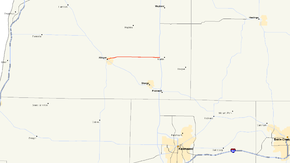
→M-222 is the current designation of a state trunkline route in the US state of Michigan. The route was formerly signed as M-118 and connects the city of Allegan with the US 131 freeway near Martin.
Contents
Route description
M-222 begins at an intersection with M-40 and M-89 in the town of Allegan at the corner of Cutler and Cedar Streets. From there, the route proceeds to the east out of town, crossing over the Kalamazoo River. From there the route continues on due east through rural areas and agricultural fields, as it approaches the communities of Watson and Martin, the fields are taken over by forested area and residential houses. The road then bisects Wetheral Lake, after which it quickly comes to its eastern terminus at exit 55 on US 131.
History
Until 1928/29, the route along 116th Street from Allegan to the old route of US 131 in Martin was designated as part of M-40. At that time, M-40 was re-designated to continue northwest out of Allegan towards Hamilton and Holland along its present alignment. The former route between Allegan and Martin is re-designated as M-118.
In 1960, the eastern end of the route was shortened to end at the new US 131 freeway. The 0.9 miles (1.4 km) east of US 131 to Martin is returned to local control.
In 1998, M-118 was resigned as M-222 designation to prevent confusion with 118th street which runs parallel to the route about one mile (1.6 km) to the north for most of the length.[2]
Major intersections
The entire highway is in Allegan County.
Location Mile[1] Destinations Notes Allegan 0.00 
 M-40 / M-89
0.49  A-37
A-37Martin Township 10.13  US 131 – Kalamazoo
1.000 mi = 1.609 km; 1.000 km = 0.621 mi References
- ^ a b "MiGDL - Center for Geographic Information - Geographic Data Library". Michigan Department of Information Technology. May 2007. http://www.mcgi.state.mi.us/mgdl/?rel=thext&action=thmname&cid=14&cat=MI+Geographic+Framework+All+Roads+%28v7b%29. Retrieved February 9, 2008.
- ^ Bessert, Christopher J. (October 22, 2006). "Michigan Highways: Highways 200 through 229". Michigan Highways. http://www.michiganhighways.org/listings/MichHwys200-229.html#M-222. Retrieved November 3, 2006.
External links
Categories:- State highways in Michigan
Wikimedia Foundation. 2010.

