Cowra Shire Council

Cowra Shire Council

Infobox Australian Place | type = lga
name = Cowra Shire
state = nsw


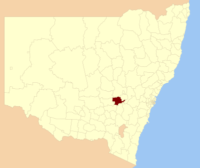
caption = Location in NSW
pop = 13,260Census 2001 AUS|id=LGA12350|name=Cowra (A) (Local Government Area)|accessdate=2007-06-30|quick=on]
area = 2810
est =
seat = Cowra (116 Kendal Street)cite web
title=Cowra Shire Council
publisher = Department of Local Government
url = http://www.dlg.nsw.gov.au/dlg/dlghome/dlg_CouncilContactDetails.asp?slacode=2350
accessdate = 2006-11-28
]
mayor = Bill West
Deputy Mayor = Ian Brown
region = Central West

url = http://www.cowra.nsw.gov.au
stategov = Electoral district of Burrinjuck
fedgov = Calare
near-nw = Forbes
near-n = Cabonne
near-ne = Blayney
near-w = Weddin
near-e = Bathurst
near-sw = Young
near-s = Boorowa
near-se = Upper Lachlan
The Cowra Shire is a Local Government Area (LGA) of New South Wales.

The largest town and council seat is Cowra. It is on the Lachlan River, the Mid-Western Highway, the Olympic Way and the Lachlan Valley Way.

The Local Government Area is between the Council areas of Blayney, Cabonne Shire, Forbes, Weddin Shire, Young and Boorowa. The Shire has a number of small villages including Billimari, Darbys Falls, Morongla, Mount McDonald, Woodstock, Gooloogong, Noonbinna, Wyangala and Wattamondara.

References


Wikimedia Foundation. 2010.

Игры ⚽ Нужен реферат?

Look at other dictionaries:

  • Cowra Shire — New South Wales Location in NSW Population: 12,945(2009) …   Wikipedia

  • Cowra Shire — Shire of Cowra Lage des Cowra Shire in New South Wales Gliederung …   Deutsch Wikipedia

  • Blayney Shire Council — Infobox Australian Place | type = lga name = Blayney Shire state = nsw caption = Location in New South Wales pop = 6,120 Census 2001 AUS|id=LGA10850|name=Blayney (A) (Local Government Area)|accessdate=2007 06 30|quick=on] area = 1525 est = seat …   Wikipedia

  • Young Shire Council — Infobox Australian Place | type = lga name = Young Shire caption = Location in New South Wales state=New South Wales region=South West Slopes area=2694 seat=Young (Boorowa St)cite web title=Young Shire Council publisher = Department of Local… …   Wikipedia

  • Weddin Shire Council — Infobox Australian Place | type = lga name = Weddin Shire state = nsw caption = Location in New South Wales pop = 3,653Census 2001 AUS|id=LGA18100|name=Weddin (A) (Local Government Area)|accessdate=2007 06 30|quick=on] area = 3410 est = seat =… …   Wikipedia

  • Forbes Shire Council — Infobox Australian Place | type = lga name = Forbes Shire state = nsw caption = Location in New South Wales pop = 9,691 Census 2001 AUS|id=LGA12900|name=Forbes (A) (Local Government Area)|accessdate=2007 06 30|quick=on] area = 4720 est = seat =… …   Wikipedia

  • Cabonne Shire Council — Infobox Australian Place | type = lga name = Cabonne state = nsw caption = Location in New South Wales pop = 11,864Census 2001 AUS|id=LGA11400|name=Cabonne (A) (Local Government Area)|accessdate=2007 06 30|quick=on] area = est = seat = Molong (99 …   Wikipedia

  • Cowra — New South Wales Main street of Cowra …   Wikipedia

  • Cowra — Ein Blick auf das Stadtzentrum von Cowra, 2005 Staat …   Deutsch Wikipedia

  • Cowra breakout — Cowra POW Camp, 1 July 1944. Japanese POWs practice baseball near their quarters, several weeks before the Cowra breakout. This photograph was taken with the intention of using it in propaganda leaflets, to be dropped on Japanese held areas in… …   Wikipedia

Share the article and excerpts

Direct link
Do a right-click on the link above
and select “Copy Link”