- Haarlem
Infobox Settlement
official_name = Haarlem
nickname = Bloemenstad (Dutch for flower city)
motto = Vicit vim virtus (Latin for Virtue conquered force)
imagesize = 230px
image_caption =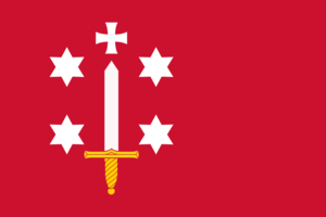
flag_size = 120x100px
image_shield = Haarlem_wapen.svg
shield_size = 120x100px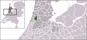
mapsize = 280px
subdivision_type = Country
subdivision_name = flagicon|NetherlandsNetherlands
subdivision_type1 = Province
subdivision_name1 = flagicon|North HollandNorth Holland
leader_name = dhr mr B.B. Schneiders
leader_party = PvdA
area_footnotes = (2006)
area_total_km2 = 32.12
area_land_km2 = 29.32
area_water_km2 = 2.80
population_as_of =1 February ,2008
population_note = Source: CBS, [http://statline.cbs.nl/ Statline] .
settlement_type = Municipality
population_total = 147613
population_density_km2 = 5035
timezone = CET
utc_offset = +1
timezone_DST = CEST
utc_offset_DST = +2
latd = 52.37
latNS = N
longd = 4.65
longEW = E
website = [http://www.haarlem.nl haarlem.nl]Audio|Nl-Haarlem.ogg|Haarlem, in the past usually Harlem in English, is a city in the
Netherlands . It is also thecapital of theprovince ofNorth Holland , which at one time was one of the most powerful of the seven provinces of theDutch Republic . The city is located on theriver Spaarne , about 20 km west ofAmsterdam and near the coastaldune s. It has been the historical center of thetulip bulb-growing district for centuries and bears the nickname 'Bloemenstad' (flower city), for this reason. Themunicipality of Haarlem also comprises part of thevillage ofSpaarndam , a newer housing estate forming part of the municipality ofHaarlemmerliede en Spaarnwoude .History of Haarlem
Middle Ages
The oldest mentioning of Haarlem dates from the 10th century. The name comes from "Haarlo-heim" or "Harulahem", which means 'place, on sand covered with trees, higher than the others'. There was a stream called "De Beek", dug from the peat grounds west of the river Spaarne as a drainage canal. Over the centuries the Beek was turned into an underground canal, as the city grew larger and the space was needed for construction. Over time it began to silt up and in the 19th century it was filled in. The location of the village was a good one: by the river Spaarne, and by a major road going south to north. By the 12th century it was a fortified town, and Haarlem became the residence of the Counts of Holland.
In 1219 the knights of Haarlem were laurelled by Count Willem I, because they had conquered the Egyptian port of
Damietta (or "Damiate" in Dutch, present-dayDimyat ) in the 5thcrusade . Haarlem received the right to bear the Count's sword and cross in itscoat of arms . OnNovember 23 1245 Count Willem II granted Haarlem city rights. This implied a number of privileges, among which the right for thesheriff andmagistrate s to administer justice, instead of the Count. This allowed for a quicker and more efficient judiciary system, more suited to the needs of the growing city.After a siege by the Kennemer people in 1270 a defensive wall was built around the city. Most likely this was an earthen wall, with wooden gates. Originally the city started out between Spaarne, Oudegracht, Ridderstraat, Bakenessergracht and Naussaustraat. In the 14th century the city expanded, and the Burgwalbuurt, Bakenes and the area around the Oudegracht became part of the city. The old defenses proved not to be sufficiently strong for the expanded city, and at the end of the 14th century a 16½-metre high wall was built, complete with a 15-metre wide canal circling the city.
In 1304 the Flemish threatened the city, but they were defeated by
Witte van Haemstede at Manpad.All the city's buildings were made of wood, and fire was a great risk. In 1328 nearly the whole city burnt down. The
Sint-Bavokerk was severely damaged, and rebuilding it would take more than 150 years. Again onJune 12 ,1347 there was a fire in the city. A third large fire, in 1351, destroyed many buildings including the Count's castle and the city hall. The Count did not need a castle in Haarlem because his castle inDen Haag had taken over all functions. The Count donated the ground to the city and later a new city hall was built there. The shape of the old city was square -- this was inspired by the shape of ancientJerusalem . After every fire the city was rebuilt quickly, an indication of the wealth of the city in those years.The
Black Death came to the city in 1381. According to an estimate by a priest fromLeiden the disease killed 5,000 people, about half the population at that time.In the 14th century Haarlem was a major city. It was the second largest city in historical Holland after
Dordrecht and beforeDelft ,Leiden ,Amsterdam ,Gouda andRotterdam . In 1429 the city gained the right to collect tolls, including ships passing the city on the Spaarne river. At the end of theMiddle Ages Haarlem was a flourishing city with a large textile industry, shipyards and beer breweries.Around 1428 the city was put under siege by the army of
Jacqueline, Countess of Hainaut . Haarlem had taken side with the Cods in theHook and Cod wars , and thus against Jacoba of Bavaria. The entireHaarlemmerhout wood was burnt down by the enemy.panish siege
When the city of
Brielle was conquered by theGeuzen revolutionary army, the municipality of Haarlem started supporting the Geuzen. KingPhilip II of Spain was not pleased, and sent an army north under the command of Don Fadrique ("Don Frederick" in Dutch), son of theFernando Álvarez de Toledo, 3rd Duke of Alba . OnNovember 17 1572 all citizens of the city ofZutphen were murdered by the Spanish army, and onDecember 1 the city ofNaarden suffered the same fate.On
December 11 1572 the Spanish army put Haarlem under siege. The city's defenses were commanded by city-governorWigbolt Ripperda .Kenau Simonsdochter Hasselaer , a very powerful woman, helped defend the city.During the first two months of the siege, the situation was in balance. The Spanish army was digging tunnels to reach the
city wall s and blow them up. The defenders dug tunnels to blow up the Spanish tunnels. The situation became worse for Haarlem onMarch 29 1573 . TheAmsterdam army, faithful to the Spanish king, controlledHaarlemmermeer lake, effectively blocking Haarlem from the outside world. Hunger in the city grew, and the situation became so tense that onMay 27 many (Spanish-loyal) prisoners were taken from the prison and murdered.Two city gates, the Kruispoort and the Janspoort collapsed during the fighting.
In the beginning of July the
Prince of Orange assembled an army of 5,000 soldiers nearLeiden to free Haarlem. The Spanish trapped them at the "Manpad" and defeated the army. After seven months the city surrendered onJuly 13 1573 . Many soldiers of the army that defended the city were slaughtered; many of them were drowned in theSpaarne river. Governor Ripperda and his lieutenant werebeheaded . The citizens were allowed to buy freedom for themselves and the city for 240,000 guilders and the city was required to host a Spanishgarrison . Don Fadrique thanked God for his victory in the Sint-Bavo Church.Great fire
The city suffered a big fire in the night from
October 22 toOctober 23 1576 . The fire started in brewery "het Ankertje", near the weighhouse at the Spaarne, which was used by German mercenaries as a guarding place. When they were warming themselves at a fire it got out of control. The fire was spotted by farmers, who sailed their ships on the river. However, the soldiers turned down all help, saying that they would put out the fire themselves. This failed, and the fire destroyed almost 500 buildings, among them St-Gangolf's church and St-Elisabeth's hospital. Most of the mercenaries were later arrested, and one of them was hanged on the Grote Markt in front of a large audience. Maps from that era clearly show the damage done by the fire: a wide strip through the city was destroyed.The combined result of the siege and the fire was that about a third of the city was destroyed.
Golden age
Linen and silk
The Spanish left in 1577 and under the
Agreement of Veere , Protestants and Catholics were given equal rights. A large influx of Flemish and French immigrants who were fleeing the Spanish occupation of their own cities made the city prosper again. The new citizens had a lot of expertise inlinen andsilk trading, and the city's population grew from 18,000 in 1573 to around 40,000 in 1622. At one point, in 1621, over 50% of the population was Flemish-born. Haarlem's linen became world famous and the city flourished, just like the rest of the country: the Golden Age in the United Provinces had started.Infrastructure
In 1632 a tow canal between Haarlem and
Amsterdam , theHaarlemmertrekvaart was opened, the first tow canal in the country. The empty areas in the city that were a result of the fire of 1576 were filled with new houses and buildings. Even outside the city wall buildings were constructed -- in 1643 about 400 houses were counted outside the wall. Having buildings outside the city walls was not a desirable situation to the city administration. Not only because these buildings would be vulnerable in case of an attack on the city, but there was also less control over taxes and city regulations outside the walls. Therefore a major project was initiated in 1671: expanding the city northwards. Two new canals were dug, and a new defensive wall was constructed (the current "Staten en Prinsenbolwerk"). Two old city gates, the Janspoort and Kruispoort, were demolished. The idea that a city had to be square-shaped was abandoned.Cultural life
Haarlem's cultural life also prospered, with famous painters like
Frans Hals andJacob van Ruisdael , the architectLieven de Key andJan Steen who made many paintings in Haarlem. On the "Grote Markt", the central market square, there's a statue ofLaurens Janszoon Coster who is allegedly the inventor of theprinting press (however, most scholars agree that the scarce evidence seems to point toJohann Gutenberg as the first European inventor). In 1628 achemist in Haarlem goes broke, and decides to join the VOC to sail to the East. His name, Jeronimus Cornelisz, will always be connected with the Batavia ship.Beer brewing
Beer brewing was a very important industry in Haarlem. Until the 16th century the water for the beer was taken from the canals in the city. These were, through the Spaarne and the IJ, connected to seawater. However, the water in the canals was getting more and more polluted, and no longer suitable for brewing beer. A place 1,5 kilometers south-west of the city was then used to take fresh water in. However, the quality of that water was not high enough either. From the 17th century a canal ("Santvaert") was used to transport water from the dunes to the city. The water was transported in barrels on ships. The location where the water was taken is called the "Brouwerskolkje", and the canal to there still exists, and is now called the Brewers' Canal ("Brouwersgracht").
Haarlem was a major beer producer in the Netherlands. The majority of the beer it produced was consumed in Noord-Holland. During the Spanish siege there were about 50 brewing companies in the city; while 45 years later in 1620 the city numbered in the vicinity of 100 breweries.
There was another epidemic of the
Black Death in 1657, which took a heavy toll in the 6 months it ravaged the city.From the end of the 17th century the economic situation in the city turned sour, for a long time. In 1752 there were only seven beer breweries left, and in 1820 no breweries were registered in the city anymore. In the 1990s the Stichting Haarlems Biergenootschap revived some of the old recipes under the new
Jopen beer brand, that is marketed as a "Haarlem bier".Tulip centre
In the 1630s, Haarlem was (and still is) a major trading centre for tulips, and it was the epicenter during
tulip mania , when outrageous prices were paid fortulip bulbs. From the time that theLeiden -Haarlem canalLeidsevaart opened in 1656, it became popular to ride fromRotterdam toAmsterdam by passenger boat rather than coach. The canals were dug for passenger service only, and were comfortable though slow. Thetowpath led these passengers through the bulb fields south of Haarlem. Haarlem was an important stopover for passengers from the last half of the 17th century and through the 18th century until the building of the first rail tracks along the routes of former passenger canal systems. As Haarlem slowly expanded southwards, so did the bulb fields, and even today rail travelers between Rotterdam and Amsterdam will see beautiful blooming bulb fields on the stretch between Leiden and Haarlem in the Spring.18th century
As the center of trade gravitated towards Amsterdam, Haarlem declined in the 18th century. The Golden age had created a large upper middle class of merchants and well-to-do small business owners. With the dependability of the
trekschuit traffic between Amsterdam and Haarlem, many people had business addresses in Amsterdam and weekend or summer homes in Haarlem. Haarlem became more and more a bedroom community as the increasingly dense population of Amsterdam caused the canals to stink in the summer. Many well-to-do gentlemen moved their families to summer homes in the Spring and commuted between addresses. Popular places for summer homes were along the Spaarne in southern Haarlem.Pieter Teyler van der Hulst andHenry Hope built summer homes there, as well as many Amsterdam merchants and councilmen. Today, it is still possible to travel by boat along the Spaarne and has turned into a popular form of tourism in the summer months.In the 18th century Haarlem became the seat of a
suffragan diocese of the Old Catholic Church of Utrecht.French rule
At the end of the 18th century a number of anti-Orange commissions were founded.
On
January 18 ,1795 the "Staatse" army was defeated nearWoerden . During the night preceding the 19th, the same night that stadtholderWilliam V of Orange fled the country, the various commissions gathered and implemented a revolution. The commissions changed the city's administrators in a bloodless revolution, and the next morning the city was 'liberated' of the tyranny of the House of Orange. The revolution was peaceful and the Orange-loyal people were not harmed. TheBatavian Republic was then proclaimed.The French army entered the liberated city two days later, on the
January 20 . An army of 1,500 soldiers was provided with food and clothing by the citizens. The new national government was strongly centralized, and the role of the cities was reduced in the national debate.The Batavian Republic had signed a mutual defense pact with France, and was thus automatically at war with England. The strong English presence at sea severely reduced the trading opportunities, and the Dutch economy suffered accordingly.
19th century
The textile industry, which had always been an important pillar of Haarlem's economy, was in a bad shape at the beginning of the 19th century. Strong international competition, and revolutionary new production methods based on steam engines by then in use in England, dealt a death blow to Haarlem's industry.
In 1815 the city's population was about 17,000 people, a large percentage of whom were poor. The foundation of the
United Kingdom of the Netherlands in that year gave many hope. Many believed that under a new government the economy would mend again, and that export-oriented economic activities such as the textile industry would recover. However, this hoped turned out to be idle -- the Dutch economy remained stuck. TheNederlandsche Handel-Maatschappij (NHM or Dutch Trade Company) was founded by King Willem I to create employment opportunities.In Haarlem, then one of the cities in the western part of the Netherlands with the worst economical situation, cotton factories were created under the NHM-program. These cotton factories produced goods for the Dutch East Indies, and because the Dutch government levied heavy taxes on foreign cotton producers this was a good market for the NHM-factories. The programme started in the 1830s, but never managed to substantially reduce the unemployment in the city. The
American Civil War in the 1860s reduced the import of raw cotton significantly, and in 1872 the protectionism measures for the East Indian market were removed.In the beginning of the 19th century the defense walls had lost their function, and architect Zocher Jr. planned a park on the location of the former defense line. The city walls and gates were demolished.
Haarlem became the provincial capital of Noord Holland province in the early 19th century. In the mid 19th century the city's economy slowly started to improve. New factories were opened, and a number of large companies were founded in Haarlem.
In 1814
George Stephenson designed the first locomotive. The government of the Netherlands was relatively slow to catch up, even though the King feared competition from newly establishedBelgium if they would construct a train track between Antwerp and other cities. Dutch parliament balked at the high level of investment needed, but a group of private investors started the Hollandsche IJzeren Spoorweg Maatschappij onJune 1 1836 . It took three years to build the first track, between Haarlem andAmsterdam along the old tow canal called theHaarlemmertrekvaart . The ground there was wet and muddy. OnSeptember 20 1839 the firsttrain service in the Netherlands started. The train had a speed of about 40 kilometers per hour. The train service gave the economy of Haarlem a strong boost. Instead of more than 2 hours, Amsterdam was now only 30 minutes away. The old trekschuits were quickly taken out of service for passengers. Today it is still possible to travel by boat from Amsterdam to Haarlem, and pleasure boating has made Haarlem a popular place to stay.The creating of new land in the
Haarlemmermeer made that the city could no longer refresh the water in its canals using the Spaarne. The new industry made the water quality even worse, and in 1859 de Oude Gracht, a canal, was filled in to create a new street.In 1878 a horse tram started servicing passenger from the railway station to Haarlemmerhout woodland park, and in 1899 the first Dutch electric
tram ran in Haarlem. From 1879 the population of the city almost doubled in thirty years, from 36,976 to 69,410 in 1909. Not only did the population grow, but the city was expanding rapidly too. The Leidsebuurt district was incorporated into Haarlem in the 1880s. A small part of (the now defunct) municipality of Schoten was incorporated in 1884 because the council of Haarlem wanted to have the hospital (het dolhuys) inside the municipal borders. This hospital was situated at "het bolwerk" on Schoten's territory.20th century
In the beginning of the 20th century the city expanded north. As early as 1905 an official plan was presented by the Haarlem municipality for expansion. However, the surrounding municipalities did not agree, and it would take 25 years to come to an agreement. On
may 1 ,1927 the municipality of Schoten became part of Haarlem, as well as part of Spaarndam, Bloemendaal and Heemstede. The population increased at once with 31,184 citizens.In 1908, a renewed railway station was opened. The station was elevated, so traffic in the city was no longer hampered by railway crossings. In 1911,
Anthony Fokker showed his plane, "de Spin" to the audience in Haarlem by flying around the Sint-Bavokerk on Queen's Day.Later the expansion of the city went southwards (Schalkwijk) and eastwards (Waarderpolder). In 1932,
Vroom & Dreesmann , a Dutch retailer built a department store at Verwulft. Many buildings were demolished, except one small chemist's shop on the corner, "Van der Pigge", who refused to be bought out and which is now encapsulated by the V&D building.The city went through rough times during the
Great Depression of 1930s.During
World War II Hannie Schaft worked for a Dutch resistance group; she was captured by the Germans and executed just before the end of the war in 1945. FromSeptember 17 toSeptember 21 ,1944 , parts of Haarlem-Noord (above Jan Gijzenvaart) were evacuated by the Germans to make place for a defensive line. The stadium ofHFC Haarlem , the soccer club, was demolished. Hundreds of people had to leave their houses and were forced to stay with other citizens.From
September 22 there was gas available only two hours per day. Electricity stopped onOctober 9 . The German occupiers built a thick, black wall through the Haarlemmerhout (in the south of the city), as well as at the Jan Gijzenvaart in the evacuated area. The wall was called Mauer-muur and was meant to help defend the city.In 1944 the family of
Corrie ten Boom was arrested by the Nazis; they had been hiding Jews and Dutch resistance workers from the German occupier throughout the war.After the war much of the large industry moved out of the city, such as the banknote printing firm of
Joh. Enschedé .In 1963 a large number of houses was built in Schalkwijk.
Religion
The
Roman Catholic diocese of Haarlem has been aDiocese since 1559 ("Dioecesis Harlemensis"). The original cathedral, Sint-Bavo Cathedral at the Grote Markt, is called after thepatron saint of Haarlem,Saint Bavo . The first bishop of Haarlem wasNicolaas van Nieuwland (born in 1510). He accepted the position onNovember 6 ,1561 . In 1569 he was advised to resign by the Duke of Alva, because of his reputation for drinking ("Dronken Klaasje").Van Nieuwland was succeeded by Godfried van Mierlo, who would be the last bishop in communion with Rome Haarlem would know for 300 years.
Haarlem's cathedral was spared from
iconoclasm during the Reformation in the Netherlands, because the city's mayor ordered the closing of the church for several months in 1566.Just before the
siege of Haarlem by the Spaniards, symbols and statues linked to theRoman Catholic faith were removed from the cathedral, however, after the siege, the Spanish army restored Roman Catholiciconography . The guilds had to restore their old altars, at great expense.On Sacrament day (
May 29 ) in 1578 Saint Bavo's Cathedral was attacked by soldiers of thePrince of Orange . One of the priests was killed, and many objects in the church were destroyed. This event, called the "Haarlemse Noon", forced the bishop to flee the city. The city council confiscated the church, and later converted it along the tenants of the EvangelicalReformed Church . The new (and current) name of the Cathedral becameSint-Bavokerk .It wasn't until 1853 that a new Roman Catholic bishop was installed. A new cathedral, again called the
Cathedral of Saint Bavo , was built at the Leidsevaart (canal to Leiden) in 1898. The Bishop of Haarlem nowadays has a formal residence on the Nieuwe Gracht canal.There is also an
Old Catholic bishop of Haarlem.Famous buildings and locations
The city is famous for its many "
hofje s": almshouses built around courtyards. These were mainly privately funded houses for elderly single women. Nowadays there are 19hofjes in Haarlem ; many open to the public on weekdays. Many hofjes are still owned by the original foundations, and are still mainly used for single (elderly) women.* The Grote Markt (central market square), with -among others- the City Hall, the
Vleeshal , the Hoofdwacht and the Grote orSint-Bavokerk
* Sint-Bavo Cathedral
* TheTeylersmuseum (the oldestmuseum of the Netherlands)
*Frans Hals Museum
* WindmillDe Adriaan
* TheAmsterdamse Poort city gate
* The art nouveau railway station of Haarlem
* Theater De Toneelschuur
* The Corrie ten Boom House
*Villa Welgelegen
*Haarlemmerhout park
* The Bosch and Vaart neighborhoodLocal government
The municipal council of Haarlem consists of 39 seats, which are divided as follows:
* PvdA - 11 seats
* VVD - 7 seats
* CDA - 4 seats
*GroenLinks - 4 seats
* StadsPartij/Leefbaar Haarlem - 4 seats
* D66 - 2 seats
*Axielijst - 1 seat
* SP - 7 seats
*ChristenUnie /SGP - 1 seat
* partij spaarnestad - 1 seat
* senior citizen's party (ouderenpartij) - 1 seatMiscellaneous
Local beer
Beer brewing has been a very important industry for Haarlem. The heyday of beer brewing in Haarlem go back to the 1400s, when there were no fewer than 100 breweries in the city. When the town's 750th anniversary was celebrated in 1995 a group of enthusiasts re-created an original Haarlem beer and brewed it again. The beer is called Jopenbier, or Jopen for short, named after an old type of beer-barrel.
Jopen "Koyt" and Jopen "Adriaan" are based on old recipes from 1402 and 1407 respectively. Jopen Adriaan is called after the windmill that re-opened in 2002. Jopenbier also features a bock beer and a light beer ("spring beer"). Jopenbier is now generally available again, mainly in the Haarlem area. Initially the beers were brewed at brewery De Halve Maan in
Hulst but now they are brewed at De Koningshoeven, the brewery ofLa Trappe , inTilburg . A local chess-club is called "De Haarlemse Jopen".Harlem, Manhattan
In 1658 Dutchman
Peter Stuyvesant founded the settlement of Nieuw Haarlem ("New Haarlem") on the island ofManhattan inNorth America . This settlement later became the neighborhood of Harlem inNew York City . In the mid-17th century, the primary Dutch settlement on Manhattan Island was Nieuw Amsterdam ("New Amsterdam "), on the southern tip of the island.Cultural references
* Folk singer
Al Stewart mentions Haarlem in his song "Amsterdam".
* The train station of Haarlem was part of a set during the movieOcean's Twelve
* The bookConfessions of an Ugly Stepsister byGregory Maguire is set in Haarlem.
* The bookThe Black Tulip byAlexandre Dumas, père has several scenes in Haarlem, most notably the ending, and it is theHorticultural Society of Haarlem that offers a reward for ablack tulip .ee also
*
References
* Ach lieve tijd: 750 jaar Haarlem, de Haarlemmers en hun rijke verleden, F.W.J.Koorn (red), Vrieseborch, Zwolle 1984 (ISBN 90-6630-035-3)
* Deugd boven geweld: een geschiedenis van Haarlem, 1245-1995, G.F. van der Ree-Scholtens (red), Uitgeverij Verloren, Hilversum 1995 (ISBN 90-6550-504-0)
* Geschiedenis en beschrijving van Haarlem, van de vroegste tijden tot op onze dagen, F. Allan, J. J. van Brederode, Haarlem 1874
* Statistics are taken from the [http://www.sdu.nl/staatscourant/gemeentes/gem192nh.htm SDU Staatscourant]External links
* [http://maps.google.nl/maps?f=q&hl=en&q=haarlem&ie=UTF8&z=12&ll=52.385449,4.637947&spn=0.092619,0.344009&om=1 Map of Haarlem and surroundings]
* [http://www.reiziger.connexxion.nl/web/show/file/id=67372/contentid=8713/filename=Haarlem_IJmond%2811%29.pdf Bus map with stops]
* [http://www.haarlemshuffle.com Haarlem Shuffle: English language resources for Haarlem, the Netherlands]
* [http://www.gfz-potsdam.de/news/ScienceAndArts/index.html Haarlem Paintings by Jacob van Ruisdael]
* [http://www.rondjehaarlem.info/index_uk.php Ride the 50 km. long bicycle route to explore Haarlem and its surroundings.]
* [http://bbs.keyhole.com/ubb/showthreaded.php?Cat=&Board=EarthTravel&Number=797150&Searchpage=1&Main=797150&Words=MrLunk&topic=&Search=true#Post797150 Haarlem Coffeeshop Tour (Google Earth)]
* [http://www.nzetc.org/tm/scholarly/Gov06_03Rail-fig-Gov06_03Rail044a.html Photo of electric train at Haarlem Station c1931]

Wikimedia Foundation. 2010.