- Crompton Moor
-
Crompton Moor 
Crompton Moor towards its summit at Crow KnowlElevation 391 m (1,283 ft) Location Location of Crompton Moor in Greater Manchester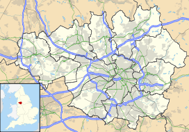
 Crompton Moor
Location Shaw and Crompton,
Greater Manchester,
EnglandRange South Pennines Coordinates 53°35′27.82″N 2°03′42.84″W / 53.5910611°N 2.0619°WCoordinates: 53°35′27.82″N 2°03′42.84″W / 53.5910611°N 2.0619°W OS grid SD960105 Geology Type Commons, Site of Biological Interest Climbing Easiest route Crompton Way Crompton Moor (archaically known as High Moor[1]) is an area of moorland in the South Pennines, in North West England. It lies along the northeastern outskirts of Shaw and Crompton, in the Metropolitan Borough of Oldham, Greater Manchester.
Spanning approximately 160 acres (65 ha), and reaching an elevation of 1,282 feet (391 m) at Crow Knowl, Crompton Moor is one of the largest open spaces run by Oldham Countryside Service.[2] It is a registered common of Greater Manchester,[3] and a Site of Biological Importance since 2003.[4]
Most of Crompton Moor is covered in Purple Moor Grass and Heather, but there is also a significant amount of Pine forest.[2] Wildlife on the moors includes Red Grouse, Golden Plover, and the Meadow Pipit.[2]
An early type of axe known as a palstave has been discovered on Crompton Moor, providing evidence of Bronze Age human activity.[5] During the 18th century Crompton Moor had several farms; dry stone walls still exist from these times as evidence of field division for pasture.
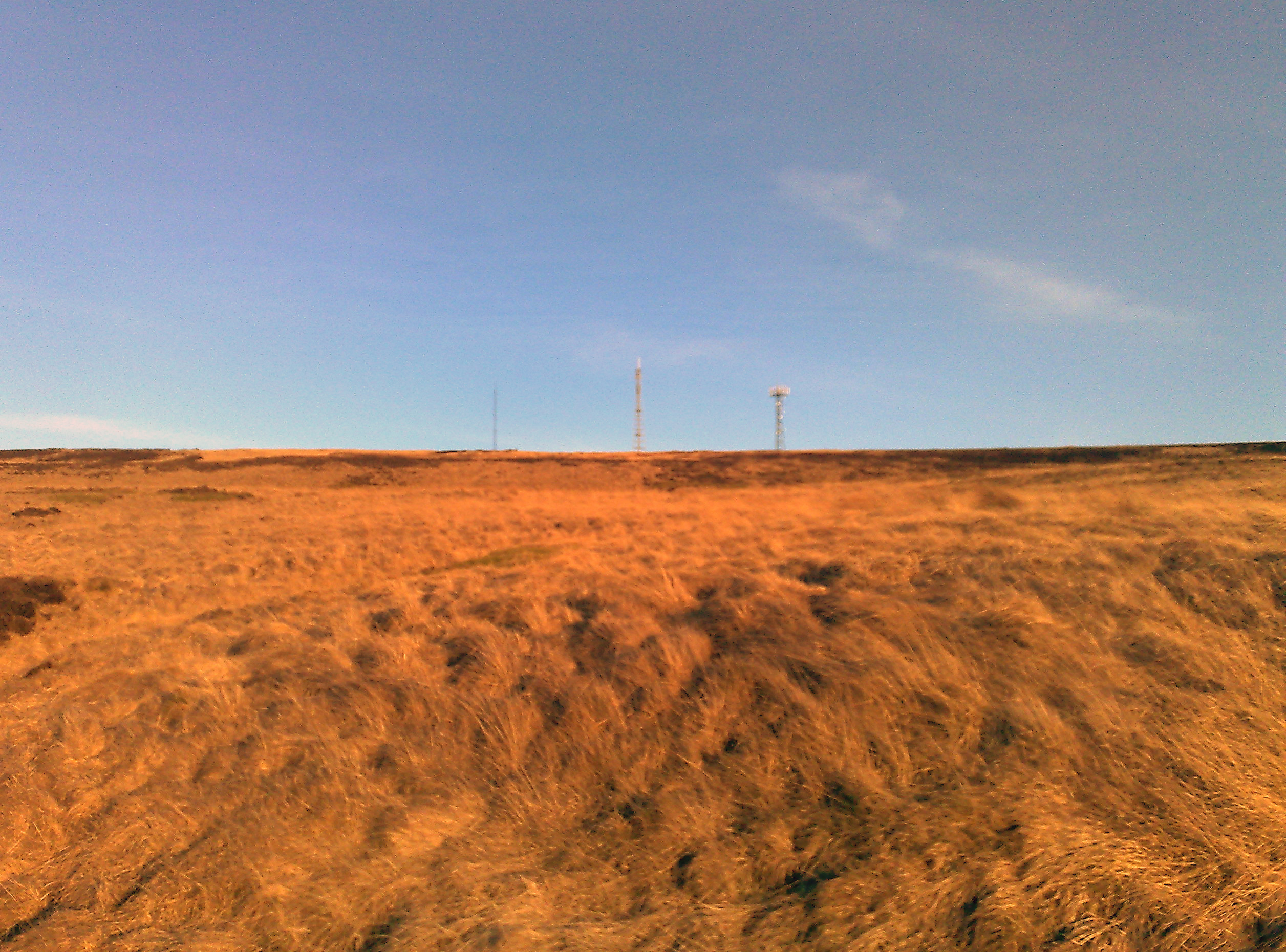
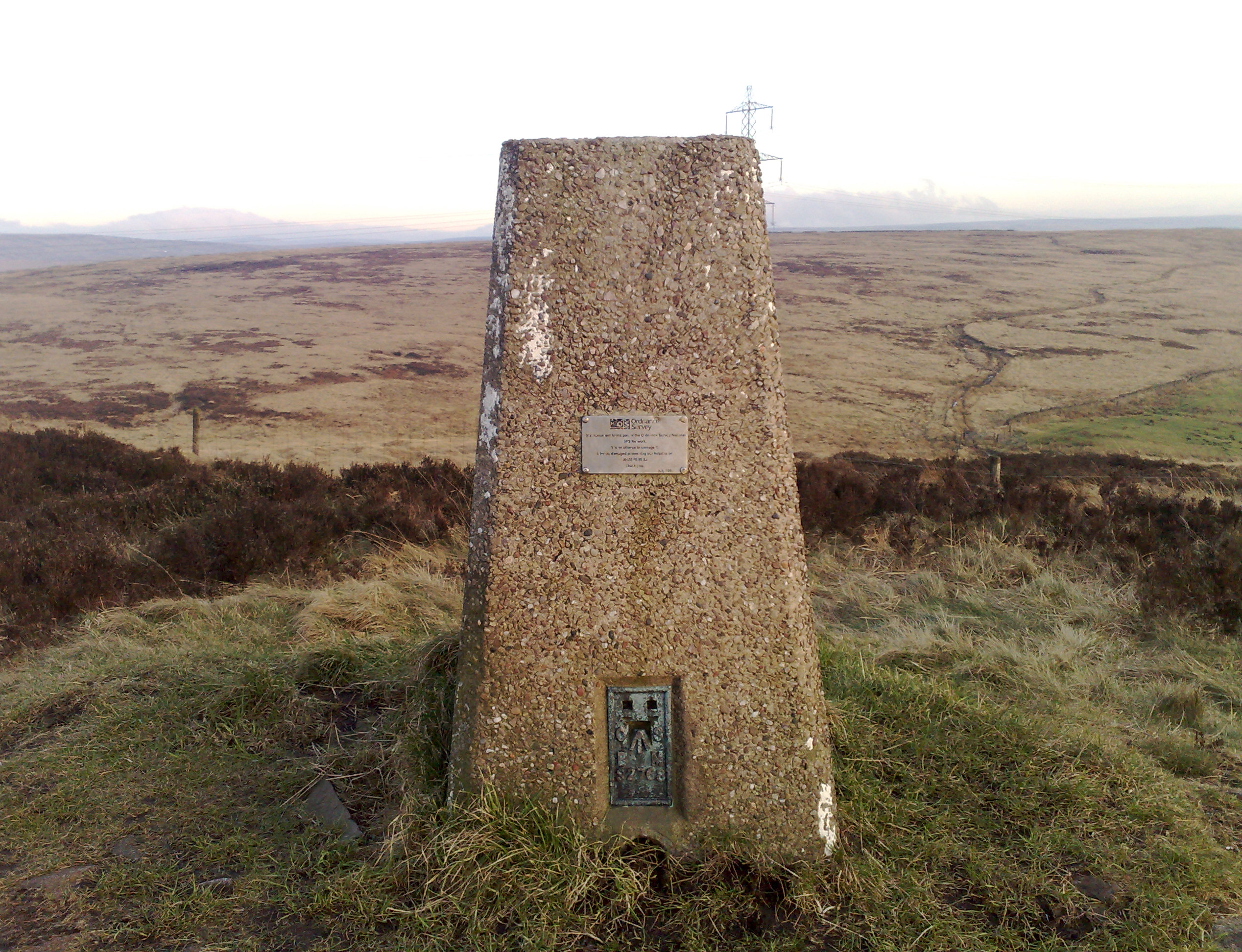
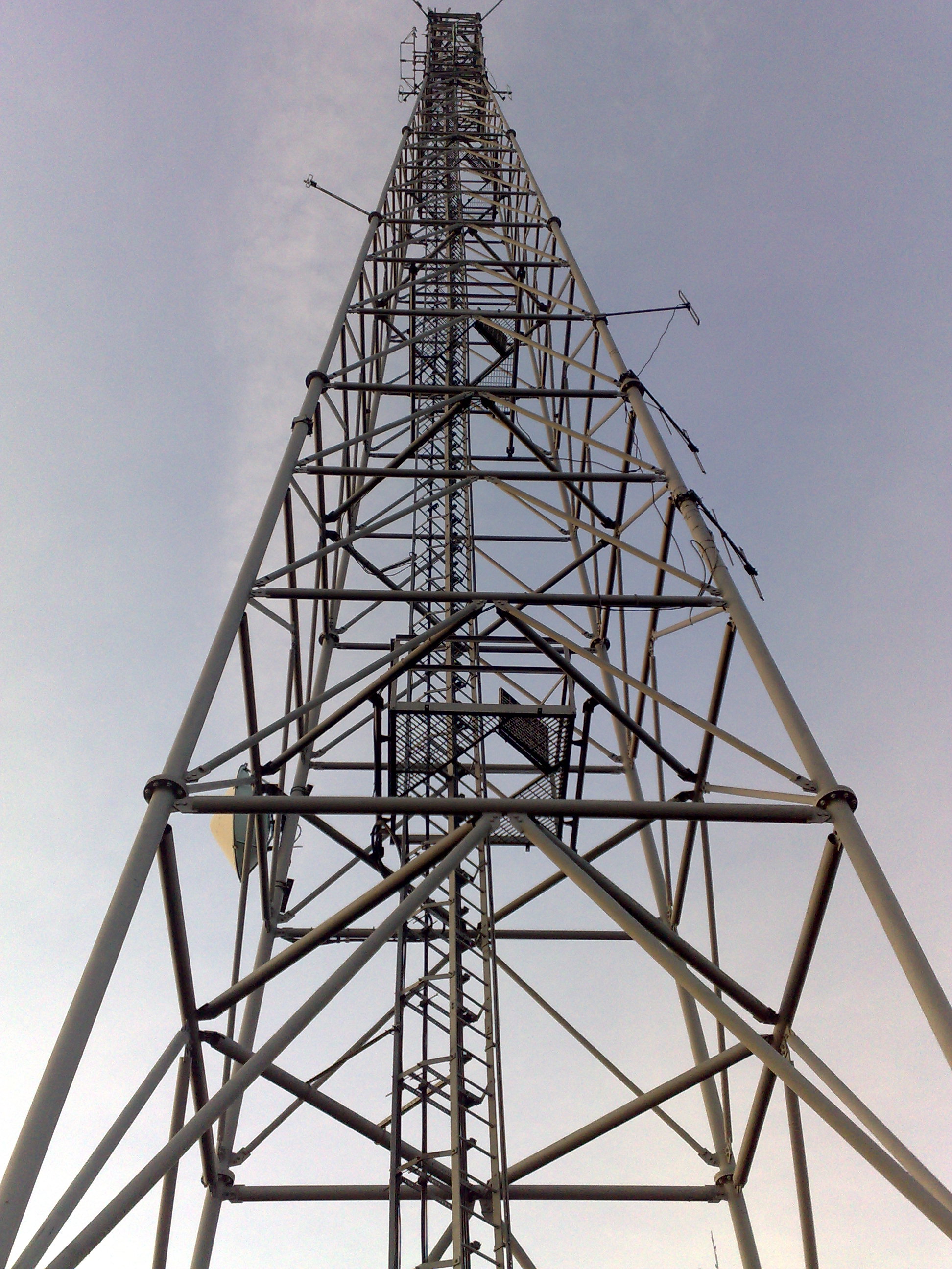
Crow Knowl, at the summit of Crompton Moor, features a transmitter station, Crow Knowl Telecommunications mast, and an Ordnance Survey triangulation station (at grid reference SD960105). Crow Knowl overlooks Rochdale to the northwest, Manchester to the southwest and Denshaw to the east, amongst other parts of Greater Manchester.[6]
Crompton Moor has been the site of several wildfires. A significant fire occurred in 1995, raging for over two weeks and burning a large proportion of the surface vegetation as well as the subsurface peat. Another took place in March 2007.
Brushes Clough and Pingot are former coal and sandstone quarries on Crompton Moor.[7] During the 1970s, quarrying was halted, the land was reclaimed, and thousands of pine trees were planted. The area has since been used for recreation, including hiking, orienteering, and mountain biking.[2][7] Brushes Clough Reservoir was constructed in the 19th century by the Oldham County Borough Council,[8] using stone quarried from this site. The area is now managed by United Utilities.[7]
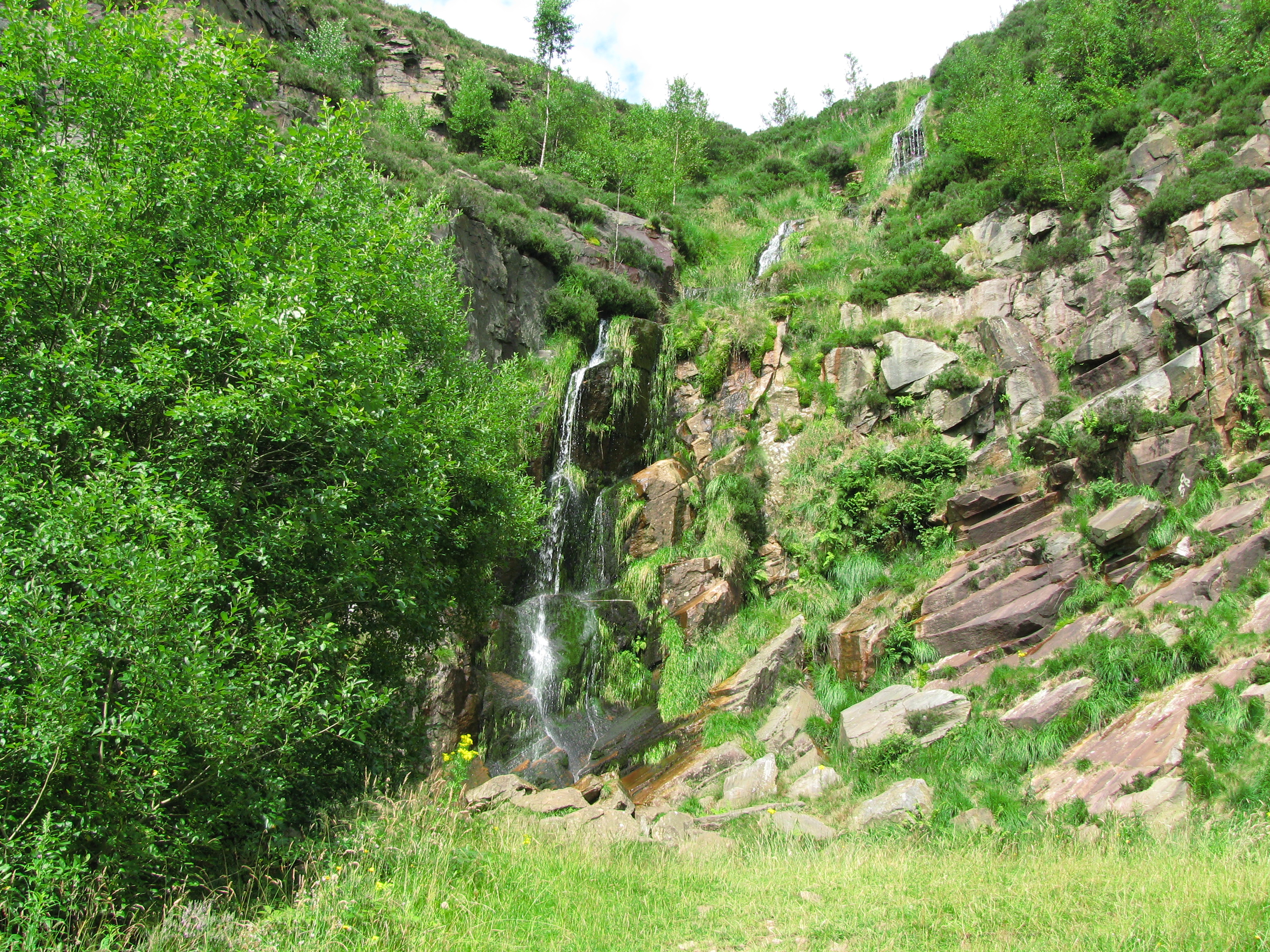
An un-named waterfall (provisionally called Crompton Waterfall) cascades off Crompton Moor into the now unused Pingot Quarry forming the Old Brook, a tributary of the River Beal.[2][7][9]
Gallery
-
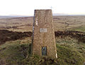
The Ordnance Survey triangulation station at Crow Knowl
-
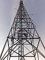
Crow Knowl Telecommications Mast
-

The waterfall at Pingot Quarry
-
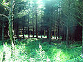
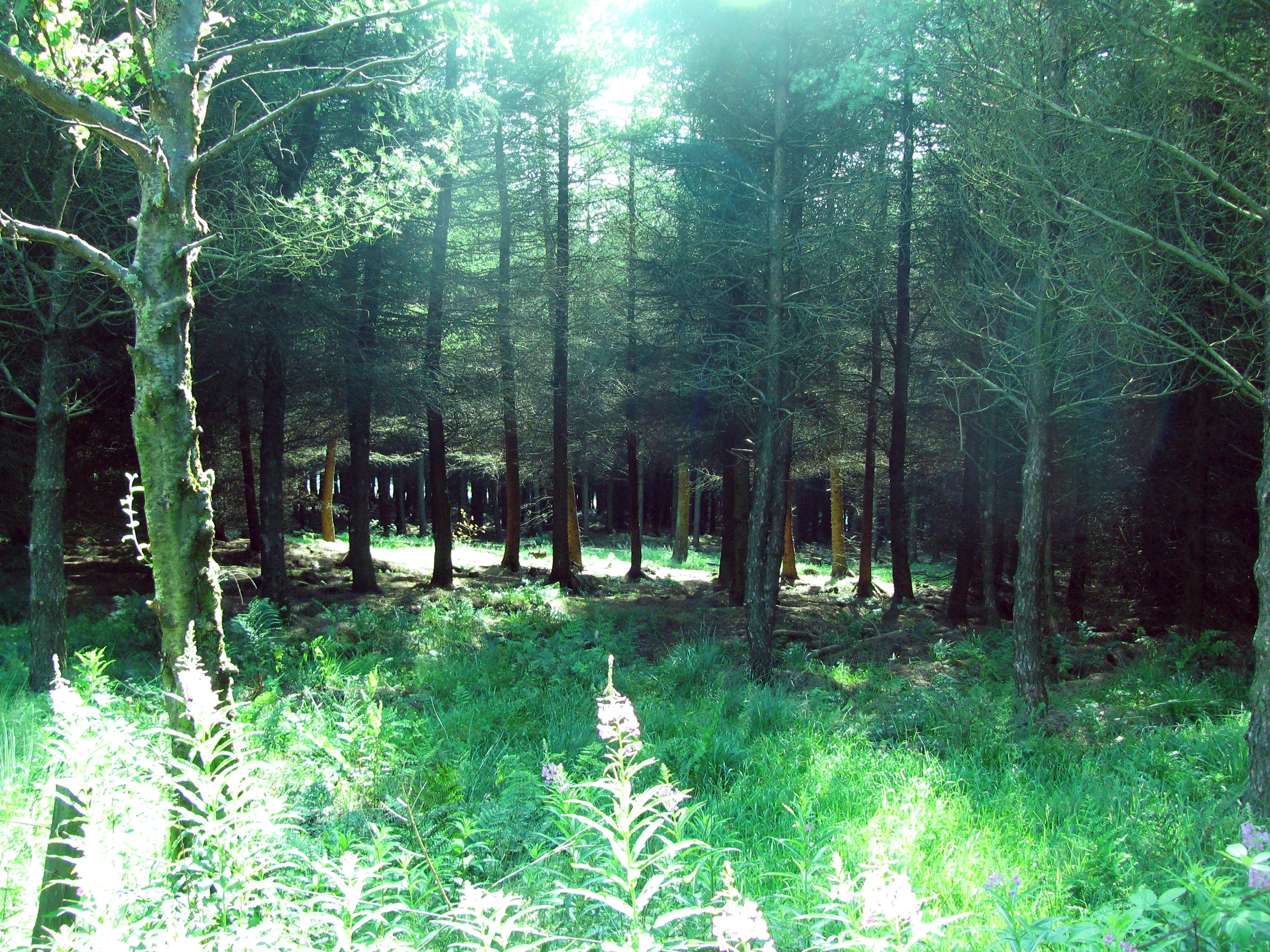
Trees in the dense forest in Crompton Moor
References
- ^ Rathbone, Peter (2000). The Lives of the People of Crompton, Lancashire 1580–1700. Lancashire and Cheshire Antiquarian Society.
- ^ a b c d e Steve Duthie (August 2007). "Moors to life". Fourmost magazine (HKR magazines): pp. 18
- ^ "The Common Lands of Greater Manchester; A Biological Survey" (pdf). Rural Surveys Research Unit. http://www.defra.gov.uk/wildlife-countryside/issues/common/pdf/greater%20manchester.pdf. Retrieved 2007-08-13.
- ^ Oldham Evening Chronicle (2007-06-28). "Northwest Riders (N.W.R.); Revamped outdoor gem relaunched". Archived from the original on 2007-09-29. http://web.archive.org/web/20070929061127/http://www.try-cycles.co.uk/9.html. Retrieved 2007-08-13.
- ^ "Monument no 46038". Pastscape.org.uk. http://www.pastscape.org.uk/hob.aspx?hob_id=46038. Retrieved on 1 August 2008.
- ^ Clarke, Rogerson (2006). Walk the South Pennines. Discovery Walking Guides. p. 46. ISBN 1-904946-13-5.
- ^ a b c d "Crompton Moor Walking Trails" (PDF). oldham.gov.uk. 2003-06-16. http://www.oldham.gov.uk/crompton-moor-walking-trails.pdf. Retrieved 2007-06-20
- ^ Crompton Urban District 1959, p. 19.
- ^ "Crompton Moor History Trail" (PDF). oldham.gov.uk. 2003-06-16. http://www.oldham.gov.uk/crompton-moor-history-trail.pdf. Retrieved 2007-06-20
External links
- Crompton Moor Walking Trails.
- breathingplaces.org, The BBC's page on Crompton Moor.
- nemo.me.uk, Crompton Moor User Group.
- trigpointinguk.com, information on the trig point at Crow Knowl.
- northwestriders.org A local mountain bike club campaigning for the creation of legal bike trails on Crompton Moor.
- Computer generated summit panorama
Categories:- Mountains and hills of Greater Manchester
- Mountains and hills of the Pennines
- Visitor attractions in Oldham
-

Wikimedia Foundation. 2010.