- 1998 Atlantic hurricane season
Infobox hurricane season
Basin=Atl
Year=1998
Track=1998 Atlantic hurricane season map.png
Last storm dissipated=December 1, 1998
Strongest storm name=Mitch
Strongest storm pressure=905
Strongest storm winds=155
Total storms=14
Total hurricanes=10
Total intense=3
Fatalities=Over 12,000
Da
Inflated=0
five seasons=1996, 1997, 1998, 1999, 2000tropical cyclone s form in theAtlantic basin ; however, the season extended through December 1 as Hurricane Nicole remained active. The most notable storms of the season wereHurricane Georges andHurricane Mitch ; the former caused heavy damages across theCaribbean Sea and on theUnited States ' Gulf Coast as well as 603 deaths, and the latter killed at least 11,000 people, mostly inHonduras andNicaragua , making it the deadliest hurricane of modern times.Season summary
The 1998 Atlantic hurricane season was the second deadliest season on record. One of the notable storms of the 1998 season was Hurricane Georges, which killed an estimated 602 people, mostly in the
Dominican Republic andHaiti , and at the time was the 19th deadliest 20th century Atlantic hurricane. Although Georges was a record-setting storm, it was a distant second to Hurricane Mitch. Mitch was responsible for at least 11,000 deaths, mostly inHonduras andNicaragua . Mitch is the second deadliest Atlantic hurricane on record, behind only theGreat Hurricane of 1780 .The season began in late July, and after a quiet beginning to August, the tropics remained active through early October. With 5 storms reaching hurricane status in September, the month was among the most active on record. 7 storms also occurred in the month. In addition, two storms existed in the month of November, one of which became a hurricane. In all, seven storms made landfall around the Atlantic Ocean, of which four were hurricanes. The Gulf of Mexico experienced six tropical cyclones, a relatively high amount.
An extremely unusual feature of the season was the presence of four simultaneous hurricanes; Georges, Ivan, Karl, and Jeanne on September 26. Such an event has never been recorded since the
1893 Atlantic hurricane season . Three simultaneous hurricanes is extremely rare on its own, and has happened only 7 times from 1950 through 2005.Storms
Tropical Storm Alex
Infobox Hurricane Small
Basin=Atl

Track=Alex 1998 track.png
Dissipated=August 2
1-min winds=45
Pressure=1002Cape Verde . After nearly 24 hours of dormancy where the storm showed poor organization and minimal convection, satellite imagery showed deep convection near the center of the now strengthening depression. At approximately midnight on the 29th, the storm was upgraded to tropical storm status. The storm stayed on its west-northwest track, but struggled to survive as wind shear and a mid- to upper-level trough nearly tore the storm apart. Early on the 31st, it was estimated that Alex reached its peak of 50mph and 1002mbar . Wind shear increased, making conditions near-impossible for further strengthening. The wind shear took its toll as it tore the storm apart, and the storm dissipated quickly as it turned to the northwest on August 2. Alex was the last storm to form in July, starting a three year gap in which no tropical storms or hurricanes formed in July until 2002, when Tropical Storm Arthur formed on July 15.Hurricane Bonnie
Infobox Hurricane Small
Basin=Atl

Track=Bonnie 1998 track.png
Dissipated=August 30
1-min winds=100
Pressure=954Antilles , and reached hurricane strength north ofPuerto Rico on August 22. At this point, Hurricane Bonnie turned to the northwest, away from the Bahamas and Florida, and toward the Carolinas. Bonnie strengthened into a 115 mph (185 km/h)Category 3 hurricane, and retained this strength until just before landfall on August 27 nearWilmington, North Carolina . As it moved over land, it continued an eastward turn started just before landfall, and returned to the Atlantic as a tropical storm. Bonnie restrengthened to a minimal hurricane, but weakened as it headed rapidly to the northeast. Bonnie became extratropical on August 30 while about convert|240|nmi|km|abbr=on south-southeast of Newfoundland.Bonnie produced a maximum of 14.61" (37.11cm.) of rain at a cooperative observing station located seven miles north of Wilmington, North Carolinas. Hurricane Bonnie is blamed for three deaths, and $720 million in damage, most of it in
Hampton Roads, Virginia . Bonnie was the 3rd hurricane to directly hit North Carolina in three years.Tropical Storm Charley
Infobox Hurricane Small
Basin=Atl

Track=Charley 1998 track.png
Dissipated=August 24
1-min winds=60
Pressure=1000Africa on the 9th. It headed west, and strengthened to a peak of convert|70|mi/h|km/h|abbr=on just as it was making landfall nearPort Aransas, Texas on August 22. Charley continued inland before dissipating near Del Rio on August 25.Charley was responsible for serious inland flooding in and around
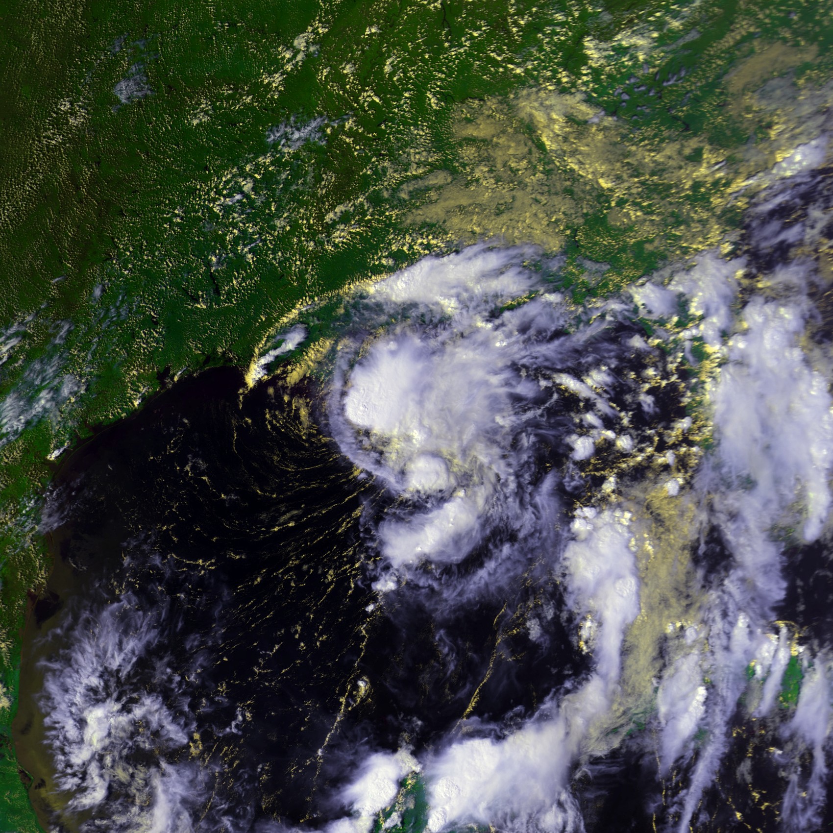
Val Verde County, Texas . Thirteen people died inTexas , and seven deaths were reported across the border inCiudad Acuña ,Coahuila . In addition, 300-1,500 homes, businesses, mobile homes and apartments were either damaged or destroyed by the floods, amounting to a damage total of $50 million (1998 USD, $58 million 2005 USD). Del Rio recorded 17 inches (43cm) of rain in 24 hours from the storm, a record for the city and the most rainfall from a tropical cyclone in Texas since Tropical Storm Claudette in 1979. [http://www.nhc.noaa.gov/1998charley.html]Hurricane Danielle
Infobox Hurricane Small
Basin=Atl
Track=Danielle 1998 track.png
Dissipated=September 3
1-min winds=92.5
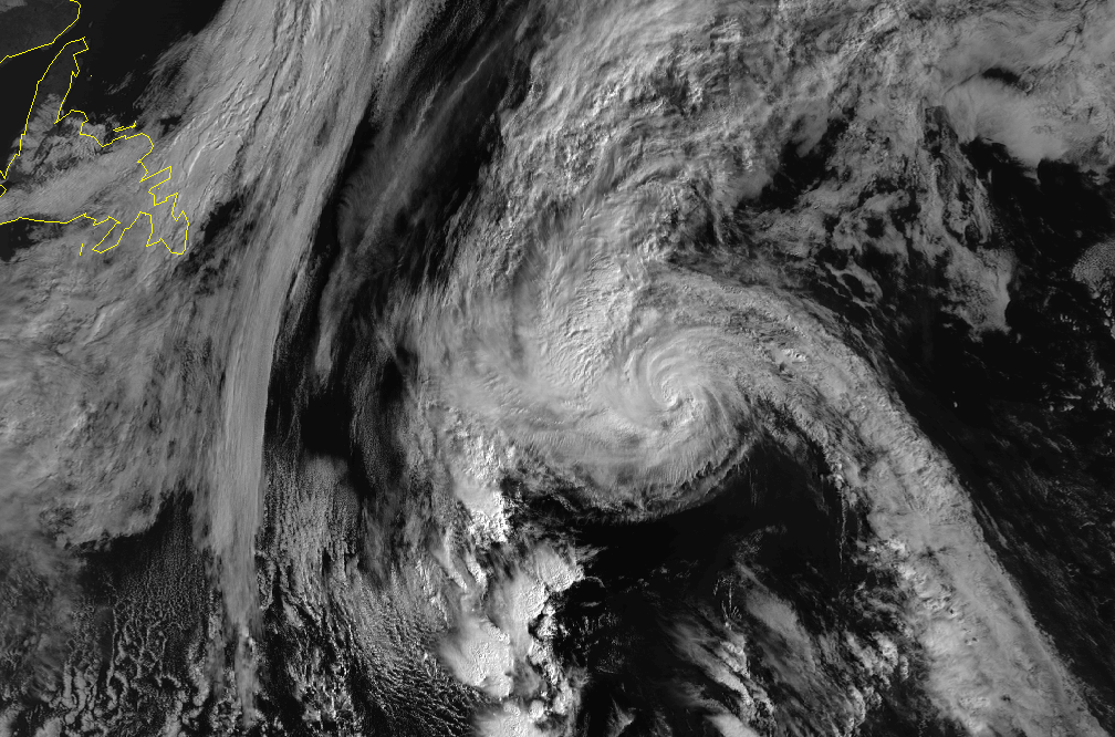
Pressure=960United States on August 31, Danielle turned, first to the north, then the northeast. Bonnie had finally moved off to the northeast after making landfall on the Carolina coast on August 28. Now all eyes were on Danielle, which by now was a Category 2 hurricane on theSaffir-Simpson Hurricane Scale with sustained winds of 100 mph (161 km/h).Danielle continued quickly northwest. A trough in the jet stream on the east coast prevented Danielle from making landfall in
Bermuda . As Danielle headed over colder water, it began losing its tropical characteristics. It was declared extratropical while south ofCape Race, Newfoundland on September 4. Danielle still had hurricane force winds when it became extratropical, and remained organized as it continued to the east. The extratropical storm was tracked until it merged with another system north ofIreland on September 8.No deaths were reported from Danielle as a tropical system. Danielle dissipated and became extratropical on September 3. The
British Isles took quite a lashing from the remnants of Danielle on September 6. Some people had to be rescued from treacherous sea conditions. Danielle was responsible for coastal damage in westernGreat Britain , causing beach evacuations inCornwall .Hurricane Earl
Infobox Hurricane Small
Basin=Atl

Track=Earl 1998 track.png
Dissipated=September 3
1-min winds=90
Pressure=988New Orleans, Louisiana . It made landfall at Category 1 on September 3 nearPanama City, Florida . After travelling inland, Earl became extratropical over Georgia, and then moved back out to sea and was tracked into the North Atlantic until it was absorbed by the extratropical remnants of Hurricane Danielle on September 8.Hurricane Earl was responsible for three deaths, and its eight foot
storm surge was largely responsible for an estimated $79 million in property damage. Prodigious rainfall fell during its transit of northern Florida, with 16.36" falling five miles (8 km) northeast of Panama City, Florida.Tropical Storm Frances
Infobox Hurricane Small
Basin=Atl
Track=Frances 1998 track.png
Dissipated=September 13
1-min winds=55
Pressure=990Corpus Christi, Texas on September 11 as a moderately strong tropical storm. It weakened to a tropical depression as it travelled north, and dissipated north ofDallas, Texas .The storm was relatively large, with tropical storm force winds extending 300 nmi (485 km) from the center of circulation. A storm surge of up to eight feet was reported along the Texas coastline, and rainfall totals for many areas exceeded ten inches (254 mm) .
Tropical Storm Frances was responsible for one direct death in
Lafourche Parish, Louisiana caused by a tornado. Heavy rainfall caused large amounts of flood damage in southeast Texas and southwestLouisiana , with an estimated total of $500 million in property damage.Hurricane Georges
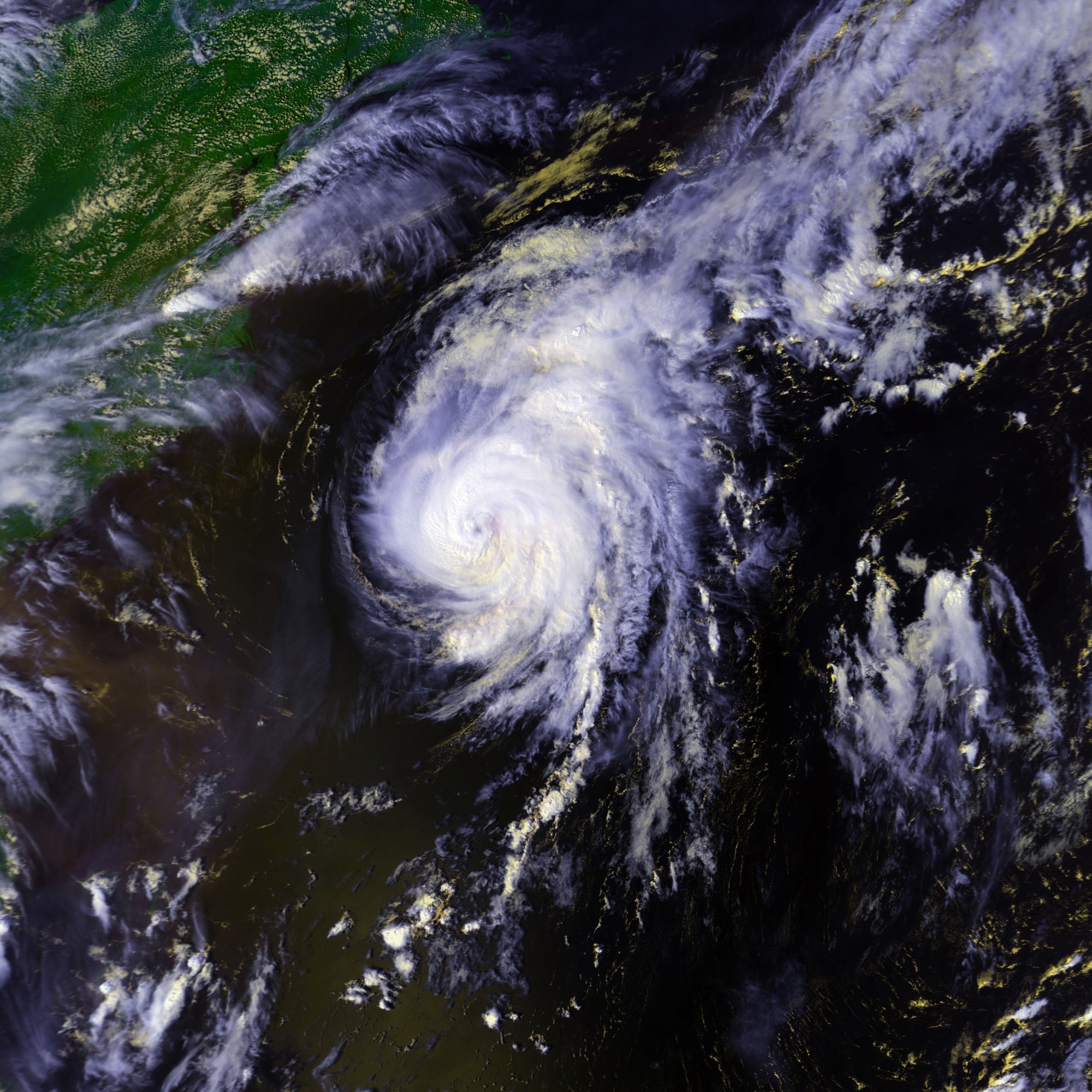
Infobox Hurricane Small
Basin=Atl

Track=Georges 1998 track.png
Dissipated=October 1
1-min winds=135
Pressure=937Africa in mid September organized into a tropical depression on September 15 while convert|300|nmi|km|abbr=on south-southwest of Cape Verde. It continued to develop, and reached tropical storm force on the 16th, while centered convert|620|nmi|km|abbr=on west-southwest of Cape Verde. Georges took a typical track for aCape Verde-type hurricane , with a nearly straight west-northwest track. Georges continued to strengthen, and nearly reached Category 5 classification on September 20, while convert|285|nmi|km|abbr=on east ofGuadeloupe . Georges weakened from this point on, but was on a track to travel up all of theLeeward Islands and theGreater Antilles .On the 21st, Georges began its seven landfalls in the Lesser Antilles, starting with Antigua. After passing through the smaller islands, it made landfall in Puerto Rico. It strengthened slightly as it left the island, but its passage over the mountainous terrain of
Hispaniola left it a minimal hurricane. Georges continued on, and traveled up the northern coast ofCuba . By September 25, it made landfall atKey West, Florida at Category 2 strength. As it entered the Gulf of Mexico, Georges began a turn to the north, and made landfall nearBiloxi, Mississippi on September 28. Georges meandered over southernMississippi , then slowly traveled east before dissipating over northern Florida on October 1.The damage caused by Georges was immense. There were 602 deaths directly associated with Georges, nearly all in the
Dominican Republic andHaiti . Property damage to theUnited States and its possessions is estimated at $5.9 billion. Monetary estimates of damage in other areas affected are not available. However, 185,000 were left homeless in the Dominican Republic, another 167,000 in Haiti, and 3,500 homes were destroyed in Cuba. Hurricane Georges was a very damaging storm, the 19th deadliest of the 20th century. Georges was one of 4 active Atlantic hurricanes on September 26.Tropical Storm Hermine
Infobox Hurricane Small
Basin=Atl
Track=Hermine 1998 track.png
Dissipated=September 20
1-min winds=40
Pressure=999Louisiana on September 17. The depression looped around offshore, then headed north. On September 19, it was upgraded to Tropical Storm Hermine. It made landfall the next day nearCocodrie, Louisiana . The storm produced two tornadoes and caused one injury and minor damage.cite web|author=Jack Beven|year=1999|title=Tropical Prediction Center- September 1998 through December 1998|publisher=Mariners Weather Log|accessdate=2007-02-21|url=http://www.vos.noaa.gov/MWL/apr1999.pdf]Hurricane Ivan
Infobox Hurricane Small
Basin=Atl
.jpg)
Track=Ivan 1998 track.png
Dissipated=September 27
1-min winds=80
Pressure=975Hurricane Jeanne
Infobox Hurricane Small
Basin=Atl
.jpg)
Track=Jeanne 1998 track.png
Dissipated=October 1
1-min winds=92.5
Pressure=969Guinea-Bissau . Jeanne formed farther east than any storm on record except for Tropical Storm Christine in 1973. It moved west-northwest and was named Tropical Storm Jeanne later on the 21st. The storm continued strengthening, and became a Category 2 hurricane. On September 25, Hurricane Jeanne began a slow turn to the right. By September 27, it was heading north, and on October 1, it crossed the Azores heading east as a weakening tropical storm. As it left the Azores, it became extratropical. The extratropical storm brought gale force winds toPortugal on October 4, and became unidentifiable overSpain later that day. No damage was reported. Jeanne was one of four active Atlantic hurricanes on September 26.Hurricane Karl
Infobox Hurricane Small
Basin=Atl
.jpg)
Track=Karl 1998 track.png
Dissipated=September 28
1-min winds=92.5
Pressure=970Hurricane Karl travelled generally northeast, and weakened to a tropical storm as it passed the Azores. On September 28, it became extratropical and was tracked until it was south of
Ireland the next day. Karl was one of 4 active Atlantic hurricanes on September 26.Hurricane Lisa
Infobox Hurricane Small
Basin=Atl
Track=Lisa 1998 track.png
Dissipated=October 9
1-min winds=65
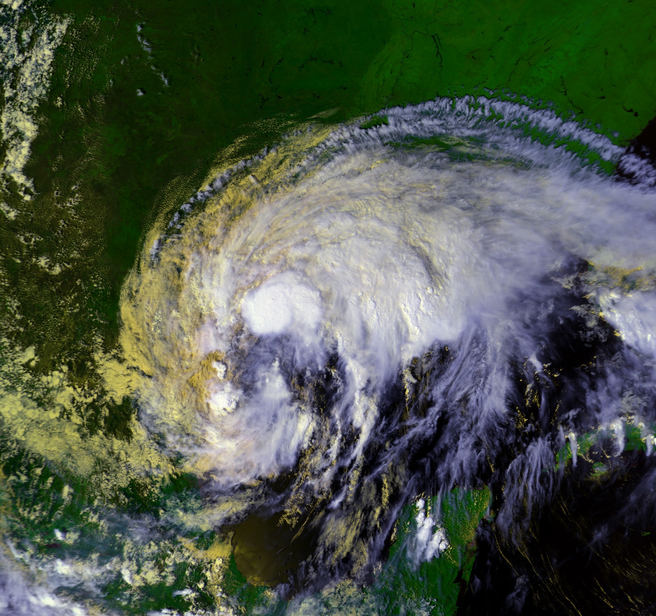
Pressure=995Hurricane Mitch
Infobox Hurricane Small
Basin=Atl
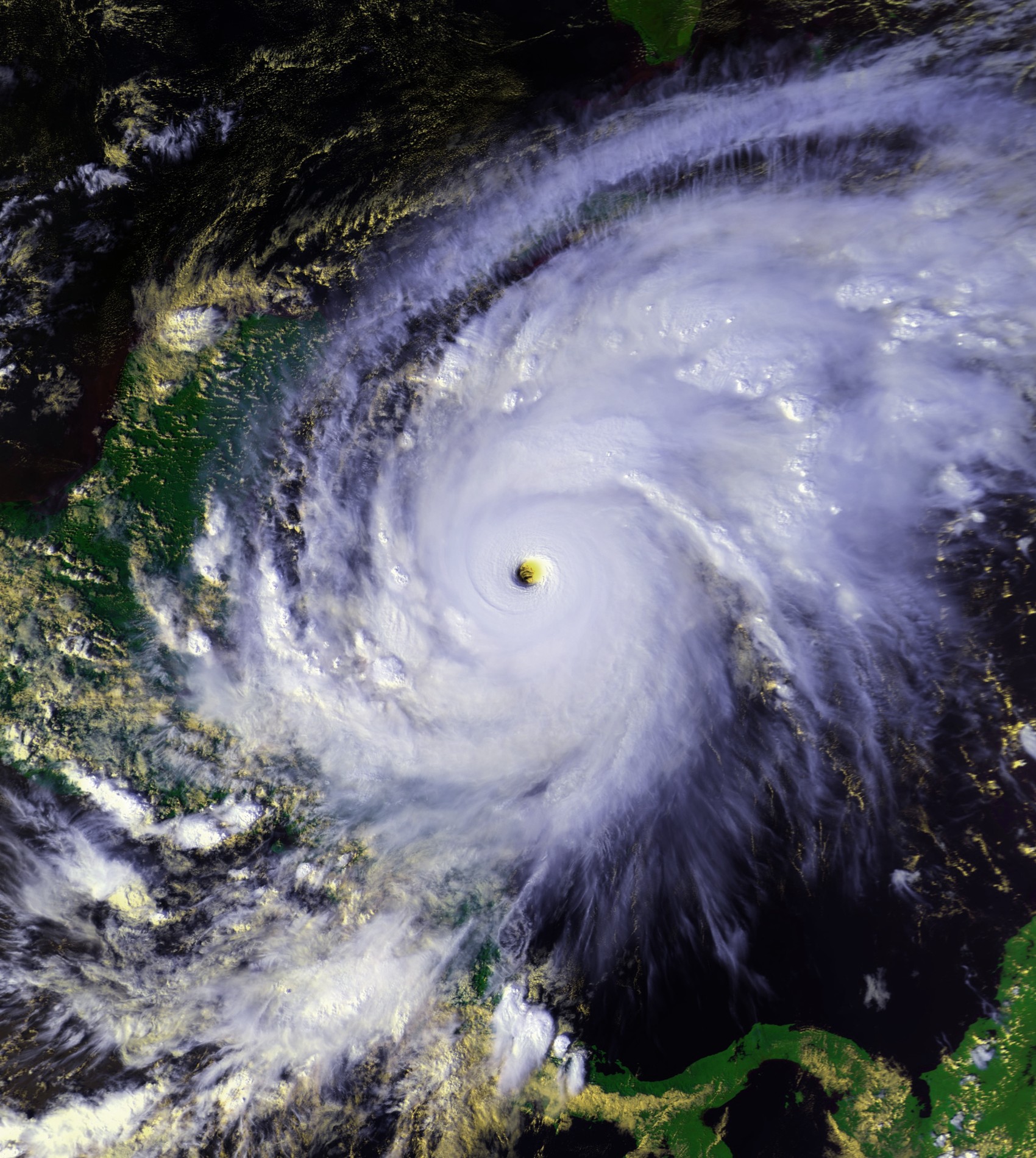
Track=Mitch 1998 track.png
Dissipated=November 5
1-min winds=155
Pressure=905mph (290km/h ). Mitch batteredCentral America from October 22, 1998 to November 5, 1998, killing at least 9,086 people and leaving over 9,000 missing. It was the deadliest hurricane in over 200 years and the second deadliest in Atlantic hurricane history.Deaths were mostly from
flooding , when the slow-moving hurricane and thentropical storm dropped nearly three feet (900 mm) of rain. Tens of thousands of homes were damaged or destroyed, leaving over 3 million homeless. Damage is estimated at over $5 billion (1998 USD). [http://lwf.ncdc.noaa.gov/oa/reports/mitch/mitch.html]As a much weaker storm, Mitch later traveled over
Yucatán and then across Florida. It continued out into the north Atlantic and was tracked north ofGreat Britain .Hurricane Nicole
Infobox Hurricane Small
Basin=Atl

Track=Nicole 1998 track.png
Dissipated=December 1
1-min winds=75
Pressure=979Canary Islands . The storm moved west-southwest for several days, and wind shear caused it to weaken to a tropical depression on November 26. The system was so weak that storm advisories were discontinued. However, it strengthened again and was again classified as a tropical storm on November 27.However, Nicole unexpectedly began a slow turn, and by November 30, Nicole was heading northeast toward the
Azores as a minimal hurricane. The storm then turned back to the north and was classified as extratropical on December 1. Hurricane Nicole never directly affected land and no damage was reported in association with it.Other storms
On April 1, a large circulation developed about 230 miles (370 km) northeast of the island of
Antigua . It deepened as it steadily northeastward, and developed deep convection near the surface circulation as the winds increased to gale force. The system developed tropical characteristics in that the latent heat release in thunderstorms was the primary energy source.cite web|author=Jack Beven and Andrew R. Shashy|year=1998|title=Marine Weather Review - Tropical Atlantic and Tropical East Pacific Areas: January to April 1998|publisher=Mariners Weather Log|accessdate=2007-02-21|url=http://www.vos.noaa.gov/MWL/aug1998.pdf] TheNational Hurricane Center issued a special tropical disturbance statement on April 2, though by the following day the system began to weaken as the convection became disorganized.cite web|author=Gary Padgett|year=1998|title=Tropical Weather Summary for April 1998|accessdate=2007-02-21|url=http://australiasevereweather.com/cyclones/1998/summ9804.txt] The low weakened further as it accelerated northeastward on April 4. Several ships encountered the storm, several of which reported winds in excess of convert|40|mi/h|km/h|abbr=on. Ships in the area reported seas of up to convert|24|ft|m in height. The Tropical Prediction Center classified the system as a hybrid low, and the National Hurricane Center reviewed data on the system to determine if it developed into asubtropical cyclone . Ultimately, it was excluded from the Atlantic hurricane database.A broad
low pressure area developed over the northwesternCaribbean Sea on October 19. It moved northwestward and gradually developed organized convection as it crossed theYucatan Peninsula . By October 21, the system resembled the formative stage of earlier Hurricane Earl and Tropical Storm Frances. A strong cold front to its north turned the system to the southwest,cite web|author=Jack Beven|year=1999|title=Tropical Prediction Center- September 1998 through December 1998|publisher=Mariners Weather Log|accessdate=2007-02-21|url=http://www.vos.noaa.gov/MWL/apr1999.pdf] and convection continued to develop near a surface center of circulation. Despite interaction with the cold front, the system organized further, prompting an Airforce reconnaissance flight into the area. On October 23, the low moved ashore onVeracruz before the recon flight reached the system. The low weakened and dissipated on October 24 overMexico .cite web|author=Gary Padgett|year=1998|title=Tropical Weather Summary for October 1998|accessdate=2007-02-21|url=http://australiasevereweather.com/cyclones/1999/summ9810.txt] The nature of the system is unknown; the organization just prior to landfall suggested tropical characteristics, though its interaction with the cold front indicated non-tropical characteristics. As such, the Tropical Prediction Center classified the system as a hybrid/tropical low.Accumulated Cyclone Energy (ACE) Rating
The table on the right shows the ACE for each storm in the season. The ACE is, broadly speaking, a measure of the power of the hurricane multiplied by the length of time it existed for, so hurricanes that lasted a long time have higher ACEs.
Storm names
The following names were used for named storms that formed in the north Atlantic in 1998. The names not retired from this list were used again in the 2004 season. This is the same list used for the 1992 season except for Alex, which replaced Andrew. Storms were named Alex, Lisa, Mitch, and Nicole for the first time in 1998. Names that were not assigned are marked in tcname unused.
Retirement
The
World Meteorological Organization retired two names in the spring of 1999: Georges and Mitch. They were replaced in the 2004 season by Gaston and Matthew.ee also
*
List of Atlantic hurricanes
*List of Atlantic hurricane seasons
*1998 Pacific hurricane season
*1998 Pacific typhoon season
*1998 North Indian Ocean cyclone season
*South-West Indian Ocean cyclone seasons: 1997–98, 1998–99
*Australian region cyclone seasons: 1997–98, 1998–99
*South Pacific cyclone seasons: 1997–98, 1998–99References
External links
* [http://www.aoml.noaa.gov/general/lib/lib1/nhclib/mwreviews/1998.pdf Monthly Weather Review]
* [http://www.nhc.noaa.gov/1998.html National Hurricane Center 1998 Atlantic hurricane season summary]

Wikimedia Foundation. 2010.