- Dickinson Theodore Roosevelt Regional Airport
-
Dickinson Theodore Roosevelt Regional Airport 
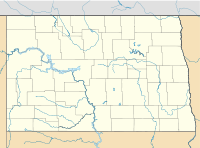
IATA: DIK – ICAO: KDIK – FAA LID: DIK Location of the Airport in North Dakota Summary Airport type Public Operator Dickinson Municipal Airport Authority Serves Dickinson, North Dakota Elevation AMSL 2,592 ft / 790 m Coordinates 46°47′51″N 102°48′07″W / 46.7975°N 102.80194°W Website Runways Direction Length Surface ft m 14/32 6,400 1,951 Asphalt 7/25 4,700 1,433 Asphalt Statistics (2006) Aircraft operations 8,673 Sources: FAA[1] and airport web site[2] Dickinson Theodore Roosevelt Regional Airport (IATA: DIK, ICAO: KDIK, FAA LID: DIK), formerly known as Dickinson Municipal Airport, is a public airport located five miles (8 km) south of the central business district of Dickinson, a city in Stark County, North Dakota, United States. It is owned by the Dickinson Airport Authority.[1]
The airport serves western North Dakota, eastern Montana and northwest South Dakota, home to Theodore Roosevelt National Park. It is mostly used for general aviation but is also served by one commercial airline, with three flights each day from Sunday through Friday, and two flights on Saturday. Service is subsidized by the Essential Air Service program. Great Lakes Airlines uses their EMB-120 and Beechcraft 1900D aircraft to operate at Dickinson.[3]
Contents
Facilities and aircraft
Dickinson Theodore Roosevelt Regional Airport covers an area of 626 acres (253 ha) which contains two asphalt paved runways: 14/32 measuring 6,400 x 100 ft (1,951 x 30 m) and 7/25 measuring 4,700 x 75 ft (1,433 x 23 m). For the 12-month period ending December 31, 2006, the airport had 8,673 aircraft operations, an average of 23 per day: 67% general aviation, 18% air taxi, 14% scheduled commercial and 1% military.[1]
Airlines and destinations
Airlines Destinations Great Lakes Airlines Denver, Sidney, Williston References
- ^ a b c FAA Airport Master Record for DIK (Form 5010 PDF), effective 2007-12-20
- ^ Dickinson Theodore Roosevelt Regional Airport, official web site
- ^ http://www.flygreatlakes.com/time_table/doc_files/time_table.pdf
External links
- Resources for this airport:
- AirNav airport information for KDIK
- ASN accident history for DIK
- FlightAware airport information and live flight tracker
- NOAA/NWS latest weather observations
- SkyVector aeronautical chart, Terminal Procedures for KDIK
- Essential Air Service documents (Docket Number 697) from the U.S. Department of Transportation:
Categories:- Airports in North Dakota
- Essential Air Service
- Buildings and structures in Stark County, North Dakota
Wikimedia Foundation. 2010.

