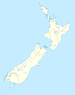
Drury, New Zealand

Drury, New Zealand
Drury is located in New Zealand
{{{alt}}}
Drury
Drury
Basic information
Local authority Auckland Council
Electoral ward Franklin
Population 3, 582 (2006)
Facilities
Surrounds
North Rosehill
Northeast Opaheke
East Ponga
Southeast Ararimu
South Ramarama
Southwest Ramarama
West Runciman
Northwest Hingaia
v · d · e

Drury is a rural town near Auckland, in northern New Zealand. Located 36 kilometres to the south of Auckland CBD, under authority of the Auckland Council. Drury lies at the southern border of the Auckland metropolitan area, 12 kilometres to the northeast of Pukekohe, close to the Papakura Channel, an arm of the Manukau Harbour[1].

Contents

History

Drury was formerly home to a military base. The population declined when this was closed. During the New Zealand land wars, Drury was the last place on the Great South Road where protection from Maori was provided. Maori used the Drury Hills to watch the Great South Road, and plan attacks from them.[citation needed]

During the major reformation of local government in 1989, Drury was included in the Auckland Region and made up the southern edge of the Papakura District, along with a certain extent of the eastern surrounding rural areas, previously known as Franklin County. Drury was until recently a relatively small semi-rural area nestling at the foot of the low-lying Bombay Hills. Urban spread of the city has rendered it an extreme southern suburb, close to the junction between State Highways 1 and 22, both of which head south towards the Waikato region.

After a review of the Royal Commission on Auckland Governance, the entire Auckland Region was amalgamated into a single city authority. As well as the former Papakura District and Franklin District, all other territorial authorities were be abolished and the entire area was dissolved into a single Auckland city council. The town of Drury was included in the Franklin ward, one of the thirteen administrative structures of the new Auckland city.

People

The Drury population is predominantly European as at 2006, at 75.3 percent. Maori residents make up 11.9 percent of the suburb, and 7.0 percent being of Asian ethnicity. According to the 2006 New Zealand census, (for residents aged 15 years and older) the most common occupational group in Drury is Managers, and the least common group is Machinery operators and drivers, with an unemployment rate of 3.3 percent of the Drury population.

References

External links

Coordinates: 37°06′S 174°57′E / 37.1°S 174.95°E / -37.1; 174.95


Wikimedia Foundation. 2010.

Игры ⚽ Поможем решить контрольную работу

Look at other dictionaries:

  • New Zealand Muslim Association — (NZMA) the oldest Islamic institution in New Zealand. It was established in 1950. In 1959 it purchased a house in Ponsonby, central Auckland, and converted it into the first Islamic Centre in the country. In 1960 the NZMA invited Maulana Said… …   Wikipedia

  • New Zealand Muslim Association — Die New Zealand Muslim Association (Muslimische Gesellschaft Neuseelands) ist die älteste islamische Organisation in Neuseeland und wurde 1950 in Auckland gegründet. Sie baute das erste islamische Haus Neuseelands im Jahre 1959. 1979 baute die… …   Deutsch Wikipedia

  • New Zealand Computer Society — NZCS redirects here. For the aerodrome with ICAO code NZCS, see Cromwell Racecourse Aerodrome. New Zealand Computer Society Inc Type Professional Organisation Founded October, 1960 Location …   Wikipedia

  • New Zealand Listener Power List — The New Zealand Listener Power List is a list of the most powerful people in New Zealand, compiled annually by the New Zealand Listener from 2004 to 2009. From 2004 to 2007, the list covered the 50 most powerful people without separating them by… …   Wikipedia

  • Federation of Islamic Associations of New Zealand — The Federation of Islamic Associations of New Zealand (FIANZ) was set up in April 1979 by Mazhar Krasniqi and other Muslim community leaders to draw together the regional Islam organisations of Auckland, Wellington and Canterbury into one… …   Wikipedia

  • Great South Road, New Zealand — The Great South Road was the northern section of the earliest highway between Auckland and Wellington, in the North Island of New Zealand. Construction of the Great South Road began in 1861 during the New Zealand Wars. The road was constructed by …   Wikipedia

  • Islam in New Zealand — has grown with inward immigration to that country. HistoryThe first Muslims in New Zealand were Chinese golddiggers working in the Dunstan gold fields of Otago in the 1870s. In the early 1900s three important Gujarati Muslim families came from… …   Wikipedia

  • National Grid (New Zealand) — The major transmission network in New Zealand. Generation and load centres are shown as blue and red circles respectively. The major AC transmission corridors are shown as black lines, with the HVDC Inter Island shown as a dashed line. The… …   Wikipedia

  • Drury — can refer to several things: Drury, New Zealand Drury, Flintshire, UK Drury University, formerly Drury College, Springfield, Missouri Drury Hotels operator of Drury Inns Drury Lane, a famous street in the Westend of London Drury, a bridge… …   Wikipedia

  • Federation of Islamic Associations of New Zealand — Die Federation of Islamic Associations of New Zealand (FIANZ) ist ein eingetragener landesweiter Verbund regionaler neuseeländischer muslimischer Organisationen mit Sitz in Wellington, welche am 15 April 1979 gegründet wurde. Initiator und erster …   Deutsch Wikipedia

Share the article and excerpts

Direct link
Do a right-click on the link above
and select “Copy Link”