- Cwm Idwal
-
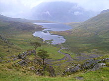
Cwm Idwal is a hanging valley in the Glyderau range of mountains in northern Snowdonia, the national park in the mountainous region of North Wales. Its main interest is to hill walkers and rock climbers, but it is also of interest to geologists and naturalists, given its combination of altitude (relatively high in UK terms), aspect (north-facing) and terrain (mountainous and rocky). In a 2005 poll conducted by Radio Times, Cwm Idwal was ranked the 7th greatest natural wonder in Britain.
Contents
Geology
Cwm Idwal is a spectacular product of glaciation, surrounded by high crags, screes, moraines and rounded rocks, with a lake on its floor (Llyn Idwal). Cwm Idwal comprises volcanic and sedimentary rock which was laid down in a shallow Ordovician sea, and later folded to give rise to the distinctive trough-shaped arrangement of strata known today as the Idwal Syncline. This fold in the rock is visible today, thanks to the layering of the sedimentary rocks. The area was then eroded by glacial action to form the classic semicircular valley.
Botany
Given its elevation and north-facing aspect, Cwm Idwal is the most southerly place in Britain where Arctic plants such as moss campion and some alpine saxifrages, such as tufted saxifrage (Saxifraga cespitosa) and Saxifraga nivalis, can be found. It is also a home of the Snowdon lily, a plant which can only be found in the UK on Snowdon and its surroundings. Evan Roberts [1], the renowned botanist and explorer from Capel Curig, did probably as much as any other (self taught) botanist to document the area. The Snowdonia hawkweed, Hieracium snowdoniense is only known to occur in Cwm Idwal.
Mountaineering
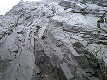
The Idwal slabs and the cliffs around the head of Cwm Idwal are a popular area for rock climbing; the Idwal Slabs (on the eastern side of the Cwm) in particular are popular with inexperienced climbers learning their skills. The Devil's Kitchen has some excellent ice climbing during the winter. It is also popular for hill walking and scrambling, given its proximity to Tryfan and Glyder Fach and Glyder Fawr and their profusion of rocky ridges.
In the mid to late 1950s and into the 1960s, this was the reunion excursion camp site of the first ascenders of Mount Everest and Kangchenjunga, held at Pen-y-Gwryd, many of whom were keen geologists and botanists.
References
External links
- Cwm Idwal is at coordinates 53°06′49″N 4°01′48″W / 53.113712°N 4.029927°WCoordinates: 53°06′49″N 4°01′48″W / 53.113712°N 4.029927°W / SH 641 593
Categories:- Valleys of Wales
- Tourism in Gwynedd
- Geography of Gwynedd
- National Nature Reserves in Wales
- Climbing areas of Wales
Wikimedia Foundation. 2010.


