- Štítnik
-
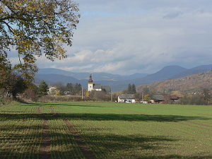
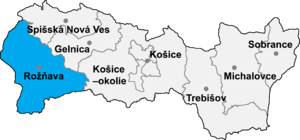
Štítnik (Hungarian: Csetnek) is a village and municipality in the Rožňava District in the Košice Region of middle-eastern Slovakia.
Contents
History
In historical records the village was first mentioned in 1243 by King Bela IV of Hungary, that was in a letter.
Historical discoveries prove that the origin of this settlement date from the earlier part of the Middle Ages, the 12th century. The town belonged to the owners of Gemer Castle.
Geography
The village lies at an altitude of 345 metres and covers an area of 34.544 km². It has a population of about 1485 people. The village is situated in the historical region of Gemer. It is located about 14 kilometers from Rožňava.
Culture
The village has a public library, a gymnasium and a football pitch. It also has a cinema. There is also Vodny Hrad which was built in the 14th century.
The Gothic evangelical church in the village was built in the 14th century, which inside it contains the oldest organ in Central Europe, constructed in 1491. There is also a Renaissance altar from 1636
External links
Dobšiná · Rožňava
Ardovo · Betliar · Bohúňovo · Bôrka · Brdárka · Bretka · Brzotín · Čierna Lehota · Čoltovo · Čučma · Dedinky · Dlhá Ves · Drnava · Gemerská Hôrka · Gemerská Panica · Gemerská Poloma · Gočaltovo · Gočovo · Hanková · Henckovce · Honce · Hrhov · Hrušov · Jablonov nad Turňou · Jovice · Kečovo · Kobeliarovo · Koceľovce · Kováčová · Krásnohorská Dlhá Lúka · Krásnohorské Podhradie · Kružná · Kunova Teplica · Lipovník · Lúčka · Markuška · Meliata · Nižná Slaná · Ochtiná · Pača · Pašková · Petrovo · Plešivec · Rakovnica · Rejdová · Rochovce · Roštár · Rozložná · Rožňavské Bystré · Rudná · Silica · Silická Brezová · Silická Jablonica · Slavec · Slavoška · Slavošovce · Stratená · Štítnik · Vlachovo · Vyšná Slaná
Coordinates: 48°40′N 20°22′E / 48.667°N 20.367°E
Categories:- Villages and municipalities in Rožňava District
- Rožňava District geography stubs
Wikimedia Foundation. 2010.


