- Rožňava
Geobox|Settlement
name = Rožňava
category = Town
etymology =
official_name =
motto =
nickname =
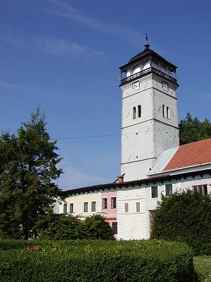
image_caption = Town tower
symbol =
symbol_type =
country = Slovakia
country_
state =
region = Košice Region
district = Rožňava District
municipality =
parent = Gemer
parent_type = Tourism region
river = Slaná
location =
elevation = 313
prominence =
lat_d =48 | lat_m =39 | lat_s =30 | lat_NS =N
long_d =20 | long_m =31 | long_s =51 | long_EW =E
highest =
highest_location = | highest_region = | highest_state =
highest_elevation =
highest_lat_d = | highest_lat_m = | highest_lat_s = | highest_lat_NS =
highest_long_d = | highest_long_m = | highest_long_s = | highest_long_EW =
lowest =
lowest_location = | lowest_region = | lowest_state =
lowest_elevation =
lowest_lat_d = | lowest_lat_m = | lowest_lat_s = | lowest_lat_NS =
lowest_long_d = | lowest_long_m = | lowest_long_s = | lowest_long_EW =
length = | length_orientation =
width = | width_orientation =
area = 45.614
area_land =
area_water =
area_urban =
area_metro =
population =19231 | population_date =31 December 2005
population_urban =
population_metro =
population_density = auto
population_density_urban =
population_density_metro =
established =1291
established_type = First mentioned
date =
government =
government_location = | government_region = | government_state =
government_elevation =
government_lat_d = | government_lat_m = | government_lat_s = | government_lat_NS =
government_long_d = | government_long_m = | government_long_s = | government_long_EW =
mayor = Vladislav Laciak
leader =
timezone =
map_caption = Location of Rožňava in Slovakia
map_background = Slovakia - background map.png
map1 = Košice Region - outline map.svg
map1_caption = Location of Rožňava in the Košice Region
map1_background = Košice Region - background map.png
commons = Rožňava
statistics = [http://www.statistics.sk/mosmis/eng/prvav2.jsp?txtUroven440808&lstObec525529&Okruhzaklad MOŠ/MIS]
website = http://www.roznava.sk
footnotes =Rožňava ( _hu. Rozsnyó, _de. Rosenau,
Latin : "Rosnavia") is a town inSlovakia , approximately 75 km by road fromKošice in theKošice Region , and has a population of 19,120.The town is an economic and tourist center of the
Gemer . Rožňava is now a popular tourist attraction with a beautiful historic town centre. The town is an episcopal seat. It has above all food, textile and remnants of mining industries.History
Archaeological finds show that the region was densely settled by miners as early as around 1200. The first written mention stems from
1291 , the royal free town status from 1410. The Roman-Catholicdiocese of Rožňava was founded in 1776.In the Middle Ages, Rožňava was a prosperous mining town for
gold ,silver , andiron . Mining activities stagnated from the 16th century (when territories to the south of the town were conquered byOttoman Turks ). Mining - this time mainly of iron ore - was renewed around 1800 and was present in the town throughout the 20th century.The name of the town probably derives from the German and/or Hungarian word for rose ("Rose" and "Rózsa").
On
13 September 2003 , Rožňava was visited by PopeJohn Paul II .Noteworthy buildings
* an important
Mining Museum
* a completely preserved medieval central town square with burgher houses
* the Cathedral (Gothic, late 13th century) with many precious historic art objects, especially a Renaissance painting of Mestercia showing realistic mining motifs
* the Town Tower (Renaissance, 1654) in the middle of the central town square
* the Jesuit church (Baroque, 1687)
* the Bishop's residence (Baroque-Classical, arose 1778 from older houses) with aplague column in front of the building
* a town hall (Classical, 1711)
* an Evangelic Lutheran church (Classical, 1786)
* a Reformed church (neo-Gothic, 1905)Demographics
According to the 2001
census , the town had 19,261 inhabitants. 69.27% of inhabitants wereSlovaks , 26.80%Hungarians , 1.59% Roma and 0.69% Czechs.cite web | title = Municipal Statistics | publisher = Statistical Office of the Slovak republic | url = http://www.statistics.sk/mosmis/eng/run.html | accessdate = 2007-12-28] The religious make-up was 41.08%Roman Catholics , 32.34% people with no religious affiliation, 12.03%Lutherans and 1.33% Greek Catholics.Notable citizens
A famous son of the town is
Pavel Jozef Šafárik .Parts of the town
* Nadabula
* Rožňava (proper)
* Rožňavská Baňa (Rožňava Mine)Twin towns
*
Bačka Topola
*Cieszyn
*Český Těšín
*Glarus
*Szerencs References
External links
* [http://www.retep.sk/ Rožňava]
* [http://www.spectacularslovakia.sk/ss2002/gemer.html Information on Rožňava and the Gemer region]
* [http://www.tourist-channel.sk/roznava/indexen.html Information on tourist sights] (with photo of the main square)
* [http://www.inforoznava.sk/ Medial information site about life in Rožňava] (In slovak language)
* [http://www.roznava.sk Official site] (Slovak only)


Wikimedia Foundation. 2010.