- Lime Point Light
Infobox Lighthouse
caption =
location =Golden Gate Bridge ,California
coordinates = coord|37.825539|N|122.478406|W
yearbuilt = 1883
yearlit = 1900
automated = 1961
yeardeactivated =
foundation =
construction =Brick
shape = Square
height = 20 ft
currentlens =
lens =
range =
characteristic =
ARLHS = USA-434
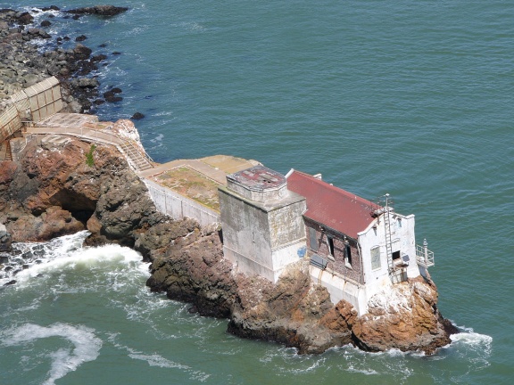
USCG = 6-4270Lime Point Lighthouse is a
lighthouse inCalifornia ,United States , on northern side of theGolden Gate Bridge .History
The lens lantern at Lime Point was hung on the wall of the fog signal building at a height of 20 feet above the water. When the Golden Gate Bridge was completed in 1937, a fog horn and light were placed at the base of the bridge’s south tower, making the Fort Point Light unnecessary. However, Lime Point Lighthouse was located next to the base of the north tower, and remained an effective position for a light and fog horn. Lime Point was automated by the
United States Coast Guard in 1961, and the three-story dwelling and other buildings were torn down, leaving only the fog signal building.External links
* [http://www.us-lighthouses.com/displaypage.php?LightID=10 Lime Point Lighthouse Page at www.us-lighthouses.com]
*gnis|1809032|Lime Point Lighthouse
Wikimedia Foundation. 2010.