- Onaping Falls, Ontario
Infobox Settlement
official_name = Onaping Falls
other_name =
native_name =
nickname =
settlement_type = Community
motto =
imagesize =
image_caption =
flag_size =
image_
seal_size =
image_shield =
shield_size =
city_logo =
citylogo_size =
mapsize =
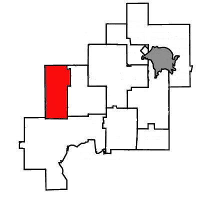
map_caption = Location of Onaping Falls withinGreater Sudbury .
mapsize1 =
map_caption1 =
image_dot_
dot_mapsize =
dot_map_caption =
dot_x = |dot_y =
pushpin_
pushpin_label_position =
pushpin_map_caption =
pushpin_mapsize =
subdivision_type = Country
subdivision_name =Canada
subdivision_type1 = Province
subdivision_name1 =Ontario
subdivision_type2 =City
subdivision_name2 =Greater Sudbury
subdivision_type3 = Ward
subdivision_name3 = 3
subdivision_type4 =
subdivision_name4 =
government_footnotes =
government_type =
leader_title = City Councillor
leader_name = Claude Berthiaume
leader_title1 = Governing Body
leader_name1 =Greater Sudbury City Council
leader_title2 = MPs
leader_name2 =Ray Bonin (Lib)
leader_title3 = MPPs
leader_name3 =France Gélinas (NDP)
leader_title4 =
leader_name4 =
established_title = Incorporated
established_date =January 1 ,1973
established_title2 = Dissolved
established_date2 =December 31 ,2000
established_title3 =
established_date3 =
area_magnitude =
unit_pref =
area_footnotes =
area_total_km2 =
area_land_km2 =
area_water_km2 =
area_total_sq_mi =
area_land_sq_mi =
area_water_sq_mi =
area_water_percent =
area_urban_km2 =
area_urban_sq_mi =
area_metro_km2 =
area_metro_sq_mi =
population_as_of = 1996
population_footnotes =Statistics Canada
population_note =
population_total = 5277
population_density_km2 =
population_density_sq_mi =
population_metro =
population_density_metro_km2 =
population_density_metro_sq_mi =
population_urban =
population_density_urban_km2 =
population_density_urban_sq_mi =
population_blank1_title =
population_blank1 =
population_density_blank1_km2 =
population_density_blank1_sq_mi =
timezone = EST
utc_offset = -5
timezone_DST = EDT
utc_offset_DST = -4
elevation_footnotes =
elevation_m =
elevation_ft =
postal_code_type = Postal Code FSA
postal_code = P0M
area_code = 705
blank_name =
blank_info =
blank1_name =
blank1_info =
website = [http://communities.mysudbury.ca/Sites/ofcan/default.aspx Onaping Falls Community Action Network]
footnotes =Onaping Falls (1996 census population 5,277) was a town in the Canadian province of
Ontario , which existed from 1973 to 2000.It was created as part of the
Regional Municipality of Sudbury . The town took its name from the waterfalls on the Onaping River.On
January 1 ,2001 , the town and the Regional Municipality were dissolved and amalgamated into the city ofGreater Sudbury . The town is now part of Ward 3 onGreater Sudbury City Council , and is represented by councillor Claude Berthiaume.The town comprised the communities of Dowling, Levack, Levack Station, Onaping and Phelans.
History
This 5,000 resident town was originally a lumber and ore/nickel mining town, 55 km northwest of Sudbury. It has become famous for High Falls, where the Onaping River drops 46 metres in a single plunge. The town is at the point where the Canadian Shield meets the Sudbury Nickel Irruptive, caused by a meteorite strike two billion years ago. There is a lookout off the main road, called the A.Y. Jackson Lookout, for the famous Group of Seven artist who memorialized the view on his canvas.
The town is also home to
Windy Lake Provincial Park .Economy
The main employers in Onaping Falls are
CVRD Inco andXstrata , both international mining companies.External links
* [http://communities.mysudbury.ca/Sites/ofcan/default.aspx Onaping Falls Community Action Network]
* [http://www.levackontario.com Levack history portal]
* [http://www.sudburymuseums.ca/index.cfm?app=w_vmuseum&lang=en&currID=1398&parID=1390 History of Onaping Falls] atGreater Sudbury Heritage Museums
Wikimedia Foundation. 2010.
