- Rayside-Balfour, Ontario
Infobox Settlement
official_name = Rayside-Balfour
other_name =
native_name =
nickname =
settlement_type = Community
motto =
imagesize =
image_caption =
flag_size =
image_
seal_size =
image_shield =
shield_size =
city_logo =
citylogo_size =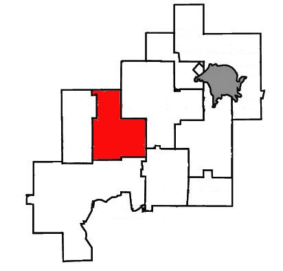
mapsize =
map_caption = Location of Rayside-Balfour withinGreater Sudbury .
mapsize1 =
map_caption1 =
image_dot_
dot_mapsize =
dot_map_caption =
dot_x = |dot_y =
pushpin_
pushpin_label_position =
pushpin_map_caption =
pushpin_mapsize =
subdivision_type = Country
subdivision_name =Canada
subdivision_type1 = Province
subdivision_name1 =Ontario
subdivision_type2 =City
subdivision_name2 =Greater Sudbury
subdivision_type3 = Ward
subdivision_name3 = 3, 4
subdivision_type4 =
subdivision_name4 =
government_footnotes =
government_type =
leader_title = City Councillor
leader_name = Claude Berthiaume, Evelyn Dutrisac
leader_title1 = Governing Body
leader_name1 =Greater Sudbury City Council
leader_title2 = MPs
leader_name2 =Ray Bonin (Lib)
leader_title3 = MPPs
leader_name3 =France Gélinas (NDP)
leader_title4 =
leader_name4 =
established_title = Incorporated
established_date =January 1 ,1973
established_title2 = Dissolved
established_date2 =December 31 ,2000
established_title3 =
established_date3 =
area_magnitude =
unit_pref =
area_footnotes =
area_total_km2 =
area_land_km2 =
area_water_km2 =
area_total_sq_mi =
area_land_sq_mi =
area_water_sq_mi =
area_water_percent =
area_urban_km2 =
area_urban_sq_mi =
area_metro_km2 =
area_metro_sq_mi =
population_as_of = 1996
population_footnotes =Statistics Canada
population_note =
population_total = 16050
population_density_km2 =
population_density_sq_mi =
population_metro =
population_density_metro_km2 =
population_density_metro_sq_mi =
population_urban =
population_density_urban_km2 =
population_density_urban_sq_mi =
population_blank1_title =
population_blank1 =
population_density_blank1_km2 =
population_density_blank1_sq_mi =
timezone = EST
utc_offset = -5
timezone_DST = EDT
utc_offset_DST = -4
elevation_footnotes =
elevation_m =
elevation_ft =
postal_code_type = Postal Code FSA
postal_code = P0M
area_code = 705
blank_name =
blank_info =
blank1_name =
blank1_info =
website = [http://communities.mysudbury.ca/Sites/RBCAN/default.aspx Rayside-Balfour Community Action Network]
footnotes =Rayside-Balfour (1996 census population 16,050) was a town in
Ontario ,Canada , which existed from 1973 to 2000.It was created as part of the
Regional Municipality of Sudbury . The town took its name from the geographic townships of Rayside and Balfour, which fell within the boundaries of the new town.Although the Regional Municipality of Sudbury was a very important centre of
Franco-Ontarian population and culture, Rayside-Balfour was the only town in the regional municipality which had a majorityfrancophone population.On
January 1 ,2001 , the town and the Regional Municipality were dissolved and amalgamated into the city ofGreater Sudbury . The Rayside-Balfour area is now divided between Wards 3 and 4 onGreater Sudbury City Council , and is represented by councillors Claude Berthiaume and Evelyn Dutrisac.In 2006, there has been interest in the deamalgamation of the former town of Rayside-Balfour from the City of Greater Sudbury. However, as any referendum on the matter would require the consent of the provincial government, it is not known whether any such move toward deamalgamation will take place.
Communities
Azilda
Azilda gets its name from Azilda Bélanger, the first female pioneer of the area. The community borders the eastern shore of
Whitewater Lake .Recently Municipal Road 35, linking Azilda to downtown Sudbury, has been increased from two lanes to four lanes. This development improves the commute for Azilda's workers, who are mostly employed in the city's urban core. In addition, it shortens the travel time for tourists hoping to visit
Sudbury Downs , which is located in the outskirts of Azilda. There are future plans to complete the widening of Municipal Road 35 between Azilda and Chelmsford, although the start of the construction has not yet been determined.On
September 12 ,1906 , Azilda was the site of a train wreck.Azilda's telephone and postal service also includes the smaller local neighbourhoods of Bélanger and Simard.
Azilda is the home of
Randy Carlyle .Chelmsford
Founded in 1868, Chelmsford started out as an outpost on the
Canadian Pacific Railway . Some say Chelmsford was named by one the Canadian Pacific Railway engineers, that was from the U.K. As with many communities inNorthern Ontario ,logging andfur trapping were the first industries. Having depleted the lumber in the early 1900s, Chelmsford turned to mining and agriculture to support the town's economy. Errington Mine and Nickel Offset mine were two of the largest mines in Chelmsford and both closed in the 1930s.Today, Chelmsford has no major industries and is mostly a residential community. Although there are still some farms producing mostly
potato es, smallfruit s andcorn , it is mostly supported by the mining activities in the nearby communities of Onaping Falls and Copper Cliff.Postal delivery and telephone service in Chelmsford also includes the smaller neighbourhoods of Boninville, Hull and Larchwood.
Chelmsford is host to an annual fiddle festival, Fiddle Works, in May of each year. It is the birthplace of
Stéphane Paquette , a popular francophone singer-songwriter and actor.Education
There are two francophone schools (École publique Franco-Nord and École catholique Ste-Marie) in Azilda. All anglophone students must attend a school in Chelmsford or Valley East.
Chelmsford is home to two secondary schools:
Chelmsford Valley District Composite School in which is aFrench immersion and English high school, specializing in technology and the trades with an excellent STAR (Science and Tech Achieving Results) academic programme. CVDCS' motto is "The Place to Be". École secondaire catholique Champlain is the francophone high school in the area, which serves the former towns of Rayside-Balfour and Onaping Falls.Chelmsford is also home to a new elementary school,
École Alliance St-Joseph . The school, part of theConseil scolaire de district catholique du Nouvel-Ontario , services the francophone community and is the largest population-wise in the entire City of Greater Sudbury, amalgamated three separate French catholic elementary schools: St-Joseph, Jacques-Cartier and Monseigneur Côté. The school uses advanced technology in the classroom, and provides its students with portable computers for in-class use.The community is also home to a French public school, Pavillon-de-l'Avenir, which is housed in the former Collège Rayside-Balfour section of the
Chelmsford Valley District Composite School building.External links
* [http://communities.mysudbury.ca/Sites/RBCAN/default.aspx Rayside-Balfour Community Action Network]
* [http://www.sudburymuseums.ca/index.cfm?app=w_vmuseum&lang=en&currID=3609&parID=2315 Greater Sudbury Virtual Heritage Museum, photo of derailment near Azilda]
* [http://www.sudburymuseums.ca/index.cfm?app=w_vmuseum&lang=en&currID=1399&parID=1390 History of Rayside-Balfour] atGreater Sudbury Heritage Museums
Wikimedia Foundation. 2010.