- Cáceres, Mato Grosso
-
Cáceres State Mato Grosso Area: 24 797 km² Population: 85 274 (Estimate: 07/2003) Height: 118 m above sea level Postcode (CEP): 78200-000 Geographic location: 16°11′S 57°40′W / 16.183°S 57.667°W Address of the local government: Prefeitura Municipal de Cáceres
Av. Getúlio Vargas, s/n
COC - Cáceres - MTWebsite: www.caceres.mt.gov.br Map 
Cáceres is an important town in the Brazilian state of Mato Grosso. It lies on the Paraguai River. Cattle ranching and fishing are the two most important economic activities of the town, and it is a popular tourist attraction during Festival Internacional de Pesca (The International Fishing Festival). It is an older Brazilian city, commonly referred to as the "Porta do Pantanal", signifying the "door to the Pantanal" as it's an entrance into the Pantanal Wetlands/Jungle. Its architecture includes the Catholic Cathedral, which is located near the banks of the river in the city square. It is abundant in wildlife, with exotic birds, reptiles, fish, mammals and all sorts of other creatures that show themselves when leaving the city to enter the dense forest.
Municipalities of Mato Grosso Capital: Cuiabá Centro-Sul Mato-Grossense Alto PantanalAlto ParaguaiCuiabáChapada dos Guimarães • Cuiabá • Nossa Senhora do Livramento • Santo Antônio do Leverger • Várzea GrandeRosario OesteAcorizal • Jangada • Rosário Oeste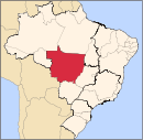
Nordeste Mato-Grossense CanaranaÁgua Boa • Campinápolis • Canarana • Nova Nazaré • Nova Xavantina • Novo São Joaquim • Querência • Santo Antônio do LesteMedio AraguaiaNorte AraguaiaAlto Boa Vista • Bom Jesus do Araguaia • Canabrava do Norte • Confresa • Luciára • Novo Santo Antônio • Porto Alegre do Norte • Ribeirão Cascalheira • Santa Cruz do Xingu • Santa Terezinha • São Félix do Araguaia • São José do Xingu • Serra Nova Dourada • Vila RicaNorte Mato-Grossense Alta FlorestaAlto Teles PiresIpiranga do Norte • Itanhangá • Lucas do Rio Verde • Nobres • Nova Mutum • Nova Ubiratã • Santa Rita do Trivelato • Sorriso • TapurahArinosJuara • Nova Maringá • Novo Horizonte do Norte • Porto dos Gaúchos • São José do Rio Claro • TabaporãAripuanãColíderColíder • Guaranta do Norte • Matupá • Nova Canaã do Norte • Nova Guarita • Novo Mundo • Peixoto de Azevedo • Terra Nova do NorteParanatingaParecisSinopCláudia • Feliz Natal • Itaúba • Marcelândia • Nova Santa Helena • Santa Carmem • Sinop • União do Sul • VeraSudeste Mato-Grossense Alto AraguaiaAlto Araguaia • Alto Garças • Alto TaquariPrimavera do LesteCampo Verde • Primavera do LesteRondonópolisDom Aquino • Itiquira • Jaciara • Juscimeira • Pedra Preta • Rondonópolis • São José do Povo • São Pedro da CipaTesouroAraguainha • General Carneiro • Guiratinga • Pontal do Araguaia • Ponte Branca • Poxoréo • Ribeirãozinho • Tesouro • TorixoréuSudoeste Mato-Grossense Alto GuaporeConquista d'Oeste • Nova Lacerda • Pontes e Lacerda • Vale de São Domingos • Vila Bela da Santíssima TrindadeJauruAraputanga • Figueirópolis d'Oeste • Glória d'Oeste • Indiavaí • Jauru • Lambari d'Oeste • Mirassol d'Oeste • Porto Esperidião • Reserva do Cabaçal • Rio Branco • Salto do Céu • São José dos Quatro MarcosTangará da SerraCategories:- Municipalities of Brazil
- Populated places in Mato Grosso
- Mato Grosso geography stubs

Wikimedia Foundation. 2010.