- Current River (Missouri)
-
Current River River Country United States States Missouri, Arkansas Regions Ozark Plateau, Mississippi Alluvial Plain Tributaries - left Sinking Creek, Little Black River, Welch Spring - right Big Creek, Jacks Fork, Big Spring Cities Van Buren, Doniphan, Missouri Source Pigeon Creek - location Montauk State Park, Dent County, Ozark Plateau, Missouri - elevation 1,450 ft (442 m) Mouth Black River - location Pocahontas, Arkansas, Randolph County, Mississippi Alluvial Plain, Arkansas - elevation 280 ft (85 m) [1] Length 184 mi (296 km) Basin 2,641 sq mi (6,840 km2) Discharge for Doniphan, Missouri - average 2,772 cu ft/s (78 m3/s) [2] - max 130,000 cu ft/s (3,681 m3/s) 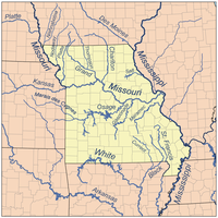 Map of major Missouri Rivers
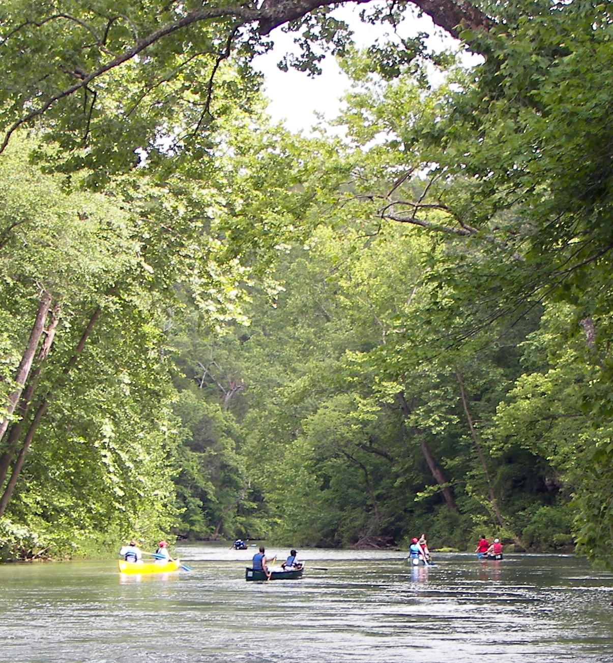
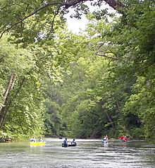 Canoers on the swift, clear upper Current below Welch Spring
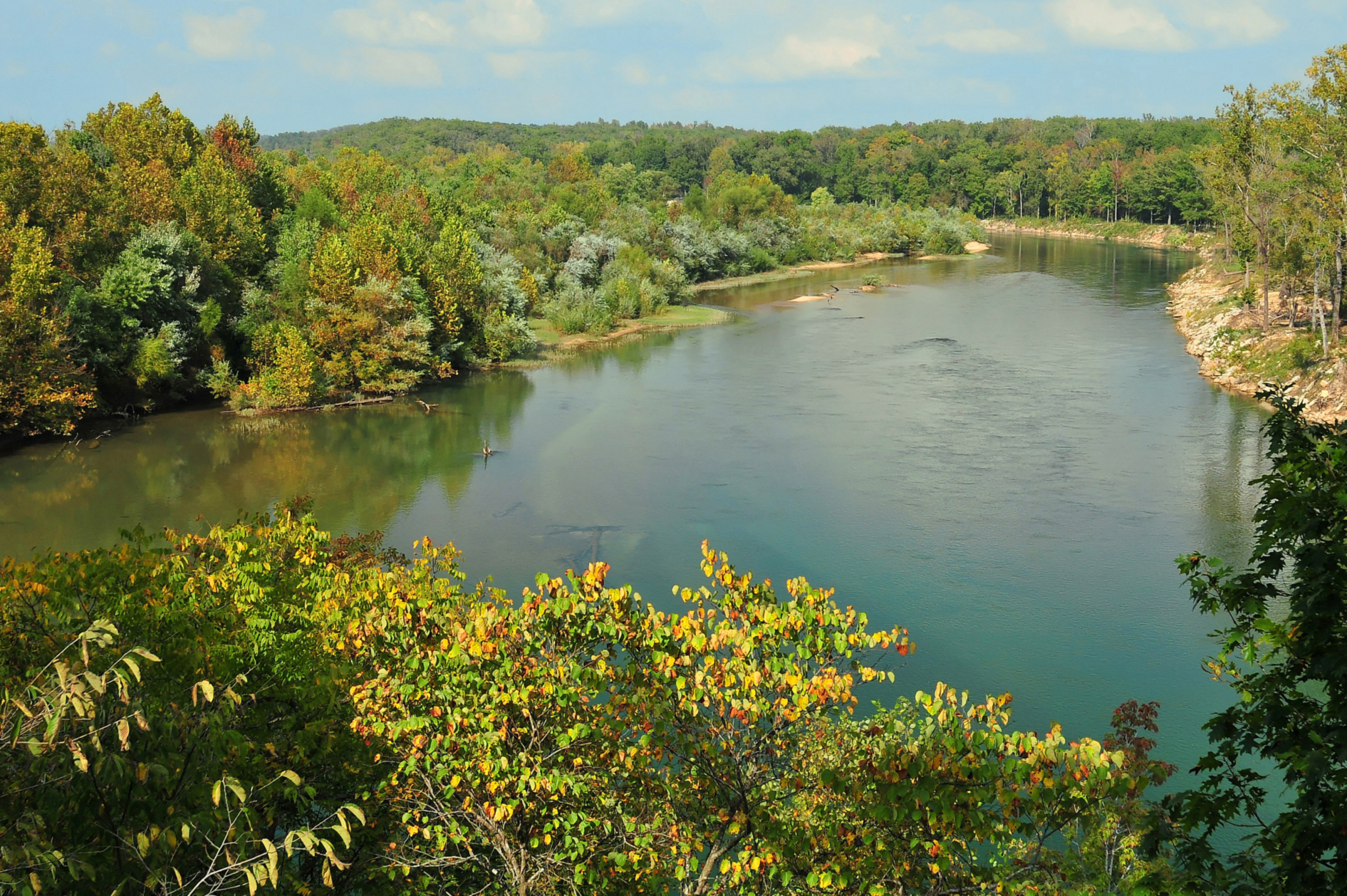
 Current River near Doniphan
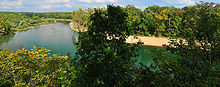 Current River near Doniphan
The Current River forms in the southeastern portion of the Ozarks of Missouri and becomes a 7th order stream [1] as it flows southeasterly out of the Ozarks into northeastern Arkansas where it becomes a tributary of the Black River, which is a tributary of the White River, a tributary of the Mississippi River. The Current River is approximately 184 miles (296 km) long and drains about 2,641 square miles (6,840 km2)[1] of land mostly in Missouri and a small portion of land in northeastern Arkansas. The headwaters of the Current River are nearly 900 feet (270 m) above sea level, while the mouth of the river lies around 280 feet (85 m)[1] above sea level. The basin drains a rural area that is dominated by karst topography, underlain by limestone bedrock with a small area of igneous rock southeast of Eminence, Missouri. The annual daily mean discharge of the river near Doniphan, Missouri is 2,815 cubic feet (79.7 m3) per second.[1] In 1964, over 134 mi (160 km) of the upper course of the river and its tributaries were federally protected as the Ozark National Scenic Riverways,[3] the first national park in America to protect a river system.
The Current River begins in Montauk State Park located in the southwestern corner of Dent County in southeastern Missouri. The confluence of Pigeon Creek and Montauk Spring form the headwaters of the river. Montauk Spring makes up most of the consistent flow of the headwaters, providing ideal conditions for trout fishing. After leaving Montauk State Park the river enters the Ozark National Scenic Riverways. The uppermost reaches of the river are swift with numerous riffles broken by deep pools of crystal clear water, further downstream the riffles continue but get further apart. Hardwood trees, rock ledges, caves, springs, gravel bars, and towering limestone bluffs line the banks of the river. Welch Spring, a first magnitude spring, enters the river approximately 14 miles (23 km) downstream from the headwaters, nearly doubling the flow of the river. Other notable springs to add to the river include Cave Spring, Pulltite Spring, and Round Spring. Downstream from the headwaters approximately 52 miles (84 km) the Current River receives its largest tributary the Jacks Fork from the west near the small town of Eminence, Missouri. Blue Spring, another first magnitude spring, empties into the river, 9 miles (14 km) downstream from the confluence with the Jacks Fork. The Current River is approximately 86 miles (138 km) long when it passes by the town of Van Buren, Missouri and under U.S. Highway 60. South of Van Buren a few miles the Current River receives its second biggest tributary, the largest spring in the Ozarks and one of the largest single spring outlets known in the world.[4] Big Spring empties into the river providing nearly 470 cubic feet (13 m3) of water per second.[5] From Big Spring the river continues southeasterly leaving the Ozark National Scenic Riverways 105 miles (169 km) from the headwaters. The river then flows through Mark Twain National Forest until reaching Doniphan, Missouri and passes under U.S. Highway 160. From here the river slows as it exits the Ozark Highlands, the river continues its slow silt laden path into Arkansas where it receives the Little Black River from the northeast before it joins the Black River near Pocahontas, Arkansas.
Canoeing, fishing, horseback riding, and camping are very popular activities along the Current River. The river is fairly gentle and is considered to have mostly class 1 rapids, and a couple class 2.
Some of the points of interest along the course of the river include Montauk State Park (trout park), Welch Spring and abandon hospital, Aker's Ferry, Cave Spring, Devil's Well, Deer Leap, Rock House Cave, Pulltite Spring, Round Spring, Jacks Fork, Blue Spring, Rocky Falls (on a small tributary), and Big Spring.
See also
- List of Missouri rivers
- List of Arkansas rivers
- List of Ozark springs
References
- ^ a b c d e http://mdc.mo.gov/fish/watershed/current/contents/
- ^ http://nwis.waterdata.usgs.gov/mo/nwis/peak?site_no=07068000&agency_cd=USGS&format=html
- ^ http://www.nps.gov/ozar/ National Park Service
- ^ "Springs of Missouri"
- ^ USGS Surface Water data for US – Big Spring 1981-2009
- Stars Upstream: Life Along an Ozark River, Leonard Hall, University of Chicago Press, Chicago, 1959 ISBN 0826200745
- Missouri Ozark Waterways, Oz Hawksley, Missouri Department of Conservation, P.O. Box 180, Jefferson City, MO 65102, 1965, Revised 1989 Conservation Commission of the State of Missouri
- Springs of Missouri, Vineyard and Feder, Missouri Department of Natural Resources, Division of Geology and Land Survey in cooperation with U.S. Geological Survey and Missouri Department of Conservation, 1982
External links
- Ozark National Scenic Riverways
- Missouri Scenic Rivers
- Information compiled by the Missouri Department of Conservation
- Discharge of Big Spring, USGS
(1981–2006)
Categories:- Rivers of Arkansas
- Rivers of Missouri
- Landforms of The Ozarks
- Tributaries of the White River (Arkansas)
- Geography of Randolph County, Arkansas

Wikimedia Foundation. 2010.