- Mé-Zóchi District
-
Mé-Zóchi — District — Location within São Tomé and Príncipe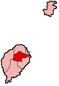
Coordinates: 0°15′N 6°40′E / 0.25°N 6.667°ECoordinates: 0°15′N 6°40′E / 0.25°N 6.667°E Country São Tomé and Príncipe Province/Island São Tomé Seat Trindade Area – Total 122 km2 (47.1 sq mi) Population (2001) – Total 35,105 – Density 287.7/km2 (745.3/sq mi) Time zone UTC (UTC+0) Mé-Zóchi is a district of São Tomé Province. Out of the seven districts that make up the equatorial Atlantic islands of São Tomé and Príncipe, it is second largest in population with approximately 35,300 and covers approximately 122 square kilometers. The district capital is Trindade (an alternative Portuguese spelling of Trinidade) (pop: 6,636 2005).
District Population History
- 1940 18,422 (30.4% of the national population)
- 1950 18,056 (30.0% of the national population)
- 1960 20,374 (31.7% of the national population)
- 1970 20,550 (27.9% of the national population)
- 1981 24,258 (25.1% of the national population)
- 1991 29,758 (25.3% of the national population)
- 2001 35,105 (25.5% of the national population)
Other
Mé-Zóchi has schools or collegiates (colegio), a lyceum (middle schools), a stadium, churches, beaches, a small port and a few squares (praças). The municipality is the middle-class in GDP and GNP in São Tomé and Príncipe.
North: Água Grande and Lobata West: Lembá Mé-Zóchi East: Atlantic Ocean South: Cantagalo São Tomé 
Príncipe Categories:- Districts of São Tomé and Príncipe
- São Tomé and Príncipe geography stubs

Wikimedia Foundation. 2010.