- Oberweningen
-
Oberweningen 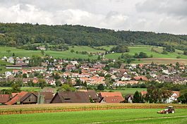
Country Switzerland 
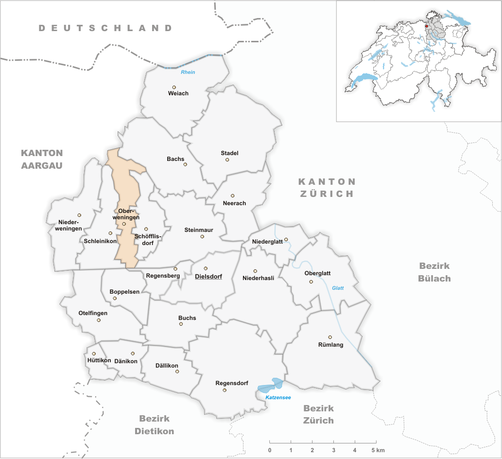
Canton Zurich District Dielsdorf 47°30′N 8°24′E / 47.5°N 8.4°ECoordinates: 47°30′N 8°24′E / 47.5°N 8.4°E Population 1,745 (Dec 2010)[1] - Density 359 /km2 (930 /sq mi) Area 4.95 km2 (1.91 sq mi)[2] Elevation 465 m (1,526 ft) Postal code 8165 SFOS number 0093 Surrounded by Bachs, Fisibach (AG), Regensberg, Schleinikon, Schöfflisdorf, Siglistorf (AG) Website www.oberweningen.ch
SFSO statistics
 OberweningenMap of Oberweningen
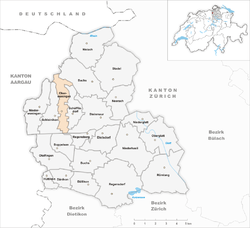
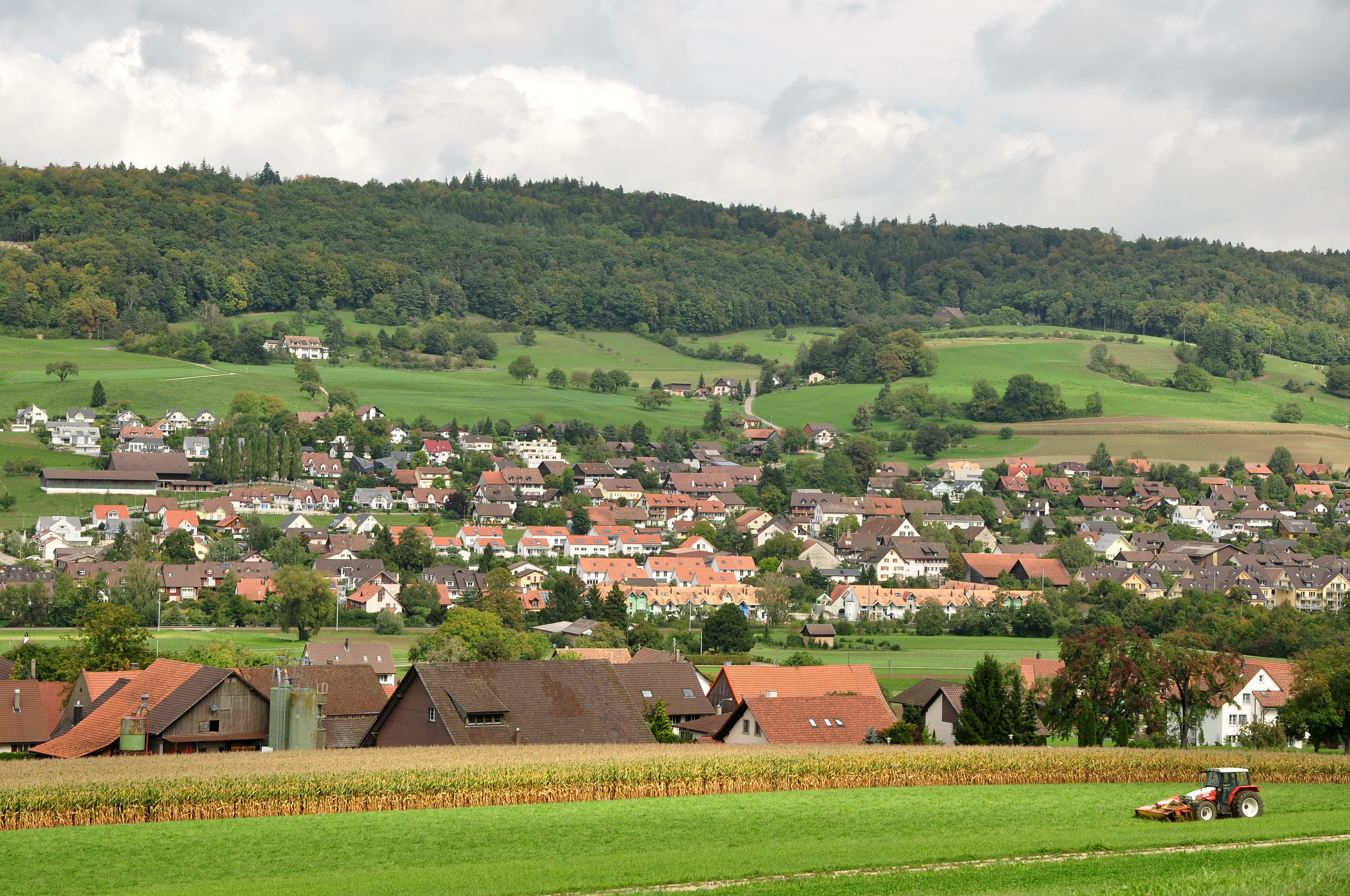
Oberweningen is a municipality in the district of Dielsdorf in the canton of Zürich in Switzerland.
Contents
History
Oberweningen is first mentioned around 1096-1111 as Waningen. In 1291 it was mentioned as Oberenweningen.[3]
Geography
Oberweningen has an area of 4.9 km2 (1.9 sq mi). Of this area, 35% is used for agricultural purposes, while 55.9% is forested. Of the rest of the land, 8.6% is settled (buildings or roads) and the remainder (0.4%) is non-productive (rivers, glaciers or mountains).[4]
The municipality is made up scattered farm houses and single family homes between the Lägern ridge and the Egg forest (Eggwald) in the Wehntal.
Demographics
Oberweningen has a population (as of 31 December 2010) of 1,745.[1] As of 2007[update], 15.1% of the population was made up of foreign nationals. Over the last 10 years the population has grown at a rate of 16.6%. Most of the population (as of 2000[update]) speaks German (92.1%), with Italian being second most common ( 1.7%) and Albanian being third ( 1.2%).
In the 2007 election the most popular party was the SVP which received 42% of the vote. The next three most popular parties were the SPS (13.1%), the FDP (12.3%) and the CSP (10.2%).
The age distribution of the population (as of 2000[update]) is children and teenagers (0–19 years old) make up 28.9% of the population, while adults (20–64 years old) make up 63.8% and seniors (over 64 years old) make up 7.3%. In Oberweningen about 81.2% of the population (between age 25-64) have completed either non-mandatory upper secondary education or additional higher education (either university or a Fachhochschule).
Oberweningen has an unemployment rate of 2.35%. As of 2005[update], there were 41 people employed in the primary economic sector and about 11 businesses involved in this sector. 49 people are employed in the secondary sector and there are 11 businesses in this sector. 115 people are employed in the tertiary sector, with 30 businesses in this sector.[4]
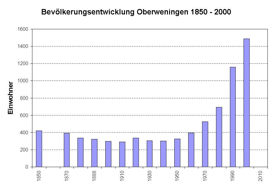
 Population 1850-2000
The historical population is given in the following table:[3]
year population 1634 116 1850 419 1900 297 1950 325 2000 1,290 Transport
Schöfflisdorf-Oberweningen is a stop of the Zürich S-Bahn on the lines S5 and S55. Its train station is a 29 minute ride from Zürich Hauptbahnhof.
References
- ^ a b Canton of Zurich Statistical Office (German) accessed 29 March 2011
- ^ Arealstatistik Standard - Gemeindedaten nach 4 Hauptbereichen
- ^ a b Oberweningen in German, French and Italian in the online Historical Dictionary of Switzerland.
- ^ a b Swiss Federal Statistical Office accessed 04-Aug-2009
External links
- Official website (German)
Bachs | Boppelsen | Buchs | Dällikon | Dänikon | Dielsdorf | Hüttikon | Neerach | Niederglatt | Niederhasli | Niederweningen | Oberglatt | Oberweningen | Otelfingen | Regensberg | Regensdorf | Rümlang | Schleinikon | Schöfflisdorf | Stadel bei Niederglatt | Steinmaur | Weiach
Canton of Zürich | Districts of Canton Zürich | Municipalities of the canton of Zurich


Wikimedia Foundation. 2010.