- Dänikon
-
Dänikon 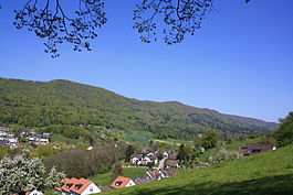
Country Switzerland 
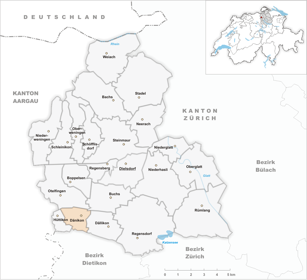
Canton Zurich District Dielsdorf 47°27′N 8°24′E / 47.45°N 8.4°ECoordinates: 47°27′N 8°24′E / 47.45°N 8.4°E Population 1,903 (Dec 2010)[1] - Density 687 /km2 (1,779 /sq mi) Area 2.87 km2 (1.11 sq mi)[2] Elevation 437 m (1,434 ft) Postal code 8114 SFOS number 0085 Surrounded by Buchs, Dällikon, Hüttikon, Oetwil an der Limmat, Otelfingen Website www.daenikon.ch
SFSO statistics
 DänikonMap of Dänikon
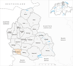
Dänikon is a municipality in the district of Dielsdorf in the canton of Zürich in Switzerland.
Contents
History
Dänikon is first mentioned in 1130 as Täninchoven.[3]
Until 1843 it was part of the municipality of Dällikon.
Geography
Dänikon has an area of 2.8 km2 (1.1 sq mi). Of this area, 53.6% is used for agricultural purposes, while 31.8% is forested. Of the rest of the land, 13.6% is settled (buildings or roads) and the remainder (1.1%) is non-productive (rivers, glaciers or mountains).[4]
The municipality is located on the left side of the Furttal.
Demographics
Dänikon has a population (as of 31 December 2010) of 1,903.[1] As of 2007[update], 23.9% of the population was made up of foreign nationals. Over the last 10 years the population has grown at a rate of 2.9%. Most of the population (as of 2000[update]) speaks German (87.4%), with Italian being second most common ( 2.6%) and Turkish being third ( 2.2%).
In the 2007 election the most popular party was the SVP which received 47.4% of the vote. The next three most popular parties were the SPS (14.7%), the FDP (9.6%) and the CSP (9.3%).
The age distribution of the population (as of 2000[update]) is children and teenagers (0–19 years old) make up 28% of the population, while adults (20–64 years old) make up 65.7% and seniors (over 64 years old) make up 6.3%. The entire Swiss population is generally well educated. In Dänikon about 75.9% of the population (between age 25-64) have completed either non-mandatory upper secondary education or additional higher education (either University or a Fachhochschule).
Dänikon has an unemployment rate of 3.08%. As of 2005[update], there were 68 people employed in the primary economic sector and about 10 businesses involved in this sector. 235 people are employed in the secondary sector and there are 26 businesses in this sector. 121 people are employed in the tertiary sector, with 35 businesses in this sector.[4]
The historical population is given in the following table:[3]
year population 1467 7 Households 1634 88 1799 173 1850 238 1900 192 1950 175 1970 373 2000 1,749 References
- ^ a b Canton of Zurich Statistical Office (German) accessed 29 March 2011
- ^ Arealstatistik Standard - Gemeindedaten nach 4 Hauptbereichen
- ^ a b Dänikon in German, French and Italian in the online Historical Dictionary of Switzerland.
- ^ a b Swiss Federal Statistical Office accessed 03-Aug-2009
External links
- Official website (German)
- Dänikon in German, French and Italian in the online Historical Dictionary of Switzerland.
Bachs | Boppelsen | Buchs | Dällikon | Dänikon | Dielsdorf | Hüttikon | Neerach | Niederglatt | Niederhasli | Niederweningen | Oberglatt | Oberweningen | Otelfingen | Regensberg | Regensdorf | Rümlang | Schleinikon | Schöfflisdorf | Stadel bei Niederglatt | Steinmaur | Weiach
Canton of Zürich | Districts of Canton Zürich | Municipalities of the canton of Zurich


Wikimedia Foundation. 2010.