- Lexington and West Cambridge Railroad
-
The Lexington and West Cambridge Railroad was a railroad company chartered in 1845 and opened in 1846, that operated in eastern Massachusetts.[1] It and its successors provided passenger service until 1977 and freight service until 1980 or early 1981.
Contents
History
Legend
in Concord: 
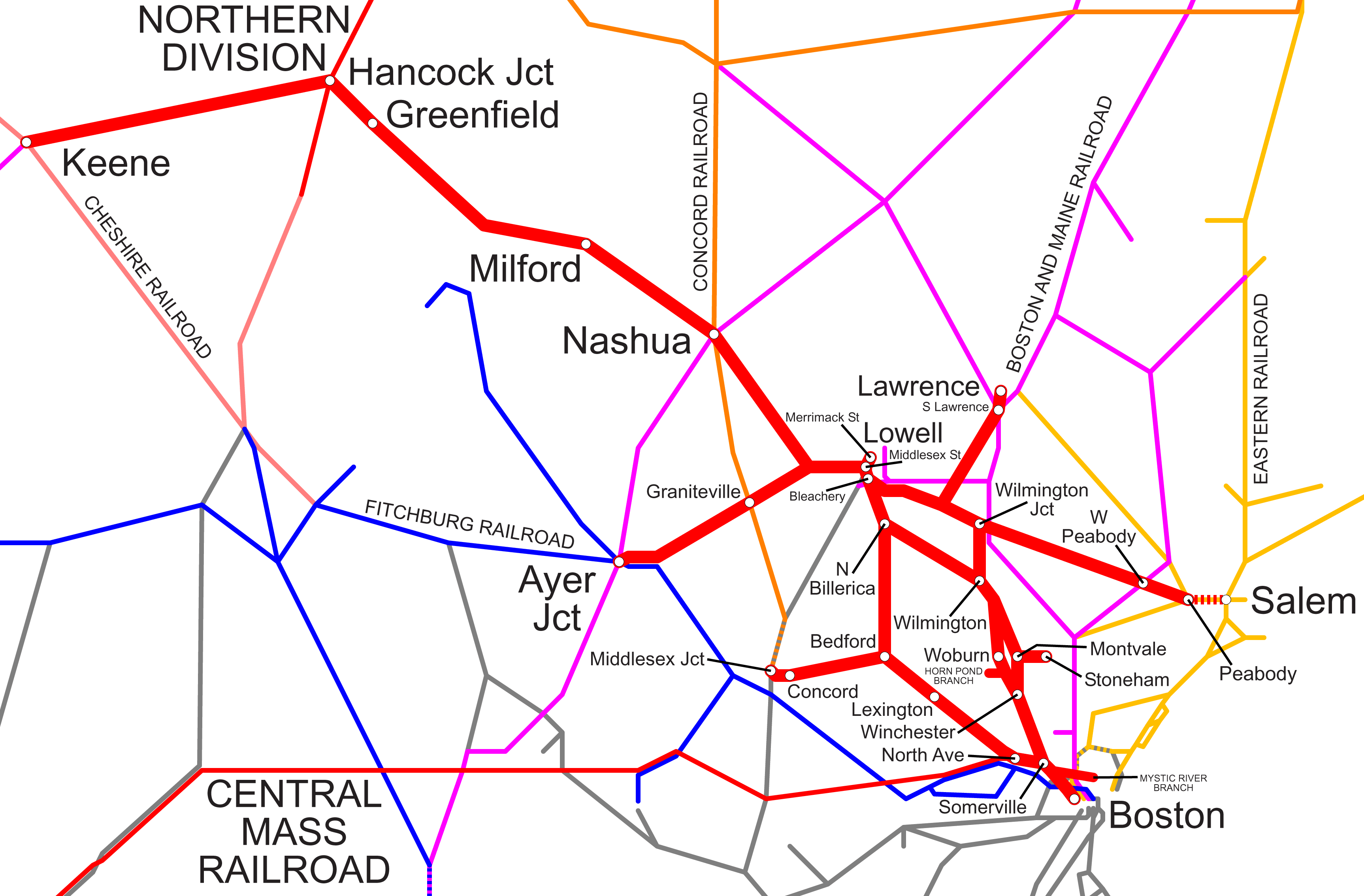
Nashua, Acton & Boston & other railroads 
Massachusetts Route 2 
Reformatory Station 
Sudbury River Concord River 
Lowell Road (Central Concord) Monument Street Massachusetts Route 62 
In Billerica: 
Boston and Lowell Railroad North Billerica Billerica Nutting Lake South Billerica 
In Bedford: 
Bedford Springs Great Road 
Middlesex and Boston Street Railway South Road 

14.81 Bedford Depot Elm Brook in Lexington: 

Hanscom Air Force Base 
Interstate 95 Bedford St. (Routes 4, 225), M&BSt.Ry. 12.28 North Lexington 11.06 Lexington Station 10.09 Munroe Station 
Pierce's Bridge (Maple Street) 9.72 Pierce's Bridge Station 9.02 East Lexington Station in Arlington: 8.06 Arlington Heights Park Avenue 7.20 Brattles Station 6.34 Arlington Centre Station Mass. Avenue (U.S. Route 3) and BERy 5.47 Lake Street Station Lake Street 
Massachusetts Route 2 in Cambridge: Alewife Brook Parkway (Routes 2, 16, U.S. 3) 4.53 Brick Yards (Fens) Station 
Fitchburg Railroad 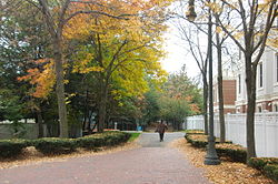 Alewife Linear Park, near the corner of Cedar Street and Massachusetts Avenue, Cambridge. When the passenger trains ran here, the North Cambridge station stood in the foreground, on the right, and the intersection was called "North Cambridge Junction".
A single track line[4] was constructed in 1845-46,[3] connecting Lexington Center to the Fitchburg Railroad (now the MBTA Fitchburg Line) in West Cambridge[5] (near the site of the modern Alewife Station). When the separate town of West Cambridge changed its name to Arlington in 1867, the railroad was also renamed, as the Lexington and Arlington Railroad.[1]
The Boston and Lowell Railroad purchased the line in 1870 and built a new connection (most of which would constitute a major portion of the later Fitchburg Cutoff) to their main line at Somerville Junction. The connection, from what is now the Magnolia Field-Varnum Street area in Arlington, ran through North Cambridge and West Somerville (Davis Square); a station was located at Somerville Junction, marked by a park near what are now Centre and Woodbine Streets.[6] It created a subsidiary, the Middlesex Central Railroad, to build an extension from Lexington to Bedford and then Concord Center (Lowell Road), which opened in 1873.[1] The Lowell Road station was adjacent to today's Minuteman National Historical Park. A 2.5-mile (4.0 km) extension from Concord Center to Concord Prison (Reformatory Station on Elm Street) would give the name Reformatory Branch to the Bedford-Concord segment in 1879.[1] The branch continued another half mile further west[7] to a junction (called "Concord Junction" or "Middlesex Junction" per different sources) with the Nashua, Acton & Boston Railroad[8] and other rail lines.
The independent Billerica and Bedford Railroad built a connecting narrow gauge line in 1877, but went bankrupt the next year.[9] In 1885, the Middlesex Central purchased the right-of-way and used it to build a standard gauge extension to North Billerica from Bedford. The North Billerica-Boston segment was known as the Lexington Branch.[1]
The Boston and Maine Railroad purchased all of the Boston and Lowell in 1887. According to railroad historians,[10] double-tracking from Somerville Junction to Lexington was instituted just prior to the B&M era, in 1885-86, and discontinued in 1927. Double width bridge abutments can be found in Arlington. The branch eventually ended service, as it had begun, as a single track line.[11]
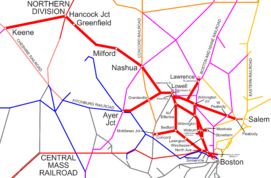
Regular service on the line used the route through Somerville Junction, via West Somerville (Davis Square) and North Cambridge, from 1870[12] until 1927,[3] at which time it reverted to the original route via the Fitchburg main line. The latter route is represented in the chart at the right (with present-day highways superimposed). The branch split off from the main line about 0.4 mile west of the West Cambridge Station, located 4.16 miles from Boston[2] at Sherman Street on the main line. The turnoff was by the once-flourishing brickyards at the site of today's Rindge Towers.[13][14]
At one time, around the turn of the century, there were 38 trains a day through Arlington,[3] a lesser number through Lexington.[citation needed] On April 24, 1926, passenger service ended on the Reformatory Branch, and on February 5, 1927, the remaining freight service was abandoned on the short segment between Concord Center and Reformatory Station. On December 31, 1931, passenger service on the outer Lexington Branch from Bedford and North Billerica was discontinued. Remaining services were converted from steam to diesel trains in 1956.[1]
In 1962, the Boston and Maine abandoned both segments north and west of Bedford. It was noted at the time that the Bedford-Concord section had only seen 19 trains in 19 years.[15] The town of Bedford purchased the rights of way within its boundaries in 1963.[1]
By 1965, the Massachusetts Bay Transportation Authority was subsidizing a single daily passenger train (using Budd Rail Diesel Cars) between Boston and Bedford.[1] On December 26, 1976, the MBTA purchased the rights of way and passenger equipment from the Boston and Maine (which retained freight trackage rights). Operation of MBTA Commuter Rail was contracted at that time to the Boston and Maine, and later was awarded to other private companies.
Beginning on January 10, 1977, a snowstorm blocked the line for a few days, after which the MBTA announced it would not resume passenger service.
In 1979, the Interstate Commerce Commission gave permission for the Boston and Maine Railroad to stop running freights on the line. Common power on the branch at that time was SW # 1227. The last freight train to ply the line was hauled by a GP9, with 23 cars. According to one source[3] the final trip was in 1980, and the same year the tracks were severed from the main line. Another source[16] gives the date of the final run as January 31, 1981.
In 1980, a federal judge ruled that the Lexington Branch must be restored after construction of the parking garage at Alewife Station over the right-of-way.[17] In 1981, the MBTA entered into an agreement with the Town of Arlington to advocate that the Lexington Branch be abandoned. In return for the MBTA's support for converting the railroad to a bikeway, Arlington allowed the MBTA to use some of its land as a construction staging area for the Red Line extension project.[16]
Rail trails
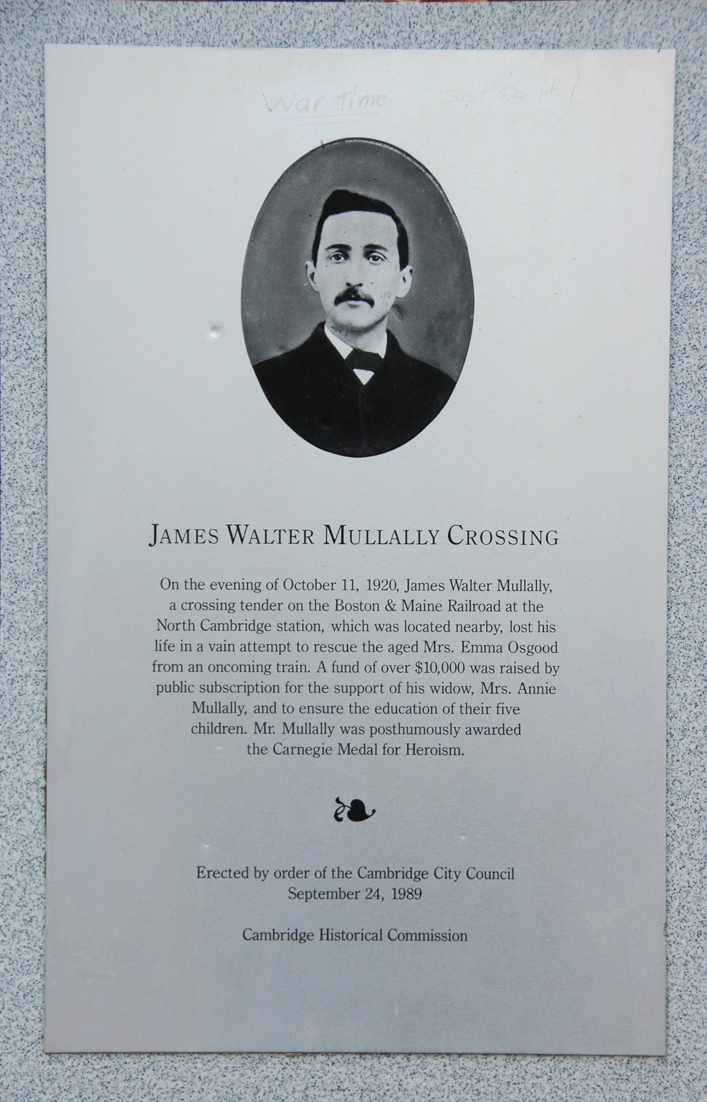
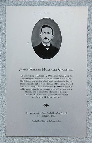 Heroism on the line. A 1920 railroad tragedy was memorialized in 1989 by a Cambridge City Council order. The historic marker shown here is displayed at the Cedar Street portal to the Alewife Linear Park.
The right-of-way was railbanked in 1991.[16] Although the rails were removed, trackage can be relaid without objection if the MBTA should find it necessary.
The Minuteman Bikeway opened between Alewife and Bedford in 1993. A former Boston and Maine Rail Diesel Car (RDC) of the type used on the line was purchased and is on display at the western end of the trail at Bedford Depot Park.
The Alewife Linear Park (portions of which are also known as the Somerville Community Path and the Cambridge Linear Park) follows the right-of-way used by the Lexington Branch from 1870 to 1927, from Somerville nearly to Alewife. One of the main access points to the Linear Park is situated where the park crosses Massachusetts Avenue, at the intersection with Cedar Street, adjacent to which the North Cambridge station was located.
The Bedford Narrow Gauge Rail Trail connects at Bedford Depot and heads north toward Billerica, passing Fawn Lake (also known as Hayden Pond). The current connection is indirect; the Minuteman ends at South Road, but the Narrow Gauge begins at Loomis Street just east of Hartford Street.[18] The Bedford DPW is planning a more direct, 10-foot (3.0 m) sidewalk connection. It is named after the Billerica and Bedford Railroad, even though a standard-gauge railroad succeeded it. A historical recreation of the narrow-gauge predecessor has been installed near Loomis Street. The trail is paved only from Loomis Street to Great Road; after that it is improved with stone dust. The public portion of the trail ends after five miles (8 km) at the Bedford/Billerica town line (marked with a pair of gates in the middle of the woods), after which it becomes sandy (requiring a mountain bike or walking on foot) and continues on private property.[19]
Reformatory Branch Rail Trail
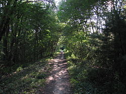
in BedfordThe Reformatory Branch Rail Trail follows the old right-of-way from Railroad Avenue at Bedford Depot Park to Concord, though the bridges over the Sudbury River and Assabet River near Egg Rock no longer exist. The unimproved dirt hiking trail passes the Great Meadows National Wildlife Refuge. From Railroad Avenue, it is 4 miles (6.4 km) to Lowell Road in Concord, and then another 2.5 miles (4.0 km) on the other side of the river to the Concord State Prison. Bedford is working on plans to pave its segment of the Reformatory Branch with asphalt.[20]
The Narrow Gauge and Reformatory Branch Rail Trails are part of the Bay Circuit Trail and Greenway.[21]
References and notes
- ^ a b c d e f g h RR History
- ^ a b April 30, 1967 B&M Employee Timetable No. 15
- ^ a b c d e Worden, John L. III (1991). Arlington's Little Local Railroad. The Arlington Historical Society. http://arlingtonhistorical.org/museumshop/.
- ^ Atlas of the City of Cambridge, Philadelphia: G.M. Hopkins & Co. (1873)
- ^ The area north of the Fitchburg Line right-of-way is now included in North Cambridge, Neighborhood 11
- ^ The park was dedicated on September 25, 2008. "City of Somerville: Park at Somerville Junction". http://www.somervillema.gov/Section.cfm?org=OSPCD&page=1321. Retrieved 2009-05-22.
- ^ "Guide to the Reformatory Branch Trail". Friends of Bedford Depot Park. 2001. http://www.bedforddepot.org/RBRT_guide.pdf. Retrieved 2009-06-28.
- ^ Cosgro, Matt. "Nashua, Acton & Boston Railroad". Nashua City Station. http://www.nashuacitystation.org/?railroad=acton. Retrieved 2009-06-28.
- ^ The Billerica & Bedford Railroad
- ^ Archival research Accessed 2010-04-18
- ^ Jones, Robert Willoughby (1999). Boston and Maine: City and Shore. Los Angeles: Pine Tree Press. pp. 88–89. ISBN 0-964035650.
- ^ Somerville, Past and Present (book excerpt) Accessed 2008-09-13
- ^ Survey of Architectural History in Cambridge: Northwest Cambridge, 1977, ISBN 0-262-53032-5, Cambridge Historical Commission, Cambridge, Mass., Fig. 46, p. 35
- ^ Another source of 1930 map retrieved 2010-02-13
- ^ Karr, Ronald D. (1994). Lost Railroads of New England. Branch Line Press. ISBN 0-942147-04-9. http://www.branchlinepress.com
- ^ a b c About the Lexington Branch
- ^ Karr, Ronald D. (1995). The Rail Lines of Southern New England - A Handbook of Railroad History. Branch Line Press. ISBN 0-942147-02-2. http://www.branchlinepress.com
- ^ http://www.arrtinc.org/google_BedfordNarrowGauge.asp
- ^ The Narrow-Gauge Rail-Trail
- ^ The Reformatory Branch Rail-Trail
- ^ Bay Circuit Trail map
External links
- Masterson, Les (October 18, 2006). "Trains brought faster service". The Arlington Advocate. http://www.wickedlocal.com/arlington/archive/x668820201. Retrieved 2009-05-22.
Categories:- Defunct Massachusetts railroads
- Rail trails in Massachusetts
- Predecessors of the Boston and Maine Corporation
- Railway companies established in 1845
- Railway companies disestablished in 1867


Wikimedia Foundation. 2010.