- Middle Musquodoboit, Nova Scotia
-
Middle Musquodoboit — Community — Location of Middle Musquodoboit, Nova Scotia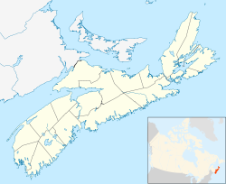
 Middle Musquodoboit
Coordinates: 45°02′35″N 63°09′06″W / 45.04306°N 63.15167°WCoordinates: 45°02′35″N 63°09′06″W / 45.04306°N 63.15167°W Country  Canada
Province  Nova Scotia
Municipality
Halifax Regional MunicipalityGovernment - Governing Council Halifax Regional Council - Community Council Marine Drive Valley & Canal Area - Total 129.9 km2 (50.2 sq mi) Population (2001) - Total 669 Canadian Postal code B0N 1X0 Area code(s) 902 Telephone exchange 384 GNBC Code CAZEY Total Dwellings 260 Part of a series about
Places in Nova ScotiaMiddle Musquodoboit is a farming community in the Musquodoboit Valley area of the Halifax Regional Municipality, Nova Scotia at the junction of Routes 357 and 224 , 60.1 kilometers from Halifax .
Contents
Schools
- Musquodoboit Valley Education Centre (pr to 6)
- Musquodoboit Rural High School (7 to 12)
Notable buildings
- Bicentennial Theatre
- Musquodoboit Valley Memorial Hospital
- Braeside Home for Special Care
- Musquodoboit Valley Co-op
Climate
Climate data for Middle Musquodoboit Month Jan Feb Mar Apr May Jun Jul Aug Sep Oct Nov Dec Year Record high °C (°F) 58.7
(137.7)17
(63)26
(79)27.2
(81.0)33.3
(91.9)33.9
(93.0)34.5
(94.1)35.6
(96.1)33
(91)26.7
(80.1)23.5
(74.3)15.6
(60.1)58.7
(137.7)Average high °C (°F) −0.7
(30.7)−0.3
(31.5)3.9
(39.0)9.3
(48.7)15.9
(60.6)21.3
(70.3)24.6
(76.3)24.3
(75.7)19.8
(67.6)13.6
(56.5)7.5
(45.5)1.9
(35.4)11.3 Average low °C (°F) −11.3
(11.7)−11.1
(12.0)−6.3
(20.7)−0.9
(30.4)3.6
(38.5)8.4
(47.1)12.1
(53.8)11.9
(53.4)7.5
(45.5)2.6
(36.7)−1.2
(29.8)−7.6
(18.3)0.6 Record low °C (°F) −34
(−29)−33
(−27)−31
(−24)−15
(5)−7.8
(18.0)−3
(27)1.1
(34.0)−1.5
(29.3)−4.5
(23.9)−10.6
(12.9)−21
(−6)−34
(−29)−34
(−29)Precipitation mm (inches) 130.5
(5.138)99.4
(3.913)125.1
(4.925)105.6
(4.157)104.9
(4.13)99.6
(3.921)107.4
(4.228)102.6
(4.039)102.9
(4.051)122.6
(4.827)131.3
(5.169)138.1
(5.437)1,369.9
(53.933)Source: Environment Canada[1] References
- ^ Environment Canada Canadian Climate Normals 1971–2000, accessed 16 July 2009
External links
Categories:- Communities in the Halifax Regional Municipality
- General Service Areas in Nova Scotia

Wikimedia Foundation. 2010.