- Mangochi
-
Mangochi Lake Malawi, on eastern edge of Mangochi
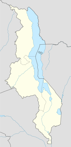
Location in Malawi Coordinates: 14°27′36″S 35°16′12″E / 14.46°S 35.27°E Country  Malawi
Region Southern Region District Mangochi District Population (2008)[1] - Total 51,429 - Languages Yao Time zone +2 Mangochi is a township in the Southern Region of Malawi. Located near the southern end of Lake Malawi, in colonial times it used to be called Fort Johnston. As of 2008 it has a population of 51,429.
Contents
History
Mangochi was founded by colonial administrator Sir Harry Johnston in the 1890s as a British colonial defense post on the littoral plain of the Shire River's western shore.[2] After this, Fort Johnston – as the town was then known – was an important slave market and administrative center.[3]
The British gunboat Gwendolen was built in Mangochi in 1897.[3] At 340 short tons (310 t), it was the largest ship to sail on Lake Malawi until being scrapped shortly after World War II.[3] The gunboat, operated by the Protectorate of Nyasaland, scored an early success in World War I when it defeated the German vessel Hermann von Wissmann in August 1914.[4]
Rioting in June 2003 injured three people.[5] From March to November 2007, roughly 480 children were "rescued" from child labor on tobacco farms in Mangochi.[6] In July 2008, elephants terrorised areas around Maldeco Fisheries in Mangochi and caused several deaths and damage to property, mainly crops.[7] The Ministry of Tourism, Wildlife and Culture proposed moving the elephants into several game reserves, although the proposal stalled when some residents said they wanted the elephants to remain.[7]
Geography
Mangochi is at an elevation of 1,541 feet (470 m), near the southern end of Lake Malawi, between the main lakeshore road and the Shire River[3] and 5 miles (8 km) south of its entrance into Lake Malombe.[2] The town is roughly 120 miles (190 km) northeast of Blantyre, Malawi's largest city.[5] It is situated 1.4 miles (2.3 km) away from Mponda, 2.2 miles (3.5 km) away from Chipalamawamba, 2 miles (3.2 km) away from Mbaluku Laini and 1.4 miles (2.3 km) away from Yangala.
Demographics
Population development
Year Population[1] 1987 14,758 1998 27,055 2008 51,429 Languages and ethnicities
Yao, specifically of the Mangochi dialect, is the main language spoken in this town.[8] A Swahili settlement was also established in Mangochi.[9] Mangochi is mainly inhabited by the Yao people.[2]
Economy
Mangochi was developed as an agricultural center and has marine-engineering shops. Cash crops grown in the area include tobacco, cotton, and groundnuts.[2] Rice and maize are intensively grown along the lakeshore, and commercial fishing is also important.[2]
Facilities
Amenities
Amenities include several shops, supermarkets, a post office and banks.[3]
Bridges
Within Mangochi there is the Shire Bridge, which Lonely Planet described as "scenic".[3]
Museums
The Lake Malawi Museum houses ethnic, environmental, and historical exhibits.[3] They include the Hotchkiss gun[3] with which the British gunboat Guendolin defeated the German gunboat Hermann von Wissmann with a single shot in their brief naval engagement in August 1914. The museum has also a scale model of the Guendolin.[3] An even older exhibit is a marine steam engine that was built in 1898 and powered the Universities' Mission to Central Africa's SS Chauncy Maples until 1953.[10]
Religion
Mangochi is home to a large mosque[3] as well as a modern Catholic Cathedral.[11]
Clocks
Mangochi is home to a clock tower erected in honour of Queen Victoria, dating back to the early 20th century.[11]
Transport
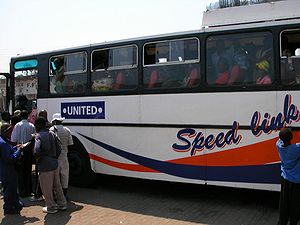
Mangochi is located just off the M3 road.[11] All buses travelling from Monkey Bay to Blantyre stop in Mangochi.[3] Minibuses travel to Liwonde, Zomba, and Blantyre.[3] Matolas travel to Liwonde National Park and to the border town of Chiponde.[3]
Tourism
Mangochi is described by Lonely Planet as having a "vaguely Swahili feel", with "palm trees, Arab-looking people and coconuts for sale in the street."[3] There are several guesthouses and lodges for tourists in Mangochi.[3] Pranay B. Gupte suggested staying at the Nkopola Lodge, where one can swim, fish, and sail.[12]
References
- ^ a b "World Gazetteer: Malawi: largest cities and towns and statistics of their population". World Gazetteer. http://www.world-gazetteer.com/wg.php?x=&men=gcis&lng=en&dat=32&srt=pnan&col=dq&geo=-150. Retrieved 2008-07-17.
- ^ a b c d e "Mangochi". Encyclopaedia Britannica. 2008. http://www.britannica.com/EBchecked/topic/362011/Mangochi. Retrieved 2008-07-18.
- ^ a b c d e f g h i j k l m n o Murphy, Alan; Armstrong, Kate; Firestone, Matthew D.; Fitzpatrick, Mary (2007). Lonely Planet Southern Africa: Join the Safari. Lonely Planet. p. 205. ISBN 1740597451.
- ^ The Story of the Rhodesias and Nyasaland A. J. Hanna Faber and Faber, 1960
- ^ a b "Soldiers Sent To Help Quell Riots in Malawi". The New York Times. 2003-06-29. http://query.nytimes.com/gst/fullpage.html?res=9C00E6DA173AF93AA15755C0A9659C8B63. Retrieved 2008-07-17.
- ^ "Attitudes to Child Labour Changing". UN Integrated Regional Information Networks (AllAfrica). 2006-11-19. http://allafrica.com/stories/200711191244.html. Retrieved 2008-07-17.
- ^ a b Msiska, Karen (2008-07-07). "Mangochi against removal of elephants". The Daily Times. http://allafrica.com/stories/200711191244.html. Retrieved 2008-07-18.
- ^ Baldauf, Richard B.; Kaplan, Robert (2004). Language Planning and Policy in Africa: Botswana, Malawi, Mozambique and South Africa. pp. 85–89. ISBN 1853597252.
- ^ Baldauf, p. 91
- ^ "The Ship". Chauncy Maples, Lake Malawi's Clinic. Chauncy Maples Trust. 2009–2011. http://www.chauncymaples.org/ship/default.php. Retrieved 28 July 2011.
- ^ a b c "Mangochi". Malawi Tourism. http://www.malawitourism.com/Pages/The%20Regions/South/mangochi.html. Retrieved 2008-07-18.
- ^ Gupte, Pranay B. (2008-09-28). "Malawi Now Inviting Visitors to Its Feast of Beauty; Malawi Is Now Inviting Visitors to Share In Its Feast of Natural Beauty If You Go". The New York Times.
External links
Categories:- Populated places in Malawi
Wikimedia Foundation. 2010.


