- Montiel
-
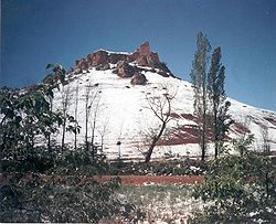
Montiel Medieval Castle of la Estrella. 
Coat of armsLocation in Spain. Coordinates: 38°42′N 2°52′W / 38.7°N 2.867°W Country Spain Autonomous community Castile-La Mancha Province Ciudad Real Comarca Campo de Montiel Government - Mayor Francisco Javier Álamo Amador (PP) Area - Total 271.29 km2 (104.7 sq mi) Elevation 900 m (2,953 ft) Population (2009) - Total 1,593 - Density 5.9/km2 (15.2/sq mi) Postal code 13326 Montiel is a municipality in the province of Ciudad Real, Castile-La Mancha, Spain.
The ruined castle on the hilltop above the town was the refuge for Peter of Castile after his defeat by the forces of Henry of Trastamara at the Battle of Montiel. He was lured into a meeting by Bertrand du Guesclin, captured, and executed by his halfbrother Henry in the tent of Bertrand.
References
Categories:- Municipalities in Ciudad Real
- Populated places in Ciudad Real
- Castile-La Mancha geography stubs
Wikimedia Foundation. 2010.


