- Midland Beach, Staten Island
-
Midland Beach (formerly known as Woodland Beach) is a Staten Island neighborhood. It lies along the east-central coast of the island, in the area known locally as the "Mid-Island, Staten Island," or, according to some, the "East Shore." To its immediate west is Grant City, south lies New Dorp Beach with Graham Beach and South Beach bordering it on the north. The Miller Field border & Prescott Ave is the West border (formerly, a lane called Maplewood Terrace paralleled New Dorp Lane), Poultney Street/Laconia Ave to the North, the Lower New York Bay, to the South, & Seaview Ave to the East. Father Capodanno Boulevard and Midland Avenue are Midland Beach's two main arteries.
Contents
History
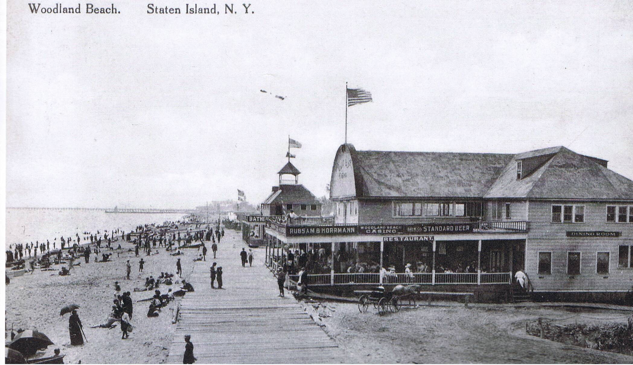
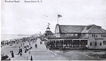 Woodland Beach Boardwalk and casino
During the late 19th and early 20th century, Midland Beach was a popular beach resort. In 1896, Midland Beach began attracting residents and tourists who came by trolley or excursion boats from Manhattan and Newark, NJ. Resorts, complete with hotels and amusement attractions, drew thousands daily. Besides its hotels and amusement park, it offered concerts, a fishing pier, vaudeville entertainment and gambling.[1] However, all of this is no longer in existence except for the new Ocean Breeze Fishing Pier which opened in September 2003. The Ocean Breeze Pier is the largest steel and concrete recreational pier built in the last 100 years on the Atlantic Ocean in the New York region.[2]
Unlike much of Staten Island, Midland Beach is mostly Irish American, and also has a significant Hispanic population. The 1990s began witnessing a large influx of Russian immigrants.[3] Rainstorms on the island caused wind or water damage (such as flooded bungalows) in Midland Beach in the 1970s, due to its lack of infrastructure and storm sewers and proximity to the coast. But the City of New York installed a new, very large storm sewer system down Greeley Avenue in 1979, which has resolved the flooding issues for most of the newer housing stock in the neighborhood. Today, the bungalows built as summer homes are owned or rented by locals for permanent residence, and many have fallen into disrepair (according to data compiled by the Roman Catholic Archdiocese of New York, the parish of St. Margaret Mary, which serves Midland Beach, is the poorest parish on Staten Island based on per capita income).
The neighborhood once had its own post office branch, bearing the postal code "Staten Island 11, New York." The building that housed the post office, located at 553 Lincoln Avenue, was one of the smallest (in terms of square footage) post offices in the entire United States at the time. It was closed in 1949.
Bluebelt
The Midland Beach (New Creek) Bluebelt, part of the larger Staten Island Bluebelt,[4] is now being constructed by the New York City Department of Parks and Recreation throughout the northern edge of the neighborhood, where most of these bungalows stand. This comprehensive watershed wetlands will alleviate much of the flooding that occurs in this low lying area. The land will be protected for passive residential use and absorb storm water runoff. Stone bridges, culverts, viaducts, walls and tree plantings will beautify the neighborhood and eventually eliminate the blight that has plagued the northern edge of Midland Beach since the 1960s.
Transportation
Midland Beach is served by the S51/S81 local buses and the X4, X5, X7, and X8 express buses along Midland Avenue. The S78/S79 travel along Hylan Blvd.
Notable residents
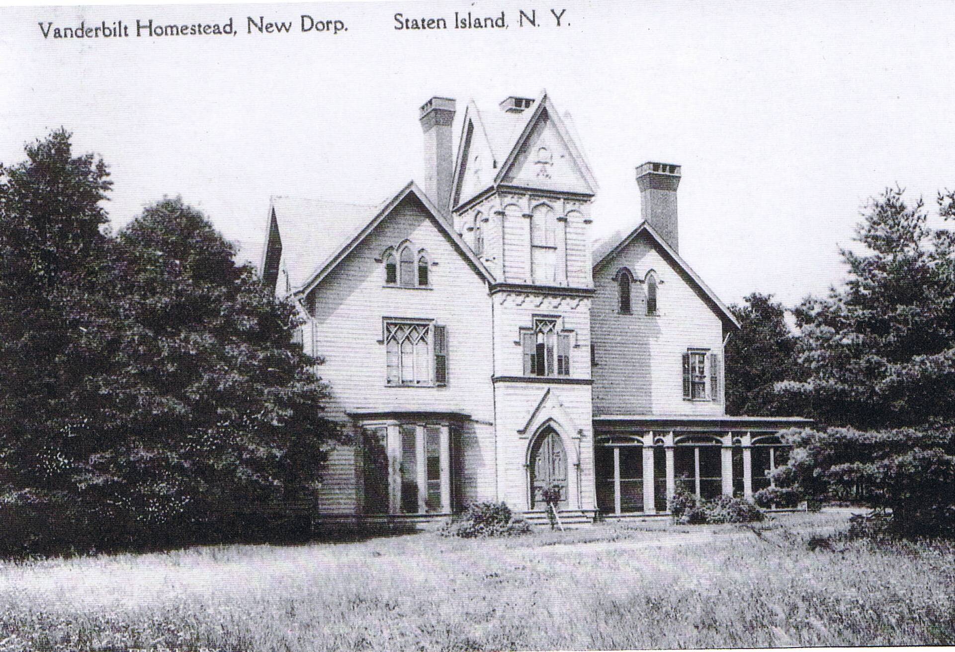
One of Woodland Beach's most famous residents was William Henry Vanderbilt, Cornelius Vanderbilt's oldest son. He maintained a profitable 186.7-acre (0.756 km2) farm in 1855 and built an Italianate style 24-room Mansion on the property, complete with horse stables, trotting field and judges stands, which was overseen by his son George Washington Vanderbilt II. It is now Miller Field, Gateway National Recreation Area.
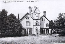 William H. Vanderbilt's Mansion in Woodland Beach, Staten Island, 1915
References
- ^ Council on the Arts and Humanities for Staten Island July/Aug 2008 Vol. 19. No. 4
- ^ "Mayor Michel R. Bloomberg and Staten Island Borough President James Molinaro Open Ocean Breeze Pier" (Press release). New York City Mayor's Office. 2003-09-20. http://www.nyc.gov/html/om/html/2003b/pr264-03.html. Retrieved 2010-01-26.
- ^ Balsamini, Dean (2007-09-16). "From Russia -- to Staten Island -- with love". Staten Island Advance. http://blog.silive.com/advanceupdate/2007/09/from_russia_to_staten_island_w.html. Retrieved 2010-01-17.
- ^ Seminar for US EPA Urban Watershed Management Branch Edison, NJ, Staten Island Bluebelt
Coordinates: 40°34′23″N 74°05′40″W / 40.57306°N 74.09444°W
Categories:- Neighborhoods in Staten Island
- Beaches of New York
Wikimedia Foundation. 2010.