Fort Queenscliff Lighthouse
- Fort Queenscliff Lighthouse
Infobox_lighthouse
name=Fort Queenscliff Lighthouse
location=Entrance to Port Phillip Bay, Australia
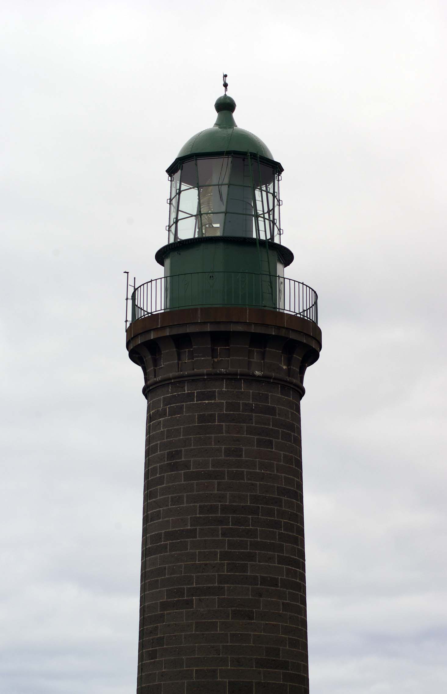
caption=
coordinates=coord|38|16|S|144|39|E
yearlit=1862
yeardeactivated=
automated=
intensity=
elevation=40 m
range=convert|14|nmi|km|0
foundation=
construction=Bluestone
shape= Cylindrical
marking=Dark stone, green lantern and gallery
height=18 m
lens=
characteristic=Either F or Oc. 15 s, depending on bearing
admiralty =K2325
NGA =7523.4
ARLHS =AUS-150Fort Queenscliff Lighthouse is situated in the grounds of Fort Queenscliff in Queenscliff, Victoria, Australia, and is one of three black lighthouses in the world, and the only one in the Southern hemisphere. Together with the nearby white lighhouse, it was built in 1862 to replace the former sandstone lighthouse of 1843 on the same site which was underpowered and deteriorating.[cite web|url=http://www.lighthouse.net.au/lights/VIC/Queenscliff%20Black/Black%20Lighthouse%20Queenscliff.htm|author=Lighthouses of Australia Inc.|title=The Black Lighthouse at Fort Queenscliff] ]
The lightsource is located 40 metres above sea level (focal plane). Depending on the tower's bearing it emits either a fixed light or an occulting signal with an interval of 15 seconds. The black lighthouse is one of four in Queenscliff that are used as a leading line to guide ships through the notoriously dangerous mouth of Port Phillip Bay.[cite web|url=http://www.unc.edu/~rowlett/lighthouse/vic.htm|author=Rowlett, Russ|title=The Lighthouse Directory] ]
=History[cite web|url=http://www.lighthouse.net.au/lights/VIC/Queenscliff%20Black/Black%20Lighthouse%20Queenscliff.htm|author=Lighthouses of Australia Inc.|title=The Black Lighthouse at Fort Queenscliff] =]
There are two conflicting legends about where the bluestone for the building came from. One version states that it came from Scotland as a ships ballast. In the other more likely version, the stone was quarried in Melbourne and shipped to Queenscliff. The fact that the stone was shipped may have led to the former theory's conception.
Fort Queenscliff was built around the lighthouse during the Australian Gold Rush after concerns that ships carrying gold might be susceptible to attack from privateers. The light was converted to gas in 1890, and then to electricity in 1924. It is supposed that the first public telephone service in Victoria was installed here. Today the lighthouse is unmanned and automated, and is serviced by the Port of Melbourne Corporation.
References
External links
* [http://au.geocities.com/aust_lighthouses2/queenscliff/black_lighthouse.htm Lighthouses of Victoria]
* [http://www.portofmelbourne.com/ Port Of Melbourne Corporation]
Wikimedia Foundation.
2010.
Look at other dictionaries:
Fort Queenscliff — Fort Queenscliff, in Victoria, Australia, dates from 1860 when an open battery was constructed on Shortland s Bluff to defend the entrance to Port Phillip Bay. The Fort, which underwent major redevelopment in the late 1870s and 1880s, became the… … Wikipedia
Queenscliff, Victoria — Infobox Australian Place | type = town name = Queenscliff state = vic caption = Queenscliff Lighthouse, an icon of the town lga = Borough of Queenscliffe postcode = 3225 pop = 3,725 est = elevation= 15 maxtemp = 20.9 mintemp = 12.9 rainfall = 580 … Wikipedia
Queenscliff — /ˈkwinzklɪf/ (say kweenzklif) noun a town at the end of the Bellarine Peninsula on the southern coast of Victoria; tourist resort and fishing port. Queenscliff is in territory traditionally inhabited by the Wathawurung people. The first European… …
Liste australischer Leuchttürme und Feuerschiffe — Diese Liste enthält Leuchttürme und Feuerschiffe in Australien. An der 25.760 km langen Küstenlinie Australiens[1] befinden sich über 350 Leuchttürme und Navigationshilfen[2] und im Inland gibt es den Point Malcolm Leuchtturm, den einzigen… … Deutsch Wikipedia
Commonwealth Heritage — The Commonwealth Heritage lists places on Commonwealth of Australia lands and waters or under Australian Government control with inportance in relation to the natural, indigenous and historic heritage of Australia.It was established by the… … Wikipedia
Commonwealth Heritage List — The Commonwealth Heritage List lists places under Australian Federal Government control, usually on land or in waters directly owned by the Crown in right of the Commonwealth of Australia. Such places must have importance in relation to the… … Wikipedia
Port Phillip — Infobox Ocean Ocean name = Port Phillip image Ocean = Port Phillip Bay.png caption Ocean = As captured by Landsat 7 image bathymetry = caption bathymetry = coords = coord|38|09|S|144|52|E|region:AU type:waterbody|display=inline,title type =… … Wikipedia
Liste des Commonwealth Heritage in Victoria — Die Liste des Commonwealth Heritage listet alle Objekte in Victoria auf, die in die Commonwealth Heritage List aufgenommen wurden. Grundlage der Liste ist der Environment Protection and Biodiversity Conservation Act aus dem Jahr 1999. Bis… … Deutsch Wikipedia
State Dockyard, Newcastle, New South Wales — The State Dockyard at Dykes Point, Newcastle was built by the New South Wales Government from 1938 until 1941 and opened in 1942 during World War II. The dockyard was constructed using much of the plant and buildings from the former Walsh Island… … Wikipedia