Davidson Glacier

Davidson Glacier
Davidson Glacier
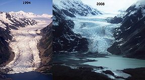
Type Valley glacier
Location Haines Borough, Alaska, U.S.
Coordinates 59°04′54″N 135°28′21″W / 59.08167°N 135.4725°W / 59.08167; -135.4725Coordinates: 59°04′54″N 135°28′21″W / 59.08167°N 135.4725°W / 59.08167; -135.4725
Area 4.6 miles (7.4 km)
Terminus Moraine/lake
Status Retreating

The Davidson Glacier is a large valley glacier near Haines, Alaska that finds its source in the Chilkat Range.

Contents

History

The Davidson Glacier was originally discovered by 1867[1] and was recounted by John Muir in his famous travels in and around Glacier Bay in 1879. The glacier was, at that time, a tidewater glacier that protruded into the Chilkat Inlet.[2] It has since receded into the mountains and created its very own glacial lake in the glacier's moraine (similar to the Mendenhall Glacier and lake) about one mile inland from the Chilkat Inlet.

Current status

Currently, the Davidson Glacier serves as a tourist attraction for Haines. While not actually located on the Chilkat Peninsula, tour operators boat or kayak tourists over to the glacier and then drive or hike them from the shore to the glacier on a road constructed for tourists' use.

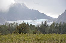
Davidson Glacier from Kalhagu Cove, 24 August 2011
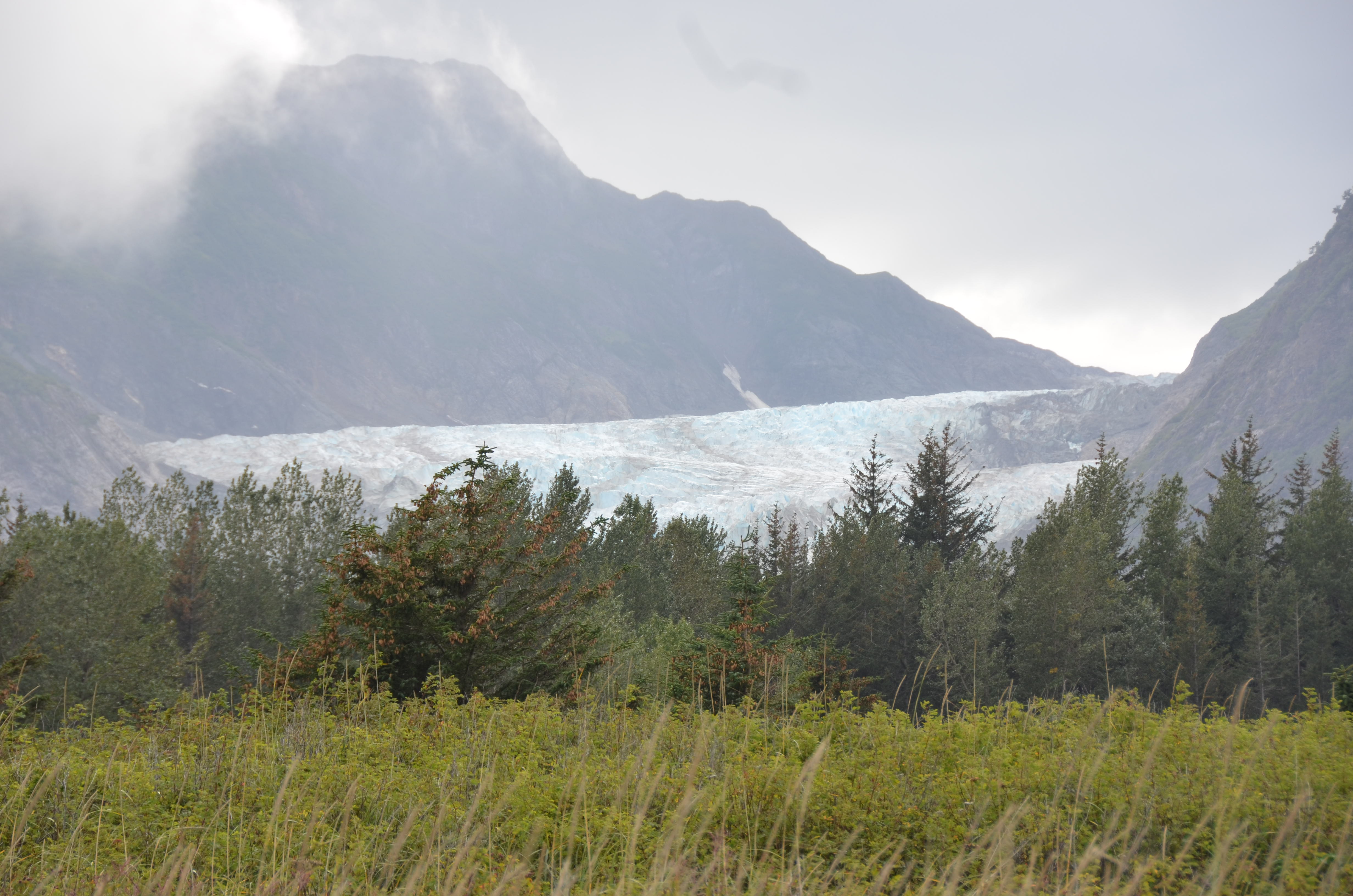
Davidson Glacier, 24 August 2011

See also

References

  1. ^ U.S. Geological Survey Geographic Names Information System: Davidson Glacier Retrieved April 17, 2007.
  2. ^ Chilkat Cruises: "Haines Wilderness Kayak Experience." Retrieved April 16, 2007.

External links


Wikimedia Foundation. 2010.

Игры ⚽ Поможем сделать НИР

Look at other dictionaries:

  • Glacier View controversy — The Glacier View controversy was a major event in the history of the Seventh day Adventist Church when church leaders (the Sanctuary Review Committee) met at Glacier View Ranch in Colorado, United States in 1980 to discuss scholar Desmond Ford s… …   Wikipedia

  • Glaciar Davidson — Glaciar Davidson …   Wikipedia Español

  • Mount Davidson (Antarctica) — Coordinates: 76°43′S 161°58′E / 76.717°S 161.967°E / 76.717; 161.967 Mount Davidson is a mountain …   Wikipedia

  • Haines, Alaska — Infobox Settlement official name = Haines, Alaska settlement type = City nickname = motto = image caption = Haines, as seen from the Chilkoot Inlet. imagesize = 250px image map caption = Location of Haines, Alaska mapsize = 250px mapsize1 = map… …   Wikipedia

  • McSweeney Point — (82°49′S 166°40′E / 82.817°S 166.667°E / 82.817; 166.667) is a sharp rock point 3 nautical miles (6 km) east of the terminus of Davidson Glacier, overlooking the Ross Ice Sh …   Wikipedia

  • Mount Rifenburgh — (82°57′S 166°20′E / 82.95°S 166.333°E / 82.95; 166.333) is a mountain, 2,690 m, standing 2 nautical miles (3.7 km) east of the head of Davidson Glacier in the Holland Range …   Wikipedia

  • Thomas Hill (peintre) — Thomas Hill Thomas Hill le 15 juillet 1906 Naissance 11 septembre  …   Wikipédia en Français

  • Current sea level rise — This article is about the current and future rise in sea level associated with global warming. For sea level changes in Earth s history, see Sea level#Changes through geologic time. Sea level measurements from 23 long tide gauge records in… …   Wikipedia

  • Mount McKinley — Denali redirects here. For other meanings, see Denali (disambiguation). Mount McKinley Denali Mount McKinley from the north. Wonder Lake is in the foreground …   Wikipedia

  • Mont MacKinley — Mont McKinley Pour les articles homonymes, voir McKinley. Mont McKinley Le mont McKinley vu du nord …   Wikipédia en Français

Share the article and excerpts

Direct link
Do a right-click on the link above
and select “Copy Link”