- Mendenhall Glacier
-
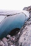
 A glacier cave under Mendenhall Glacier
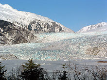
Mendenhall Glacier is a glacier about 12 miles (19 km) long located in Mendenhall Valley, about 12 miles (19 km) from downtown Juneau in the southeast area of the U.S. state of Alaska.
Originally known as Sitaantaagu ("the Glacier Behind the Town") or Aak'wtaaksit ("the Glacier Behind the Little Lake") by the Tlingits, the glacier was named Auke (Auk) Glacier by naturalist John Muir for the Tlingit Auk Kwaan (or Aak'w Kwaan) band in 1888. In 1891 it was renamed in honor of Thomas Corwin Mendenhall. It extends from the Juneau Icefield, its source, to Mendenhall Lake and ultimately the Mendenhall River.
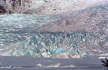
The Juneau Icefield Research Program has monitored the outlet glaciers of the Juneau Icefield since 1942 , including Mendenhall Glacier. From 1951–1958 the terminus of the glacier, which flows into suburban Juneau, has retreated 1,900 feet (580 m). The glacier has also receded 1.75 miles (2.82 km) since 1958, when Mendenhall Lake was created, and over 2.5 miles (4.0 km) since 1500. The end of the glacier currently has a negative glacier mass balance and will continue to retreat in the foreseeable future.
Given that average yearly temperatures are currently increasing, and the outlook is for this trend to continue, it is actually possible that the glacier might experience a period of stabilization or slight advance during its retreating march. This is because increasing amounts of warm, moist air will be carried up to the head of the icefield, where colder ambient temperatures will cause it to precipitate as snow. The increased amount of snow will feed the icefield, possibly enough to offset the continually increasing melting experienced at the glacier's terminus. However, this interesting phenomenon will fade away if temperatures continue to climb, since the head of the glacier will no longer have cold enough ambient temperatures to cause snow to precipitate.
Contents
Visitor Center
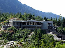
The United States Forest Service administers the Mendenhall Glacier Visitor Center as part of Tongass National Forest. US Forest Service interpreters offer conservation education programs throughout the year for children and adults. It is the only visitor center in the United States within a half mile of a terminal glacier that calves icebergs into a lake. The center is open year-round and receives close to 500,000 visitors each year, many coming by cruise ship in summer. The visitor center has two accessible entrances - an upper entrance with a ramp and a lower entrance with elevators.
This was the first US Forest Service visitor center built in the nation. Dedicated in 1962, it originally served pie and coffee in the area of the center that today shows movies to local residents and visitors. Exhibits in the Center cover the history of Mendenhall Glacier showing how it covered the valley when Joseph Whidbey, master of the HMS Discovery during George Vancouver's 1791-95 expedition, toured the area in 1794 and what is happening due to climate change today. The exhibits depict the variety of wildlife in the area including mountain goats, wolves, black bears and red salmon in the nearby streams. Forest interpreters provide tours, children's nature programs, point out wildlife and answer questions about the area.
There is a large parking lot with access to several trails in the area. Photo Point Trail and the salmon, bear and Steep Creek Trail are easy and accessible trails. Elevated boardwalks above Steep Creek provide safe bear viewing in June, July, August and September. Visitors can hike via the East Glacier Loop to an overlook within a half mile of the glacier. For the more adventurous, there is the Nugget Falls Trail that leads you to the five-story Nugget Falls near the face of the glacier, or you can actually hike up onto the glacier via the West Glacier Trail. Access to the area and trails is free.
From May through September, there is a $3 admission fee to go into the visitor center to view the exhibits and see audio visual presentations. Activities outside the center building itself are free of charge, and visitors may use the restrooms and visit the bookstore without paying the fee. This fee provides for maintenance of the trails, programs during summer, and updating the exhibits in the center. There is no fee in the winter.
In addition to the busy summer season, the Center hosts the Fireside program series for several months in winter every Friday night. Programs cover the ecological and culture history and events in Southeast Alaska. Inside the Visitor Center is a natural and cultural history bookstore run by the Alaska Natural History Association which is a non-profit organization supporting the public lands of Alaska. Trail guides, wildlife and bird guides, children books and other materials are available here.
Gallery
See also
Coordinates: 58°29′45″N 134°31′56″W / 58.49583°N 134.53222°W[1]
References
External links
Categories:- Glaciers of Alaska
- Landforms of Juneau City and Borough, Alaska
Wikimedia Foundation. 2010.


