- Nerkin Getashen
-
Coordinates: 40°08′45″N 45°15′50″E / 40.14583°N 45.26389°E
Nerkin Getashen
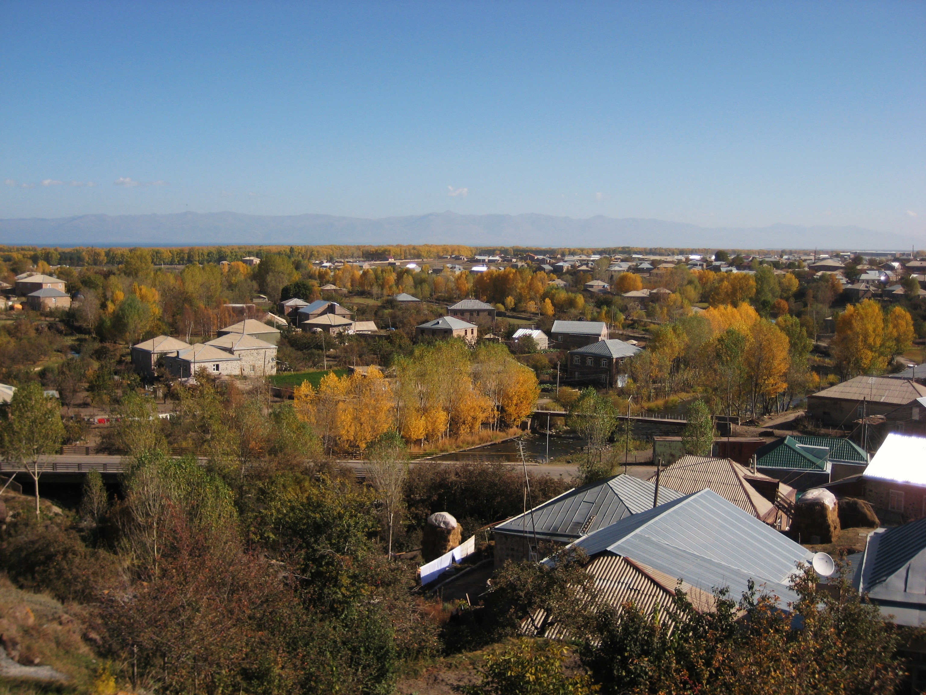
Ներքին ԳետաշենThe village of Nerkin Getashen, October 2009.
 Nerkin Getashen
Ներքին ԳետաշենCoordinates: 40°08′45″N 45°15′50″E / 40.14583°N 45.26389°E Country Armenia Province Gegharkunik Government – Mayor Karo Gevorgyan Elevation 1,948 m (6,391 ft) Population (2008) – Total 7,614 Nerkin Getashen (Armenian: Ներքին Գետաշեն, also Romanized as Nerk’in Getashen, Nerkin Getachen, and Nerqin Getashen - meaning "Lower Getashen"; prior to 1945, Nerkin Adyaman and Nizhniy Adyaman - both meaning "Lower Adyaman") is a fishing village on the south coast of Lake Sevan in Gegharkunik, Armenia. In the early medieval it was the capital of the region known during that time as Kot.
In the village is the 9th century monastery and church of Kotavank overlooking the village and the Argitchi River with a large cemetery adjacent. Turkic rune inscriptions are located nearby. Within the village is also a ruined basilica called "Jam" by the locals with khachkars built into its walls, and not far away is a small shrine. There are also two large stone forts from the Middle Ages located 2 km to the east and 3 km the west of the village.
South of Nerkin Getashen lies Verin Getashen (upper Getashen), founded 1828-29 from by migrants from Mush and Alashkert.
Gallery
-

Kotavank and the adjacent cemetery.
References
- Nerkin Getashen at GEOnet Names Server
- World Gazeteer: Armenia – World-Gazetteer.com
- Report of the results of the 2001 Armenian Census, National Statistical Service of the Republic of Armenia
- Kiesling, Brady (2005), Rediscovering Armenia: Guide, Yerevan, Armenia: Matit Graphic Design Studio
External links
Capital: GavarGavar Berdkunk · Gandzak · Gavar · Gegharkunik · Hayravank · Karmirgyugh · Lanjaghbyur · Lchap · Noratus · Sarukhan · Tsaghkashen · Tsovazard
Sevan Chkalovka · Ddmashen · Geghamavan · Lchashen · Norashen · Semyonovka · Sevan · Tsaghkunk · Tsovagyugh · Varser · ZovaberChambarak Martuni Artsvanist · Astghadzor · Dzoragyugh · Geghhovit · Lichk · Madina · Martuni · Nerkin Getashen · Tsakkar · Tsovasar · Tsovinar · Vaghashen · Vardadzor · Vardenik · Verin Getashen · Yeranos · ZolakarVardenis Akhpradzor · Akunk · Areguni · Arpunk · Avazan · Ayrk · Azat · Daranak · Geghakar · Geghamabak · Geghamasar · Jaghatsadzor · Kakhakn · Karchaghbyur · Khachaghbyur · Kut · Kutakan · Lchavan · Lusakunk · Makenis · Mets Masrik · Nerkin Shorzha · Norabak · Norakert · Pambak · Pokr Masrik · Shatjrek · Shatvan · Sotk · Torfavan · Tretuk · Tsapatagh · Tsovak · Vanevan · Vardenis · Verin ShorzhaCategories:- Populated places in Gegharkunik
- Gegharkunik geography stubs
-


Wikimedia Foundation. 2010.