- Morro da Igreja
-
Morro da Igreja 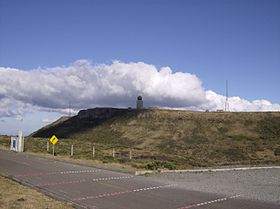
The summitElevation 1,822 m (5,978 ft) Translation Hill of the Church (Portuguese) Pronunciation Portuguese: [ˈmoʁu dɐ iˈɡɾeʒɐ] Location Urubici, state of Santa Catarina,
 Morro da Igreja
 Brazil
Range Serra Geral Coordinates 28°07′30″S 49°28′28″W / 28.125°S 49.47444°WCoordinates: 28°07′30″S 49°28′28″W / 28.125°S 49.47444°W Climbing Easiest route By car from Urubici on the road SC 439. 
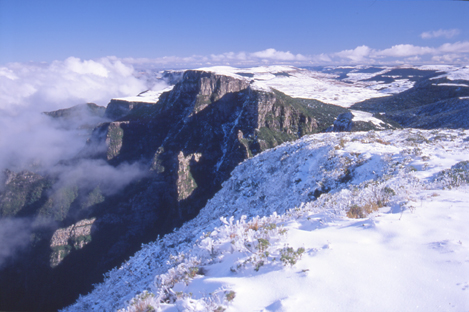
Morro da Igreja (Portuguese pronunciation: [ˈmoʁu dɐ iˈɡɾeʒɐ] "Hill of the Church") is a peak situated in Urubici, a municipality of the Santa Catarina state, in southern Brazil. Its latitude is 28º07'31" S and its longitude is 49º29'38" W, with an elevation of 1,822 metres (5,977 feet), the highest inhabited point and the second most elevated of this state. This peak registered the lowest (unofficial) temperature in Brazil: -17.8°C (0°F),[1] on June 29, 1996. It is considered the coldest place in this country; tourism is popular in the winter, when snowfalls can occur.
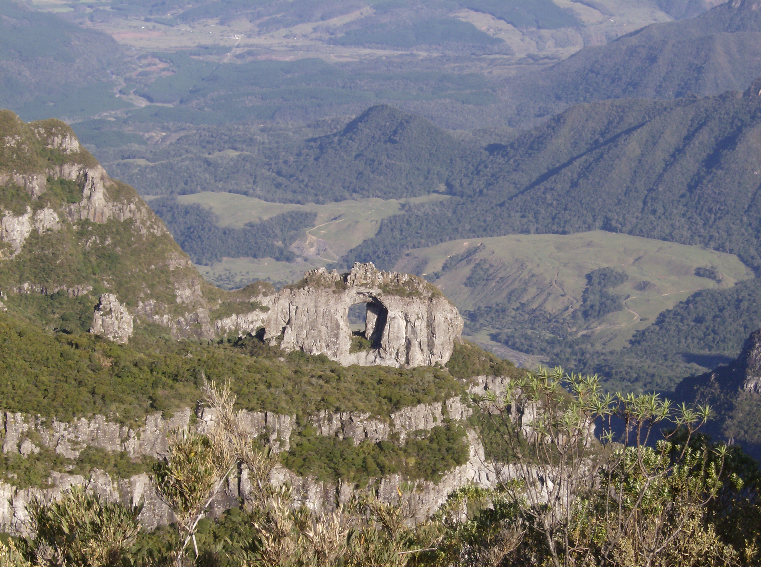
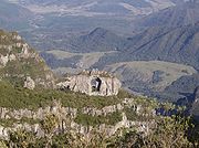 Pedra Furada, a stone photographed from the peak.
The Brazilian Air Force has a military base on the summit equipped with radars and radio relays for air traffic control (CINDACTA) of the Brazilian Southern Region.
There is a curious natural formation in this area, called Pedra Furada (literally Drilled Stone), and it can be spotted from the peak.
See also
- Morro da Boa Vista, the highest peak of Santa Catarina.
- Serra do Rio do Rastro
Notes
- ^ (Portuguese) Sibéria brasileira no sul do Brasil ("Brazilian Siberia in the South of Brazil"), Fantástico, July 18, 2006.
External links
- (Portuguese) Portal of Morro da Igreja
Categories:- Mountains of Brazil
- Santa Catarina geography stubs

Wikimedia Foundation. 2010.