- Chilworth railway station
-
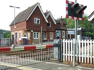
Chilworth 
Location Place Chilworth, Surrey Local authority Guildford Operations Station code CHL Managed by First Great Western Number of platforms 2 Live arrivals/departures and station information
from National Rail EnquiriesAnnual rail passenger usage 2004/05 * 17,627 2005/06 * 17,349 2006/07 * 16,669 2007/08 * 17,444 2008/09 * 20,706 2009/10 * 19,748 History Opened 20 August 1849 National Rail - UK railway stations A B C D E F G H I J K L M N O P Q R S T U V W X Y Z * Annual passenger usage based on sales of tickets in stated financial year(s) which end or originate at Chilworth from Office of Rail Regulation statistics. Please note: methodology may vary year on year. Chilworth railway station serves the village of Chilworth in Surrey, England. The station, and all trains serving it, are operated by First Great Western. It is situated on the North Downs Line.
History
It opened in 1849. It was destaffed in November 1967
Services
The typical off-peak service on the North Downs Line (from December 2006) is one train every two hours between Reading and Redhill.
Preceding station  National Rail
Following station Shalford First Great Western
North Downs LineGomshall Coordinates: 51°12′54″N 0°31′30″W / 51.215°N 0.525°W
Categories:- Railway stations in Surrey
- Former South Eastern Railway (UK) stations
- Railway stations opened in 1849
- Railway stations served by First Great Western
- DfT Category F2 stations
- Surrey building and structure stubs
- South East England railway station stubs

Wikimedia Foundation. 2010.