- St Albans, Victoria
Infobox Australian Place | type = suburb
name = St Albans
city = Melbourne
state = vic
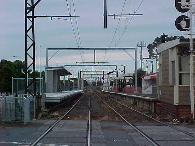
caption = St Albans Station
lga = City of Brimbank
postcode = 3021
pop = 33,511 (2006)Census 2006 AUS | id = SSC21635 | name = St Albans (State Suburb) | accessdate = 2007-09-26 | quick = on]
area = 13
est = 1887
propval = $215,500 [ [http://www.domain.com.au/public/suburbprofile.aspx?suburb=St%20Albans&postcode=3021 St Albans] , accessed 27 November 2006]
stategov = Kororoit, Derrimut
fedgov = Gorton, Maribyrnong
dist1 = 18
location1=Melbourne
dist2 =
location2=
near-nw = Delahey
near-n = Keilor Downs
near-ne = Kealba
near-w = Kings Park
near-e = Kealba
near-sw = Albanvale
near-s = Cairnlea
near-se = Sunshine NorthSt Albans is a large suburb 18 km north-west of
Melbourne in Victoria,Australia . It is in theLocal Government Area of the City ofBrimbank . Itspostcode is 3021. The main commercial and shopping precinct is located on Main Road West, Main Road East, Alfrieda Street, the railway station and East Esplanade. It has become a very multicultural area with 53.5% of residents being born overseas and has a high proportion non-English speaking background residents. Census 2006 AUS | id = SSC21635 | name = St Albans (State Suburb) | accessdate = 2007-09-26 | quick = on]History
St Albans was first established as a township in 1887 and originally subdivided by the Metropolitan Land and Development Co. Pty. Ltd. who had acquired nearly convert|1000|acre|km2 in the hope of a quick financial gain during that period's land boom. The town was promoted as an attractive location for professionals who had easy rail access to central Melbourne and adjoining suburbs with a recently constructed railway station platform attracting potential homeowners to industry in nearby locations.
Development of St Albans suddenly slowed with the economic depression of the late 1890s and did not restart in large numbers until after
World War II , with the influx ofdisplaced people and continuing through the 1950s and 1960s with the influx of European migrants in response to the Australian Government's gradual relaxation of itsWhite Australia Policy in 1947, 1957 & 1958.During the depression 1890s many local farm properties did well, especially when the farmers commenced the
dairy ing of cattle.Horse s were also being trained locally for the Melbourne Cup and the Caulfield Guineas, some were successful.St Albans remained geographically isolated from other suburbs, with large areas of open land between it and other suburbs, until the 1980s. It was sometimes surrounded by flood waters during heavy summer storms, cutting off the (then) four major roads and railway line, stranding commuters and visitors for a day or two.
St Albans is now, (2000s)considered to be a middle-city suburb as the Melbourne Metropolitan area boundary now extends to over 35km from the
Melbourne CBD .Demographics
St Albans' ethnic makeup is predominantly second and third generation immigrants - the ABS 2001 Census reported that 43% were of Southern or Eastern European origin, with 10% of Maltese extraction alone and about 20% from the
Balkan region, including Macedonians,Italians ,Bosnians ,Croatians ,Serbs andSlovenians . Significant communities fromVietnam andChina were also reported.Since the 2001 Census, there has also been a rapid increase in the number of
refugee s from theHorn of Africa settling in St Albans.Flora and Fauna
Great parks are located on the East and West borders of the suburb. These areas (particularly in the West) used to have large healthy populations of native reptiles, including
Tiger snake ,Eastern Blue-tongued Lizard andEastern brown snake . Unfortunately due to development these species are now rarely seen in the area.Due to development of the
Cairnlea estate, on the southern border of St Albans, native species of frogs have taken advantage and have taken up residents in the new wetlands and lakes. TheEastern Banjo Frog ,Common Eastern Froglet and even the now endangeredGrowling Grass Frog have been seen and heard in the new wetlands and aroundKororoit Creek .*
Brimbank Park, Melbourne
*Kororoit Creek Trail
*Kororoit Creek Education
St Albans boasts a large number of schools including the following;
*
Victoria University, Australia
* Brimbank College
* Catholic Regional College St Albans
* Holy Eucharist Primary School
* St Albans Secondary College
* St Albans Primary School
* St Albans Heights Primary School
* St Albans East Primary School
* St Albans Meadows Primary School
* St Albans South Primary School
* St Albans North Primary School
* Sacred Heart Primary School
* Stevensville Primary SchoolFootball (Aussie rules)
The local Football club (St Albans FC) is very large and is actually based in
Kings Park, Victoria . The club has been very successful, particularly over the past 10 years and has developed an impressive name for itself.Soccer
The local
soccer team, theSt Albans Saints , is backed by the Croatian community. Whilst theGreen Gully Cavaliers are backed by the Maltese community.See also
*
City of Keilor - the former local government area of which St Albans was a part.
*City of Sunshine - the former local government area of which St Albans was a part.
*St Albans railway station, Melbourne References
External links
Wikimedia Foundation. 2010.