- Divín
-
-
- For Slovak figure skater see Karol Divín
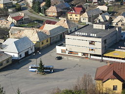
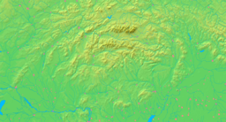
Divín Village Center of DivínCountry Slovakia Region Banská Bystrica District Lučenec Elevation 265 m (869 ft) Coordinates 48°27′N 19°32′E / 48.45°N 19.533°E Area 23.925365 km2 (9.24 sq mi) Population 2,045 (2004-12-31) Density 85 / km2 (220 / sq mi) First mentioned 1329 Postal code 985 52 Area code +421-47 Car plate LC Wikimedia Commons: Divín Statistics: MOŠ/MIS Divín (German: Diwein; Hungarian: Devény) is a village and municipality in the Lučenec District in the Banská Bystrica Region of Slovakia.
History
In historical records, the village was first mentioned in 1329 as a parish and a castle (1329 castrum Dyun' villa sub eodem castro, 1393 Dyen, Dyuen, 1497 Dywyn, 1473 Dewen). Many noble families ruled the village and lived in the castle: Tomay, Lossonczy, Balassa, Zichy. In 1575 the fortress was occupied by Turks up to 1593. In 1604, it passed to nobles Bocskay, and after to Balassa family again. In 1674, the castle was destroyed by General Strassoldo.
External links
Ábelová · Belina · Biskupice · Boľkovce · Budiná · Bulhary · Buzitka · Čakanovce · Čamovce · Divín · Dobroč · Fiľakovské Kováče · Gregorova Vieska · Halič · Holiša · Jelšovec · Kalonda · Kotmanová · Lehôtka · Lentvora · Lipovany · Lovinobaňa · Lupoč · Ľuboreč · Mašková · Mikušovce · Mučín · Mýtna · Nitra nad Ipľom · Nové Hony · Panické Dravce · Pinciná · Píla · Pleš · Podrečany · Polichno · Praha · Prša · Radzovce · Rapovce · Ratka · Ružiná · Stará Halič · Šiatorská Bukovinka · Šurice · Šávoľ · Šíd · Tomášovce · Točnica · Trebeľovce · Trenč · Tuhár · Veľká nad Ipľom · Veľké Dravce · Vidiná Categories:
- Banská Bystrica Region geography stubs
- Slovak building and structure stubs
- European castle stubs
- Villages and municipalities in Lučenec District
- Castles in Slovakia
-
Wikimedia Foundation. 2010.


