Mikkabi, Shizuoka

Mikkabi, Shizuoka
Mikkabi
三ヶ日町
Former municipality
Since July 1, 2005
Currently part of Kita-ku, Hamamatsu
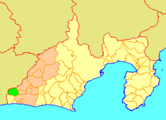
Location of Mikkabi
Mikkabi's location in Shizuoka, Japan.
Location
Country Japan
Region Chūbu region (Tōkai region)
Prefecture Shizuoka
District Inasa District,
Physical characteristics
Area 75.65 km²
Population (as of June 1, 2005)
     Total 16,059
     Density 212.28/km²
Location 34°48′11″N 137°33′22″E / 34.80306°N 137.55611°E / 34.80306; 137.55611
Symbols
Tree Inumaki
Flower Satsuma (fruit)
Bird Japanese White-eye

Coordinates: 34°48′11″N 137°33′22″E / 34.80306°N 137.55611°E / 34.80306; 137.55611

Mikkabi (三ヶ日町 Mikkabi-chō?) was a town located in Inasa District, Shizuoka Prefecture, Japan.

On July 1, 2005 Mikkabi, along with the town of Haruno, from Shūchi District, the towns of Hosoe and Inasa, all from Inasa District, the towns of Sakuma and Misakubo, the village of Tatsuyama, all from Iwata District, the towns of Maisaka and Yūtō, both from Hamana District, and the cities of Tenryū and Hamakita, was merged into the city of Hamamatsu, and is now part of Kita-ku.

At the time of its merger, the town had an estimated population of 16,059 and a density of 212.28 persons per km². The total area was 75.65 km².

Mikkabi is known for its production of mikan oranges.


Wikimedia Foundation. 2010.

Игры ⚽ Нужна курсовая?

Look at other dictionaries:

  • Mikkabi Station — 三ヶ日駅 Mikkabi Station Location Prefecture Shizuoka …   Wikipedia

  • Prefectura de Shizuoka — Shizuoka 静岡県 Shizuoka ken Prefectura de Japón …   Wikipedia Español

  • Misakubo, Shizuoka — Misakubo 水窪町 Former municipality Since April 1, 2005 Currently part of Tenryū ku, Hamamatsu …   Wikipedia

  • Maisaka, Shizuoka — Maisaka 舞阪町 Former municipality Since July 1, 2005 Currently part of Nishi ku, Hamamatsu …   Wikipedia

  • List of mergers in Shizuoka Prefecture — The following is a list of mergers that occurred in the 2000s in Shizuoka Prefecture, Japan.(as of April 1, 2008)Mergers from April 1, 1999 to March 31, 2000Mergers from April 1, 2000 to March 31, 2001Mergers from April 1, 2001 to March 31,… …   Wikipedia

  • Inasa District, Shizuoka — Inasa (引佐郡; gun) was a district located in Shizuoka, Japan. On July 1 2005, All towns were merged into Hamamatsu which will dissolved the district officially.In 2003, the district had an estimated population of 52,485 and a density of 227.20… …   Wikipedia

  • List of Japan-related articles (M) — TOCleftThis page lists Japan related articles with romanized titles beginning with the letter M. For names of people, please list by surname (i.e., Tarō Yamada should be listed under Y , not T ). Please also ignore particles (e.g. a , an , the )… …   Wikipedia

  • Okuhamanako Station — 奥浜名湖駅 Okuhamanako Station Location Prefecture …   Wikipedia

  • Hamamatsu — Infobox City Japan Name= Hamamatsu JapaneseName= 浜松市 Map Region= Chūbu Prefecture= Shizuoka District= Area km2= 1511.17 PopDate= March 2007 Population= 808,182 Density km2= 534.81 Coords= LatitudeDegrees= 34 LatitudeMinutes= 43 LatitudeSeconds=… …   Wikipedia

  • Hamamatsu — shi (浜松市) La rivière Futamatagawa au cœur de l arrondissement de Tenryū Administration Pays Japon Région Chūbu …   Wikipédia en Français

Share the article and excerpts

Direct link
Do a right-click on the link above
and select “Copy Link”