- Otaihanga
-
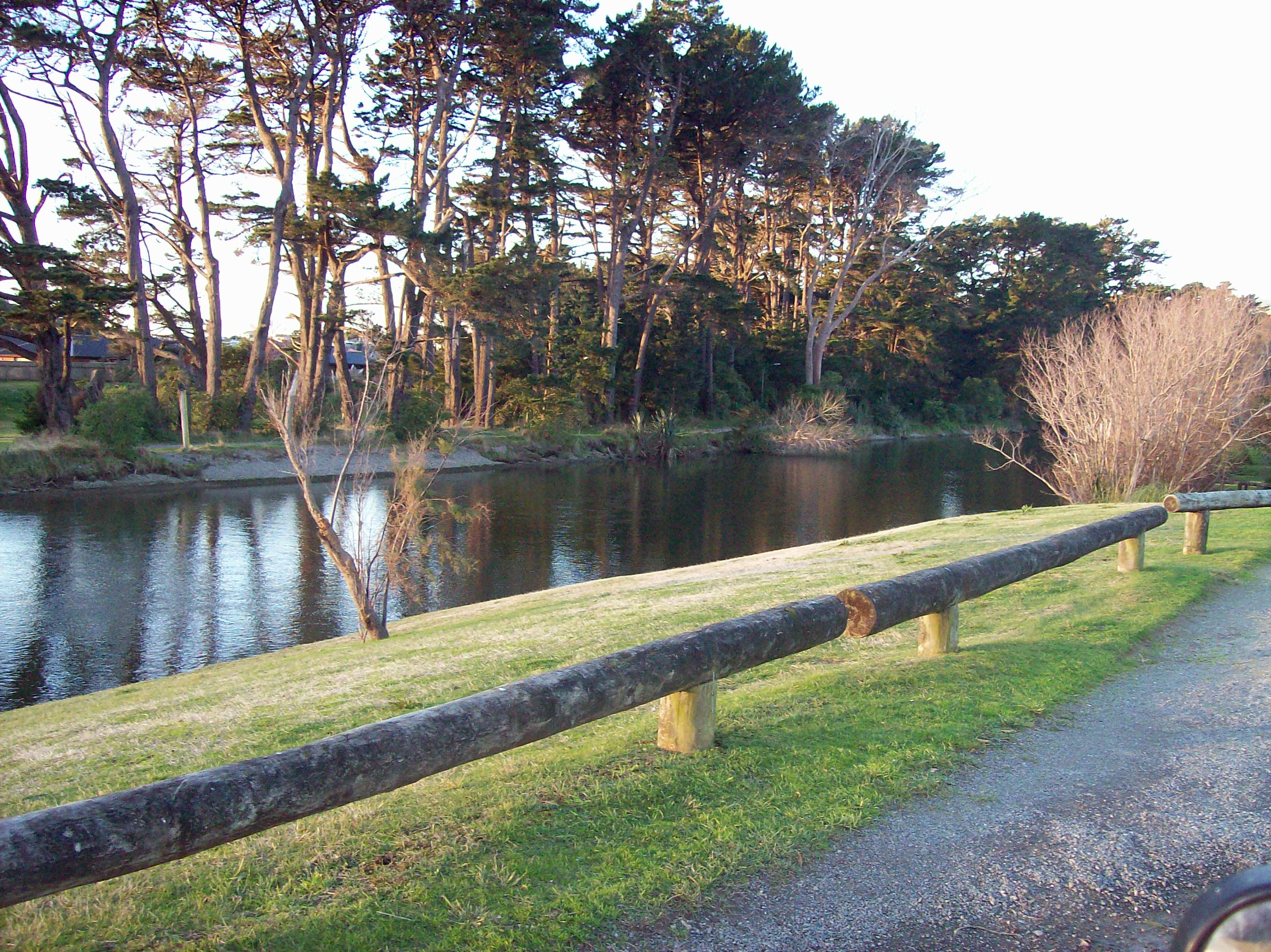
 The Waikanae River as viewed from its southern bank in Otaihanga. Across the river is the town of Waikanae Beach.
Otaihanga is on the Kapiti Coast of New Zealand's North Island.[1] It is just north of Paraparaumu on the south bank of the Waikanae River and is roughly 55 km north of New Zealand's capital city, Wellington. Its name means "the place made by the tide" in Māori.[2]
Contents
Attractions
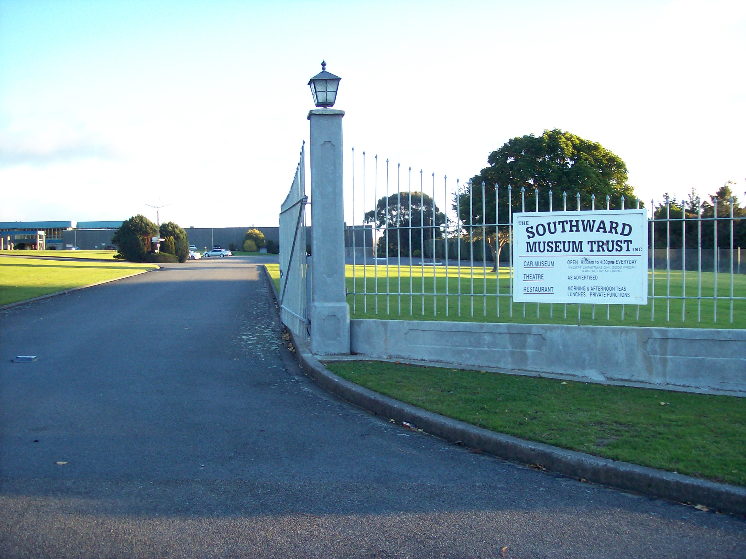
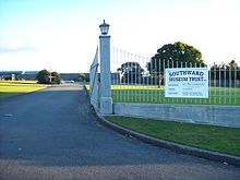 The entrance to Southward Car Museum from Otaihanga Road.
Located in Otaihanga is one of the Kapiti Coast's most significant tourist attractions, the Southward Car Museum[2] on Otaihanga Road between the North Island Main Trunk Railway to the west and State Highway 1 to the east. It has one of the largest collections of cars in the Southern Hemisphere and contains other attractions such as heritage planes, and it has a large theatre.
Economy
Agriculture used to take place, but has now largely ceased as residential developments have been built. Otaihanga has become primarily residential, and some small-scale commercial businesses operate. The Kapiti Coast's main rubbish tip is in Otaihanga.[3]
Education
There are no educational institutions in Otaihanga, but there are primary schools and a secondary school, Paraparaumu College, minutes away in Paraparaumu. One of the primary schools, Kenakena School, has been involved in works to improve Otaihanga's environment at Greendale Reserve.[4]
Environment
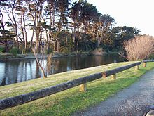
 The Makora Road entrance to the Otaihanga Domain.
As Otaihanga is on the banks of the Waikanae River, it can be susceptible to flooding during storms and periods of high rainfall. Serious flooding in the first week of January 2005 damaged 18 houses and necessitated the evacuation to higher ground of a number of residents by boat.[5] After the flooding, the raising of three houses was prioritised and long term options such as upgrading flood stopbanks and extracting gravel from the riverbed were investigated.[6]
The main parkland in Otaihanga is the Otaihanga Domain, on the banks of the Waikanae River. It is used for leisure activities and has no sporting facilities. It has family amenities and a footbridge across the river to Waikanae.[7] Another parkland, Greendale Reserve, was formerly two rundown paddocks but it has been the subject of local volunteer efforts to revitalise its environment and restore native plants. These efforts began in 1997 and have involved the students of Kenakena School. In 2006, the volunteer work was honoured by a Conservation Week Merit Award, with the school receiving the 2006 Young Conservationist Award.[4]
Transport
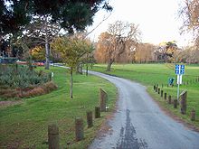
 The North Island Main Trunk Railway, looking south from the Otaihanga Road level crossing. On the right is the location of a former halt; on the left is Southward Car Museum.
State Highway 1 runs through eastern Otaihanga. The intersection of the highway and Otaihanga Road is a notorious traffic black spot and in August 2006, Transit New Zealand lowered the speed limit of the highway in the area from 100 km/h to 80 km/h as an attempt to reduce accidents.[8]
Otaihanga is on the North Island Main Trunk Railway, on a section built by the Wellington and Manawatu Railway Company. The two ends of the line met at Otaihanga and the last spike was driven at a public ceremony by Governor William Jervois.[9] The railway opened on 3 November 1886 and passed into the ownership of the New Zealand Railways Department on 8 December 1908. There was a passenger halt at Otaihanga until 1902. Kapiti Line commuter services stop at Paraparaumu and the terminus at Waikanae.
References
- ^ "Place Name Detail: Otaihanga". New Zealand Geographic Placenames Database. Land Information New Zealand. http://www.linz.govt.nz/placenames/find-names/topographic-names-db/database/index.aspx?p=27764. Retrieved 2007.
- ^ a b Kapiti Coast District Council, "Tourism", accessed 28 November 2007.
- ^ Kapiti Coast District Council, "Waste Management", accessed 28 November 2007.
- ^ a b Greater Wellington Regional Council, "Friends of Greendale", accessed 28 November 2007.
- ^ "18 homes flooded north of Wellington". The New Zealand Herald. 6 January 2005. http://www.nzherald.co.nz/floods/news/article.cfm?c_id=205&objectid=9005702. Retrieved 1 November 2011.
- ^ Greater Wellington Regional Council, "House Raising in Otaihanga Brought Forward", posted 8 March 2005, accessed 28 November 2007.
- ^ Kapiti Coast District Council, "Parks and Reserves", accessed 28 November 2007.
- ^ Transit New Zealand Wellington Regional Office, "Media Release: Speed Limit Change At Otaihanga", posted 1 August 2006, accessed 28 November 2007.
- ^ Geoffrey B. Churchman and Tony Hurst, The Railways of New Zealand: A Journey Through History (Auckland: HarperCollins, 1991), 165.
External links
Coordinates: 40°52′53″S 175°00′49″E / 40.8815°S 175.0137°E
Categories:- Wellington Region
- Populated places in New Zealand
- Kapiti Coast


Wikimedia Foundation. 2010.