- Molonglo River
-
Molonglo River 
Black swans on Molonglo RiverOrigin Tinderry Range, New South Wales Mouth Murrumbidgee River Basin countries Australia Length 80 kilometres (50 mi) Source elevation 1,100 metres (3,609 ft) Basin area 198,900 ha (768 sq mi) 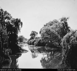 Molonglo River at Acton in 1920
The Molonglo River rises on the western side of the Great Dividing Range of eastern Australia in the state of New South Wales. Its source is on the other side of the mountain range from where the Shoalhaven River rises, in Tallaganda state forest at ~1200 metres altitude. The Molonglo River flows from south to north before turning northwest, through the outskirts of the New South Wales town of Queanbeyan, where it picks up its major tributary the Queanbeyan River, and then continues through the nation's federal capital city of Canberra, where it has been dammed to form Lake Burley Griffin. It then flows on to empty into the Murrumbidgee River to the northwest of Canberra. Over its course the Molonglo River alternates between long broad floodplains and narrow rocky gorges several times. One of these floodplains is called the Molonglo Plain.
Contents
Origin of name
The river's name was recorded as the "Yeal-am-bid-gie" in 1820 by the explorer Charles Throsby.[1] This was probably the collective local Ngunnawal language name for the river. (The suffix "bidgee" was common in Aboriginal names for rivers in the Canberra area and presumably means "water" or "river".) The Moolinggolah people of the district around Captains Flat probably gave the Molonglo its name. Where the river flowed through what is now Canberra, it was probably known after the Ngambri people, transcribed as Kembury, Canberry, and other transcription variations.
History
In the early years of European settlement both the Molonglo and the Queanbeyan were known as the "Fish River" for the abundance of native fish in them. The Molonglo was renowned as a beautiful river with excellent fishing for native Murray Cod, Golden Perch and Silver Perch. Sadly, this abundance of native fish did not last. In the 1930s and 1940s, mine tailings at Captains Flat twice collapsed into the upper reaches of the river, eradicating all native fish and most other aquatic life downstream from the site. Despite government funded rehabilitation programs in 1976, some toxic leachates still enter the river from the Captain's Flat mine site.
Consequently, when Lake Burley Griffin was built upon the Molonglo and filled in 1964, the waters were devoid of native fish. Restocking commenced in the 1970s and continued through 1980s have re-established Murray Cod and Golden Perch in the lake and a short stretch of river upstream. A large stretch of the Molonglo still holds nothing but introduced fish species and is still waiting for the native fish species to be re-established by stockings.
Selected References
- ^ Australian Bureau of Statistics, Official yearbook of the Commonwealth of Australia, Number 24, 1931 p456
Lintermans, M. (2000) The Status of Fish in the Australian Capital Territory : A Review of Current Knowledge and Management Requirements. Technical Report No. 15. Environment ACT, Canberra.
See also
Categories:- Rivers of the Australian Capital Territory
- Rivers of New South Wales
- Tributaries of the Murrumbidgee River
- Borders of the Australian Capital Territory


Wikimedia Foundation. 2010.