- King Island (Tasmania)
Infobox Islands
name = King Island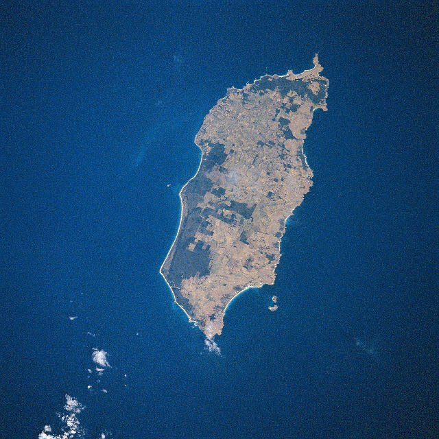
image caption = King Island from space, April 1993 (South is at top)
locator
native name =
native name link =
location =Tasmania
coordinates= 39°52'S 143°59'E
area = 1 098 km² (424 sq mi)
highest mount = Mount Stanley
elevation = 213 m (700 ft)
country = Australia
country admin divisions title = State
country admin divisions = flag|Tasmania
country admin divisions title 1 = LGA
country admin divisions 1 = Municipality of King Island
country largest city = Currie
country largest settlement population = population 800
population = 1 570
population as of = 2005
density = 1.43/km² (3.70/sq mi)
ethnic groups =King Island is one of the islands that make up the state of
Tasmania ,Australia . It is by far the largest of a group known as New Year Islands, comprising King Island, New Year Island and Christmas Island to the northwest and smallerCouncillor Island to the east.The southernmost point is called Stokes Point and the northernmost point is called Cape Wickham.It is located in
Bass Strait , off the north-western tip of the main island of Tasmania, about half way between Tasmania and Victoria. The island was named King's Island after Governor King ofNew South Wales , whose territory at the time included what is now Tasmania. The Local Government Area of the island isKing Island Council .The population in 2005 was 1,570 with a median age of 43.1. [http://www.abs.gov.au/ausstats/abs@.nsf/Latestproducts/3218.0Main%20Features72004-05?opendocument&tabname=Summary&prodno=3218.0&issue=2004-05&num=&view=]
History
King Island was discovered by Captain Reed, hunting seals in the schooner Martha in 1799.Matthew Flinders’ first map of Van Dieman’s Land and Basses Strait [This map is held at the National Library Canberra] - that was sent to England (before Flinders had left) and was published in June 1800, did not show King Island.
However, Before Flinders left Sydney for England in 1800, Reed had informed Flinders - of the existence of the island. Flinders’ second map of Van Diemen’s Land and Bass’s Strait (properly finished on route to England) and published with his Observations [Opservations on the coast of Van Diemen's Land, on Bass's Strait and its Islands, and on Parts of the coast of New South Wales-By Matthew Flinders 1801] in 1801 shows: [common map dated 1798-99 and showing-"land seen"] “ Land of considerable extent has been seen about this situation”.
Captain Black also visited the island just after reed in the brig Harbinger, after which the dangerous Harbinger Rocks off the island's north-west coast are named. It was found to abound in both fur seals and elephant seals which were soon being exploited to the edge of extinction.
Governor King, knowing that the French navigator Nicolas Baudin was going to head for the Island, when he left Port Jackson in 1800, sent the Cumberland from Sydney to formally claim the islands for Britain , the Cumerland arrived just before the French and the British had hastily erected the British Flag in a tree. [The Journal of Post Captain Nicolas Baudin-liibraries Board of South Australia 1974]
As a result of this incident, British settlements were established at the River Derwent and Port Dalrymple in Tasmania and later Port Phillip.
Sealers continued to harvest the island intermittently until the mid 1820s, after which the only inhabitants were some old sealers and their
Australian aboriginal wives who mostly huntedwallaby for skins. The last of these left the island in 1854 and for many years it was only occasionally visited by hunters and more often castaways from shipwrecks.The first
submarine communications cable across Bass Strait in 1859 went via King Island, starting atCape Otway , Victoria, it made contact with the Tasmanian mainland at Stanley Head, and then continued on to George Town. However it started failing within a few weeks of completion, and by 1861 it failed completely. A later telephone and telegraph cable across Bass Strait operated via King Island from 1936 until 1963.In the 1880s the land was opened for grazing. A township developed at Currie and the Post Office opened on
June 1 ,1892 (known as King's Island until 1903, King Island until 1917, thereafter Currie).Citationlast = Premier Postal History | title = Post Office List | url = https://www.premierpostal.com/cgi-bin/wsProd.sh/Viewpocdwrapper.p?SortBy=TAS&country= | accessdate = 2008-04-11 ]
Currie, on the west coast, now has the only Post Office on the island, but in the past Grassy, in the southeast (1918-1935, 1943-1991), Naracoopa on the east coast (1920-1962), Pearshape to the south (1946-1959) and Egg Lagoon in the north (1925-1967) (replacing Yambacoona (1922-1925)) all had official Post Offices. The other localities of King Island are Bungaree, Loorana, Lymwood, Nugara, Pegarah, Reekara, Sea Elephant, Surprise Bay, Wickham and Yarra Creek.Citation
last = Premier Postal History | title = Post Office List | url = https://www.premierpostal.com/cgi-bin/wsProd.sh/Viewpocdwrapper.p?SortBy=TAS&country= | accessdate = 2008-04-11 ]
Shipwrecks
Situated in the centre of the western entrance to
Bass Strait , King Island has been the location of over 60 known ship wrecks, involving the loss of well over 700 lives. These include:*1801, large unidentified three-masted
full rigged ship , probably a whaler. No survivors known.
*1835, "Neva",convict ship 327 tons, 225 lives lost.
*1840, "Isabella", full-rigged ship 287 tons, no lives lost.
*1845, "Cataraqui", full-rigged ship 802 tons, 400 lives lost.
*1854, "Brahmin", full-rigged ship 616 tons, 17 lives lost.
*1854, "Waterwitch",schooner 134 tons, no lives lost.
*1855, "Whistler", Americanclipper ship , 942 tons, two lives lost.
*1855, "Maypo",brig 174 tons, no lives lost.
*1865, "Arrow," schooner 166 tons, one life lost.
*1866, "Netherby", full-rigged ship 944 tons, no lives lost.
*1871, "Loch Leven", iron clipper ship 1868 tons, one life lost.
*1874, "British Admiral", iron clipper ship, 79 lives lost.
*1875, "Blencathra", iron barque, 933 tons, no lives lost.
*1910, "Carnarvon Bay", steel full-rigged ship 1932 tons, no loss of life.The Island today
The largest town is Currie, situated on the western side of the island. Grassy, in the east was a mining town, where
scheelite was mined in an open cut mine. After the mine closed, Grassy virtually became aghost town . This has gradually changed and in recent years the population has grown and the town now boasts a Gourmet Butcher, Supermarket, Bold Head Brasserie at the Grassy Club, the G Cafe, the Grassy Emporium, E J Motors and Kelp Craft as well as a swimming pool, laundromat and accommodation in the town and bed & breakfast at the Portside Links as well as a campus set up byBallarat and Clarendon College . Grassy is also known for the natural penguin rookeries near the (safe harbour) port.The island is noted for its production of
cheese ,lobster s,mineral water ,kelp , andbeef . It is a safe harbour for passing yachts and the site of a wind farm operated byHydro Tasmania .The island has a football competition, The
King Island Football League with just three teams, Currie FC, Grassy FC and Norths FC.Climate
"Source": [http://www.bom.gov.au/climate/averages/tables/cw_098001.shtml Australian Bureau of Meteorology] .
ee also
* Huxley Hill Wind Farm
*King Island Airport
*New Year Island (Tasmania)
*Christmas Island (Tasmania)
*Councillor Island References
External links
* [http://www.kingisland.net.au Municipality of King Island]
* [http://www.bom.gov.au/climate/averages/tables/cw_098001.shtml Currie climate averages (Australian Bureau of Meteorology)]
* [http://www.ahouseonkingisland.com King Island Property]
* [http://web.archive.org/web/20050428014209/www.arts.monash.edu.au/ncas/multimedia/gazetteer/list/currie.html Australian Places - Currie]
Wikimedia Foundation. 2010.