- Macdonald, Meredith and Aberdeen Additional, Ontario
Infobox City
official_name = Township of Macdonald, Meredith
and Aberdeen Additional
other_name =
native_name =
nickname =
motto =
imagesize =
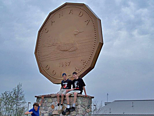
image_caption = The "Big Loonie" in Echo Bay.
flag_size =
image_
seal_size =
image_shield =
shield_size =
image_blank_emblem =
blank_emblem_size =
mapsize =
map_caption =
pushpin_
pushpin_label_position =
subdivision_type = Country
subdivision_name =Canada
subdivision_type1 = Province
subdivision_name1 =Ontario
subdivision_type2 = District
subdivision_name2 = Algoma
subdivision_type3 =
subdivision_name3 =
subdivision_type4 =
subdivision_name4 =
government_type = Township
leader_title = Mayor
leader_name = Lynn Watson
leader_title1 = Governing Body
leader_name1 = Macdonald, Meredith and Aberdeen Additional Township Council
leader_title2 =MP
leader_name2 =Tony Martin (NDP)
leader_title3 =MPP
leader_name3 =David Orazietti (OLP)
leader_title4 =
leader_name4 =
established_title = Incorporated
established_date = 1899
established_title2 =
established_date2 =
established_title3 =
established_date3 =
area_magnitude =
unit_pref =
area_footnotes =
area_total_km2 = 161.73
area_land_km2 =
area_water_km2 =
area_total_sq_mi =
area_land_sq_mi =
area_water_sq_mi =
area_water_percent =
area_urban_km2 =
area_urban_sq_mi =
area_metro_km2 =
area_metro_sq_mi =
population_as_of = 2006
population_footnotes =ref label|Stats_Canada|1|1(sc)
population_note =
settlement_type = Township
population_total = 1550
population_density_km2 = 9.6
population_density_sq_mi =
population_metro =
population_density_metro_km2 =
population_density_metro_sq_mi =
population_urban =
population_density_urban_km2 =
population_density_urban_mi2 =
timezone = EST
utc_offset = -5
timezone_DST = EDT
utc_offset_DST = -4
latd=
longd=
elevation_footnotes =
elevation_m =
elevation_ft =
postal_code_type =
postal_code =P0S
area_code =705
website = [http://hosting.soonet.ca/twpmacd/index.html Macdonald, Meredith and Aberdeen Additional]
footnotes =Macdonald, Meredith and Aberdeen Additional is a township in
Algoma District, Ontario . Originally surveyed as separate geographical townships, Macdonald and Meredith were incorporated as a single, municipal township in 1892. The geographical township of Aberdeen Additional was added to Macdonald and Meredith township in 1899 to create the municipal township of Macdonald, Meredith and Aberdeen Additional.The township encompasses the unincorporated communities of Echo Bay, Bar River and Sylvan Valley.
The township had a population of 1,550 in the
Canada 2006 Census .Communities
Bar River is a small hamlet straddling the boundary between the townships of Macdonald, Meredith and Aberdeen Additional and Laird.
Echo Bay is located on the shores of the Echo Bay and Lake George. The community is home to a big
loonie , similar to theBig Nickel in Sudbury, around 260 km eastward.Robert-Ralph Carmichael , one of the Canadian dollar coin's designers, lives near Echo Bay.External links
* [http://hosting.soonet.ca/twpmacd/index.html Macdonald, Meredith and Aberdeen Additional]
Wikimedia Foundation. 2010.
