- Culloden Point
-
Coordinates: 41°04′13″N 71°57′36″W / 41.07028°N 71.96°W
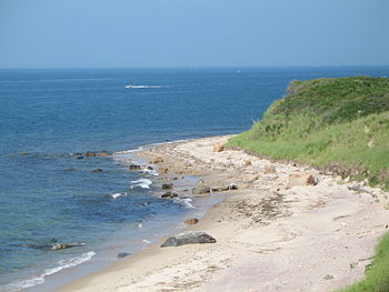
 Photo from parking lot at the top of the bluff in July 2006. The large rock with red on its side is the landmark for scuba divers, who follow a heading of 333 degrees from it to reach the wreck of the HMS Culloden
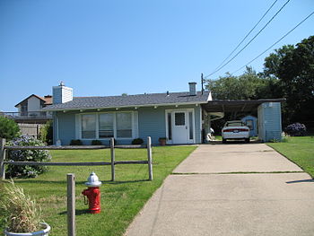
 One of the more than 200 Leisurama second homes at Culloden Point.
Culloden Point is a small peninsula north of Montauk, New York that marks the east side entrance to Fort Pond Bay from Long Island Sound.
Contents
HMS Culloden
The British ship HMS Culloden ran aground here in 1781 while pursuing a French frigate. To keep it from falling into enemy hands, the British threw the cannons overboard and burned the ship.
The wreck was discovered in the 1970s when portions of it washed ashore (reports indicate that some of the washed-up debris had been used for beach campfires). One of the cannons is on display at the East Hampton Marine Museum in Amagansett, New York, which has an extensive display of Culloden artifacts.
Other cannons are still on the bottom close to shore and about 20 to 25 feet below the surface. The wreck is protected on the National Register of Historic Places and now is the first underwater park on Long Island, New York. The park is accessible on a single-lane gravel road at the west end of Soundview Drive. Divers use a large rock with pebbles on top of it to the north of the bluff stairs as the landmark for reaching the wreck. They follow a heading of 333 degrees. It is about 150 feet off shore. The debris field is marked by buoys.
Prior to the discovery of the wreck in the 1970s, the spit was called Will's Point, possibly named after Will Indian, a herder mentioned in early East Hampton Town records.
Amistad
In 1839 the Amistad anchored at Culloden Point after the surviving crew tried to convince their revolting slave captors that they had returned to Africa. They went for provisions in the village of Montauk. The ship was seized here by the USS Washington (1837).
Leisurama
In the early 1960s, about 200 Leisurama prefabricated homes were built at the point after being sold from a display on the ninth floor of the Macy's in New York City.
External links
Categories:- East Hampton (town), New York
- Geography of Suffolk County, New York
Wikimedia Foundation. 2010.
