- Discovery Island (British Columbia)
-
This article is about the small island near Victoria, B.C.. For other islands with a similar name, see Discovery Island (disambiguation).


Discovery Island is located off the eastern side of Vancouver Island and is viewable from Ten Mile Point, near Cadboro Bay, and Oak Bay. Discovery Island Marine Provincial Park occupies the southern portion of Discovery Island, 3 miles (4.8 km) east of Oak Bay. The northern portion of the island is part of Discovery Island Indian Reserve 3, under the control of the Songhees First Nation.
Discovery island was named in 1846 by surveyors in honour of HMS Discovery, the ship used by 18th-century British Explorer Captain George Vancouver to chart the coastline of British Columbia between 1792 and 1794 (see the Vancouver Expedition). The adjacent Chatham Islands were named after his escort ship, HMS Chatham.
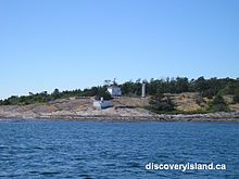
The Lighthouse at Sea Bird Point, the eastern end of Discovery Island, marks the junction of the Haro and Juan De Fuca Straits. These two straits form the border between Canada and the United States. The lighthouse was built in 1886 and manned for 110 years before being fully automated in 1996. Sea Bird Point was named after an American paddle steamer which caught fire and was run aground in 1858 to save the lives of the crew.
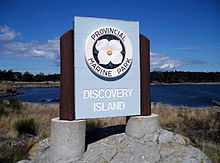
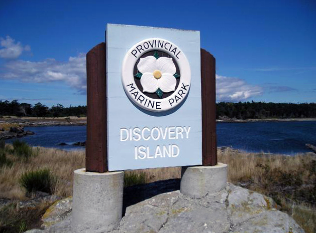
Designated as a park in 1972, the uninhabited and undeveloped 61-hectare Discovery Island Marine Provincial Park was once inhabited by First Nations people and resident lighthouse keepers. The island was once the home of Captain E.G. Beaumont, who purchased part of the island in 1918. He died in 1967 after living on Discovery Island with his wife for nearly half a century. Beaumont owned roughly 160 acres (half) of Discovery Island, and in his will gave his share of the island to the province of British Columbia. Beaumont was an avid seaman and even in his 80's would regularly row his boat from Discovery Island to Ten Mile Point, where he would go for walks in the woods. Evidence of the Beaumonts' beautiful home and gardens overlooking Rudlin Bay can still be seen.
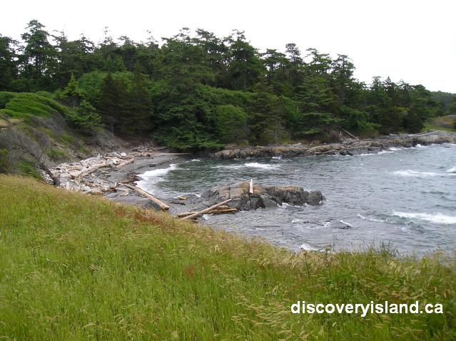
Discovery Island Marine Provincial Park is open year round. There is a camping fee and services provided from May 1 - September 30. During the off-season, there is no fee and no services. There are gravel beaches and a few walking and hiking trails along the shores and through fir and arbutus woodlands. The trail system runs from the lighthouse on Sea Bird Point to Commodore Point and across to the western shore of the park. Hikers can ascend the 38-metre (125 foot) Pandora Hill for improved views of the area and spectacular sweeping views of the Olympic Mountains.
References
- "Discovery Island". BC Geographical Names. http://apps.gov.bc.ca/pub/bcgnws/names/17376.html.
- discoveryisland.ca
- Lighthouses of British Columbia - Discovery Island Lighthouse
- Discovery Island - BC Parks
Coordinates: 48°25.4′N 123°14.0′W / 48.4233°N 123.233°W
The Gulf Islands of British Columbia Howe Sound Islands Northern Gulf Islands (major) Northern Gulf Islands (minor) Southern Gulf Islands (major) Gabriola • Galiano • Kuper • Mayne • North and South Pender • Saltspring • Saturna • Thetis • ValdesSouthern Gulf Islands (minor) Belle Chain Islets • Chain Islets • Chatham Islands • D'Arcy • Dayman • De Courcy • Discovery • James • Moresby • Mudge • Newcastle • North Secretary • Parker • Piers • Portland • Prevost • Protection • Ruxton • Sidney • Skull • Trial Islands • WallaceCategories:

Wikimedia Foundation. 2010.