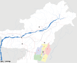
- Mayang Imphal
-
Mayang Imphal — city — Coordinates 24°36′N 93°54′E / 24.60°N 93.90°ECoordinates: 24°36′N 93°54′E / 24.60°N 93.90°E Country India State Manipur District(s) Imphal West Population 20,536 (2001[update]) Time zone IST (UTC+05:30) Mayang Imphal is a town and a nagar panchayat in Imphal West district in the Indian state of Manipur.
Contents
Geography
Mayang Imphal is located at 24°36′N 93°54′E / 24.60°N 93.90°E.[1]
Demographics
As of 2001[update] India census,[2] Mayang Imphal had a population of 20,536. Males constitute 50% of the population and females 50%. Mayang Imphal has an average literacy rate of 56%, lower than the national average of 59.5%: male literacy is 67%, and female literacy is 45%. In Mayang Imphal, 17% of the population is under 6 years of age.
Politics
Mayang Imphal is part of the Lok Sabha constituency of Inner Manipur.[3]
References
- ^ "Yahoo maps location of Mayang Imphal". Yahoo maps. http://maps.yahoo.com/#mvt=m&lat=24.59878&lon=93.898132&zoom=14&q1=Mayang%2520Imphal. Retrieved 2008-12-30.
- ^ "Census of India 2001: Data from the 2001 Census, including cities, villages and towns (Provisional)". Census Commission of India. Archived from the original on 2004-06-16. http://web.archive.org/web/20040616075334/http://www.censusindia.net/results/town.php?stad=A&state5=999. Retrieved 2008-11-01.
- ^ "Assembly Constituencies - Corresponding Districts and Parliamentary Constituencies". Manipur. Election Commission of India. http://archive.eci.gov.in/se2002/background/S14/Dist_PC_AC.pdf. Retrieved 2008-10-07.
Municipalities of Manipur Categories:- Cities and towns in Imphal West district
- Imphal West
- Manipur geography stubs
Wikimedia Foundation. 2010.


