Chinchani

Chinchani
Chinchani
—  city  —
Chinchani
Location of Chinchani
in Maharashtra and India
Coordinates 19°52′N 72°42′E / 19.87°N 72.7°E / 19.87; 72.7Coordinates: 19°52′N 72°42′E / 19.87°N 72.7°E / 19.87; 72.7
Country India
State Maharashtra
District(s) Thane
Population 13,435 (2001)
Time zone IST (UTC+05:30)
Area

Elevation


9 metres (30 ft)

Chinchani is a census town in Thane district in the state of Maharashtra, India.

Geography

Chinchani is located at 19°52′N 72°42′E / 19.87°N 72.7°E / 19.87; 72.7.[1] It has an average elevation of 9 metres (29 feet). It is well connected by roads and nearby railway station. Also it is the important center of education and commercial activities in the region. Chinchani has got one of the best natural, beautiful,and non-polluted sea-beach on the west coast.

Demographics

As of 2001 India census,[2] Chinchani had a population of 13,435. Males constitute 51% of the population and females 49%. Chinchani has an average literacy rate of 79%, higher than the national average of 59.5%; with male literacy of 83% and female literacy of 75%. 11% of the population is under 6 years of age.

References

  1. ^ Falling Rain Genomics, Inc - Chinchani
  2. ^ "Census of India 2001: Data from the 2001 Census, including cities, villages and towns (Provisional)". Census Commission of India. Archived from the original on 2004-06-16. http://web.archive.org/web/20040616075334/http://www.censusindia.net/results/town.php?stad=A&state5=999. Retrieved 2008-11-01. 
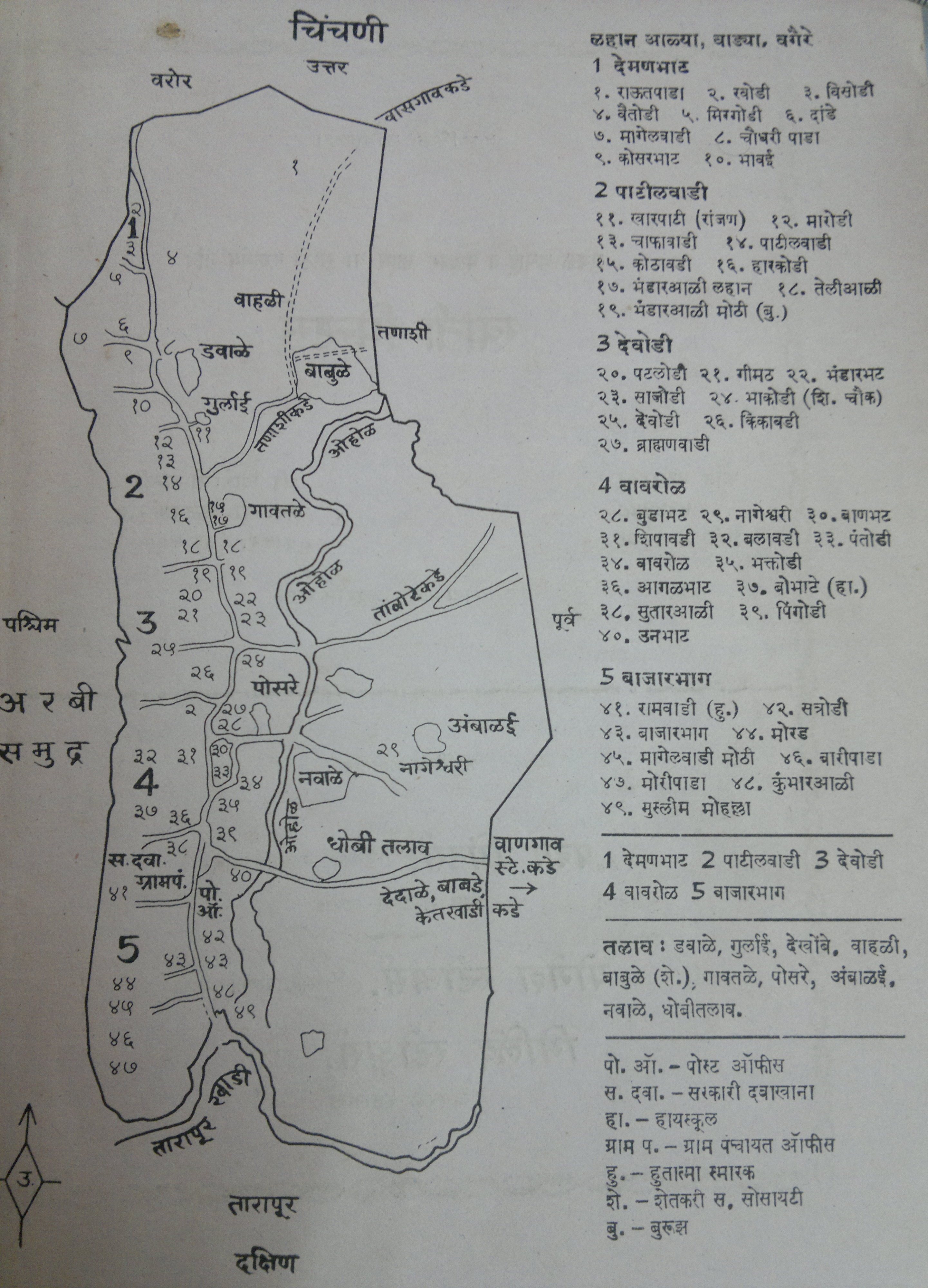
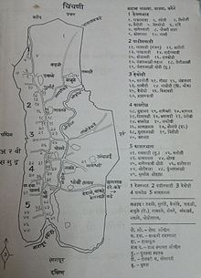
Schematic Map of Chinchani (In marathi language)

Wikimedia Foundation. 2010.

Игры ⚽ Поможем написать реферат

Look at other dictionaries:

  • Chinchani — Original name in latin Chinchani Name in other language Chinchani, Chinchni State code IN Continent/City Asia/Kolkata longitude 19.87458 latitude 72.6851 altitude 13 Population 14357 Date 2013 02 08 …   Cities with a population over 1000 database

  • Konkani Muslims — Konkani / Kokani Muslims is a Muslim sub ethnic group of Maharashtrian Muslims living in the Konkan region of India. They speak the Konkani language. A good number of them live in Mumbai. There is a large Konkani Muslim diaspora community of… …   Wikipedia

  • Tarapur, Maharashtra — Infobox Indian Jurisdiction native name = Tarapur | type = city | latd = 19.85 | longd = 72.7 locator position = right | state name = Maharashtra district = Thane leader title = leader name = altitude = 10 population as of = 2001 population total …   Wikipedia

  • List of India-related articles — Articles (arranged alphabetically) related to India or Indian culture include: NOTOC List of India related topics People are listed by their first names. 1231 SGM 3 STR 2002 Gujarat violence 2005 in India ( previous years ) 2004 Indian Ocean… …   Wikipedia

  • List of forts — This is a list for articles on notable historic forts which may or may not be under current active use by a military. There are also many towns named after a Fort, the largest being Fort Worth, Texas, USA. Contents 1 Australia 2 Bahamas …   Wikipedia

  • Thane district — Infobox Indian Jurisdiction type = district native name = Thane hq = Thane area total = 9558 latd = 20.20 longd = 73.48 locator position = left state name = Maharashtra altitude = abbreviation = collector = population total = 8131849 population… …   Wikipedia

  • Somvanshi Kshatriya — Introduction Somvanshi Kshatriya are the direct descendants of Mahabharat. As the name SOM indicate this community belongs to lunar dynasty. This community is based majorly in Hardoi, Pratapgarh and Allahabad in UP, Kumaon in Uttaranchal, Some… …   Wikipedia

  • Mangela Kolis — is a subcaste among the Maharashtrian Koli community. They are found in most of the villages along the coast from north of Mumbai in Maharashtra. They speak Mangeli, a dialect of Marathi with a Gujrathi influence.[1] Contents 1 History and origin …   Wikipedia

  • List of forts in Maharashtra — The following is a list of forts in the Indian state of Maharashtra. A*Aad *Abhasgad *Achala *Achalpur (Ellichpur) *Adas *Adgaum (Argaon) *Agashi *Ahmadnagar *Ahiwant (Sarp/Serpent) *Ajare *Ajinkyatara *Akeri *Akhrani *Akluz *Akola… …   Wikipedia

  • Chachadi — taluk names = savadatti   village   Coordinates Country India State …   Wikipedia

Share the article and excerpts

Direct link
Do a right-click on the link above
and select “Copy Link”