- Cottontail Ranch
-
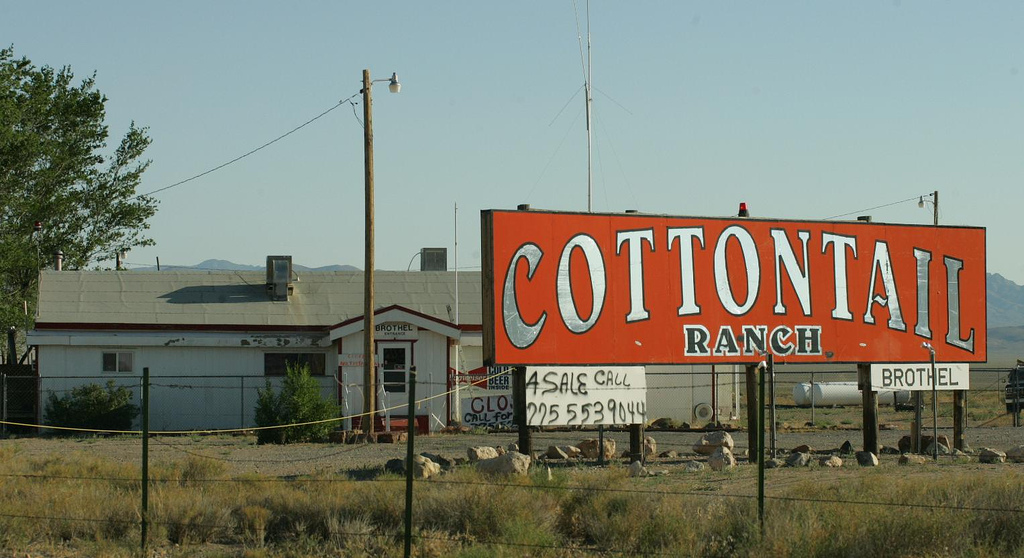
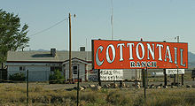 The Cottontail Ranch in 2006. The "for sale" telephone number listed belongs to the adjacent Lida Junction Airport.[1]
Cottontail Ranch was a legal, licensed brothel in Nevada that opened in October 1967. Located near the intersection of U.S. Route 95 and State Route 266 known as Lida Junction, in Esmeralda County, Nevada. It is also known as the Cottontail Ranch Club.
Contents
History
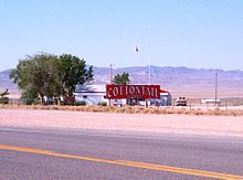 Another view of the brothel
In 1967, Howard Hughes allegedly made several visits to the Cottontail Ranch for entertainment while he was living in Las Vegas.[2]
In the 1970s, then madam Beverly Harrell battled with the United States Bureau of Land Management which was attempting to have the brothel removed from federal land.[3] Harrell also was a candidate for the Nevada Assembly in 1974. She published a book about the Ranch, An Orderly House, in 1975 (ISBN 0440058856).
A record, Coming My Way, was released in 1976 and was a collection of stories by the employees of the brothel.[4]
Howard Harrell operated the brothel before selling the Cottontail.
The Cottontail Ranch was closed in 2004 when the madam retired. All the real estate was purchased by real estate investor Lanny D. Love; Miss Love also purchased the luxury house a few miles from the brothel and an additional ≈3,300 acres (1,300 ha) in the area.[citation needed]
The property remains closed and is now available for sale.
See also
References
- ^ http://www.flightcentral.net/AirportsDetailView1.aspx?id=0L4
- ^ P. SOLOMON BANDA (2008-05-15). "Court hears man's claim to cut of Hughes' estate". AP News. http://www.thefreelibrary.com/Court+hears+man%27s+claim+to+cut+of+Hughes%27+estate-a01611533413. Retrieved 2009-12-07.
- ^ Las Vegas Review-Journal, January 20, 2007, Page B1
- ^ Las Vegas Review-Journal, January 20, 2007, Page B1
External links
- Cottontail Ranch (archived at Wayback Machine, March 25, 2004)
Coordinates: 37°30′03.1″N 117°11′06.95″W / 37.500861°N 117.1852639°W
Categories:- Brothels in Nevada
- Buildings and structures in Esmeralda County, Nevada
- 1966 establishments

Wikimedia Foundation. 2010.